MyTopo
Artichoke Lake Minnesota US Topo Map
Couldn't load pickup availability
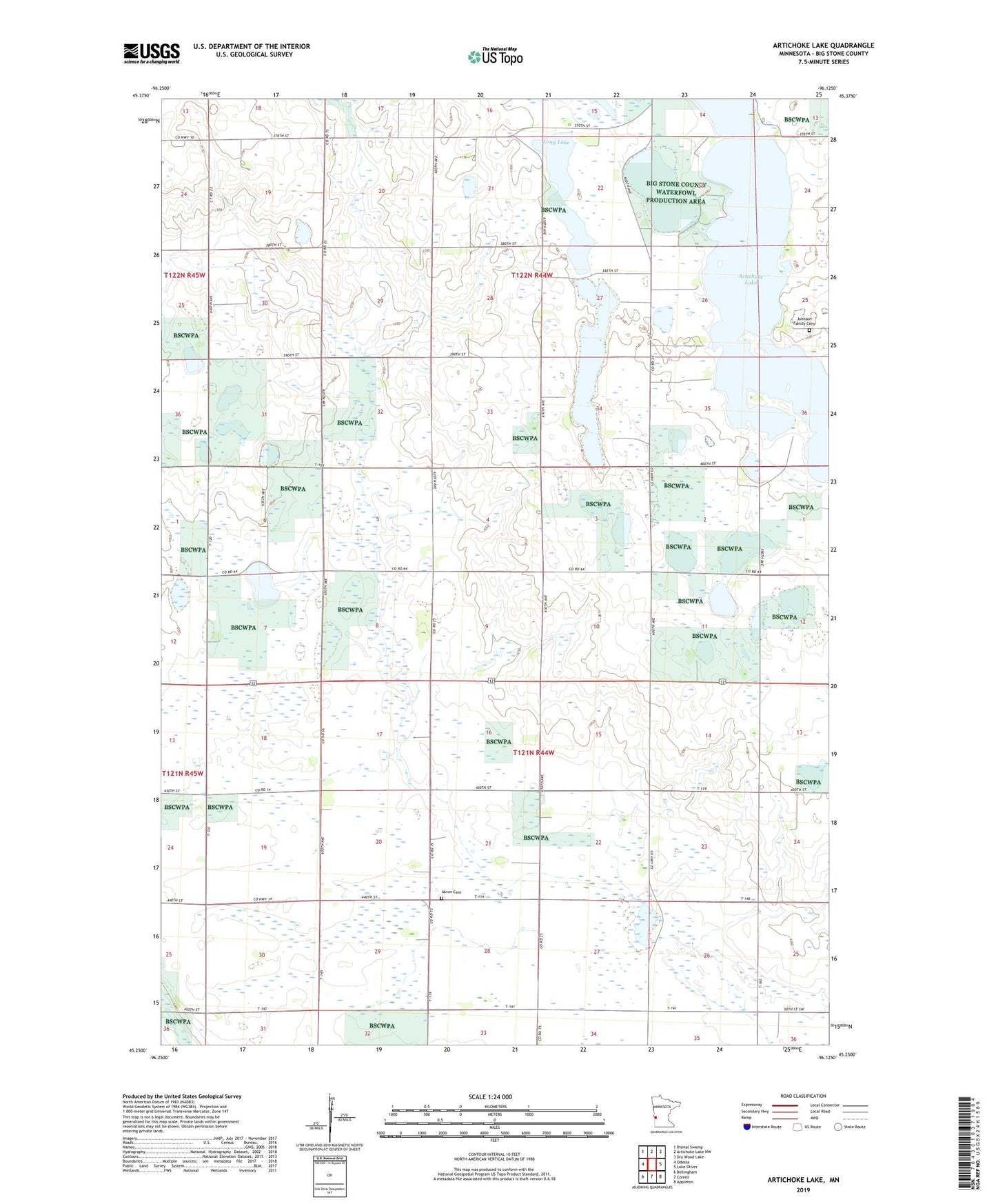
2019 topographic map quadrangle Artichoke Lake in the state of Minnesota. Scale: 1:24000. Based on the newly updated USGS 7.5' US Topo map series, this map is in the following counties: Big Stone. The map contains contour data, water features, and other items you are used to seeing on USGS maps, but also has updated roads and other features. This is the next generation of topographic maps. Printed on high-quality waterproof paper with UV fade-resistant inks.
Quads adjacent to this one:
West: Odessa
Northwest: Dismal Swamp
North: Artichoke Lake NW
Northeast: Dry Wood Lake
East: Lake Oliver
Southeast: Appleton
South: Correll
Southwest: Bellingham
Contains the following named places: Akron Cemetery, Artichoke Lake, County Ditch Number Two, Johnson Family Cemetery, Klages State Wildlife Management Areas, Long Lake, Township of Akron, Township of Artichoke, ZIP Code: 56227