MyTopo
Asbury Minnesota US Topo Map
Couldn't load pickup availability
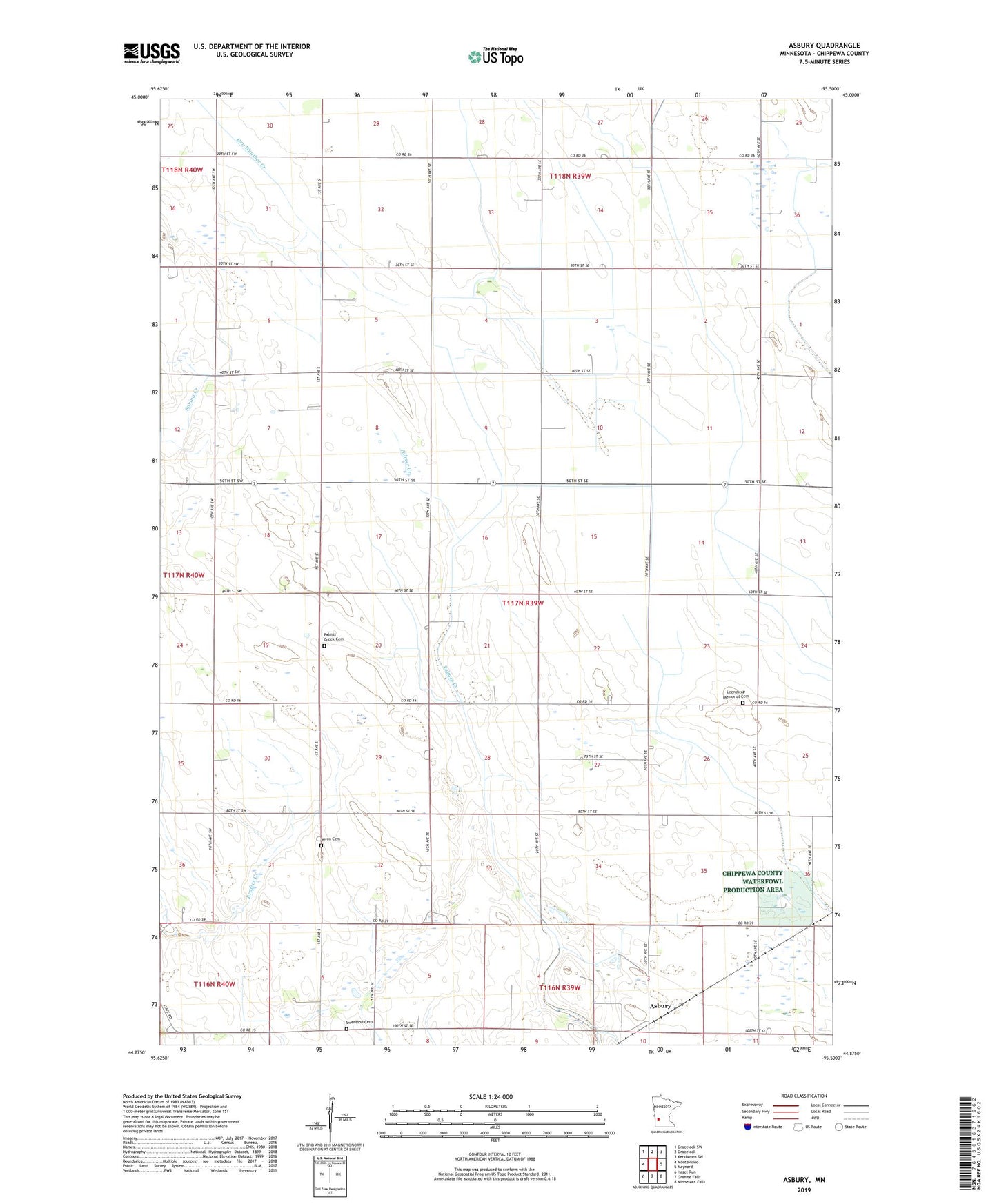
2022 topographic map quadrangle Asbury in the state of Minnesota. Scale: 1:24000. Based on the newly updated USGS 7.5' US Topo map series, this map is in the following counties: Chippewa. The map contains contour data, water features, and other items you are used to seeing on USGS maps, but also has updated roads and other features. This is the next generation of topographic maps. Printed on high-quality waterproof paper with UV fade-resistant inks.
Quads adjacent to this one:
West: Montevideo
Northwest: Gracelock SW
North: Gracelock
Northeast: Kerkhoven SW
East: Maynard
Southeast: Minnesota Falls
South: Granite Falls
Southwest: Hazel Run
This map covers the same area as the classic USGS quad with code o44095h5.
Contains the following named places: Asbury, Boike State Wildlife Management Area, County Ditch Number Eleven, County Ditch Number Fiftyseven, County Ditch Number Sixty, County Ditch Number Sixtyeight, County Ditch Number Thirtyseven, KKRC-FM (Granite Falls), Leenthrop Memorial Cemetery, Palmer Creek Cemetery, Saron Cemetery, Saron Church, School Number 316, Swensson Cemetery, Swensson Farm Museum, Township of Leenthrop