MyTopo
Hazel Run Minnesota US Topo Map
Couldn't load pickup availability
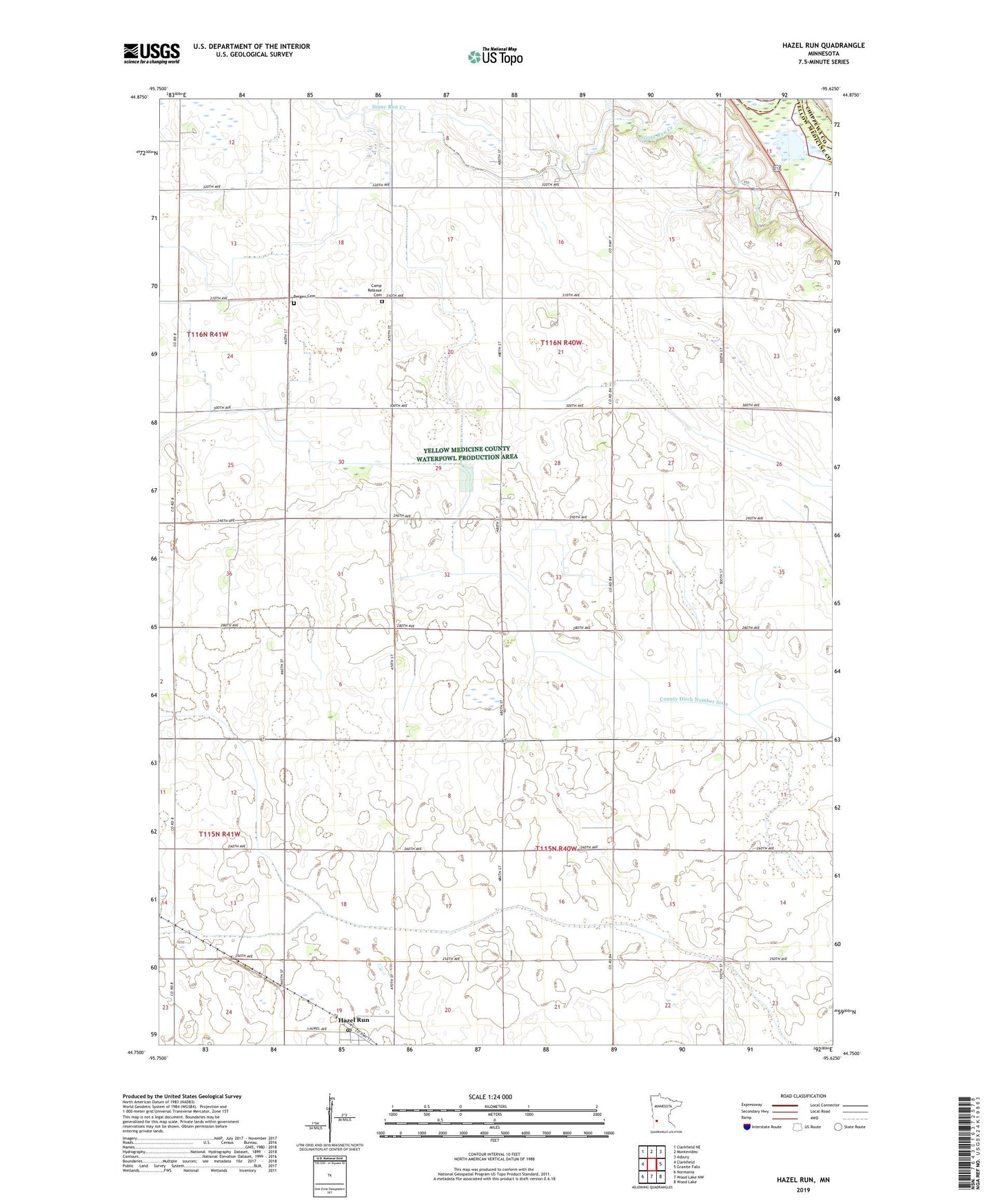
2022 topographic map quadrangle Hazel Run in the state of Minnesota. Scale: 1:24000. Based on the newly updated USGS 7.5' US Topo map series, this map is in the following counties: Yellow Medicine, Chippewa. The map contains contour data, water features, and other items you are used to seeing on USGS maps, but also has updated roads and other features. This is the next generation of topographic maps. Printed on high-quality waterproof paper with UV fade-resistant inks.
Quads adjacent to this one:
West: Clarkfield
Northwest: Clarkfield NE
North: Montevideo
Northeast: Asbury
East: Granite Falls
Southeast: Wood Lake
South: Wood Lake NW
Southwest: Normania
This map covers the same area as the classic USGS quad with code o44095g6.
Contains the following named places: Bergen Cemetery, Bergen Church, Camp Release Cemetery, Chippewa River Reservoir, Chippewa River-Montevideo Dam, Clawson State Wildlife Management Area, County Ditch Number Thirtysix, Hazel Run, Hazel Run Lutheran Church, Hazel Run Post Office, KMGM-FM (Montevideo), Stony Run Church, Stony Run Creek, Township of Hazel Run, Township of Stony Run, W Johnson Field