MyTopo
Backus Minnesota US Topo Map
Couldn't load pickup availability
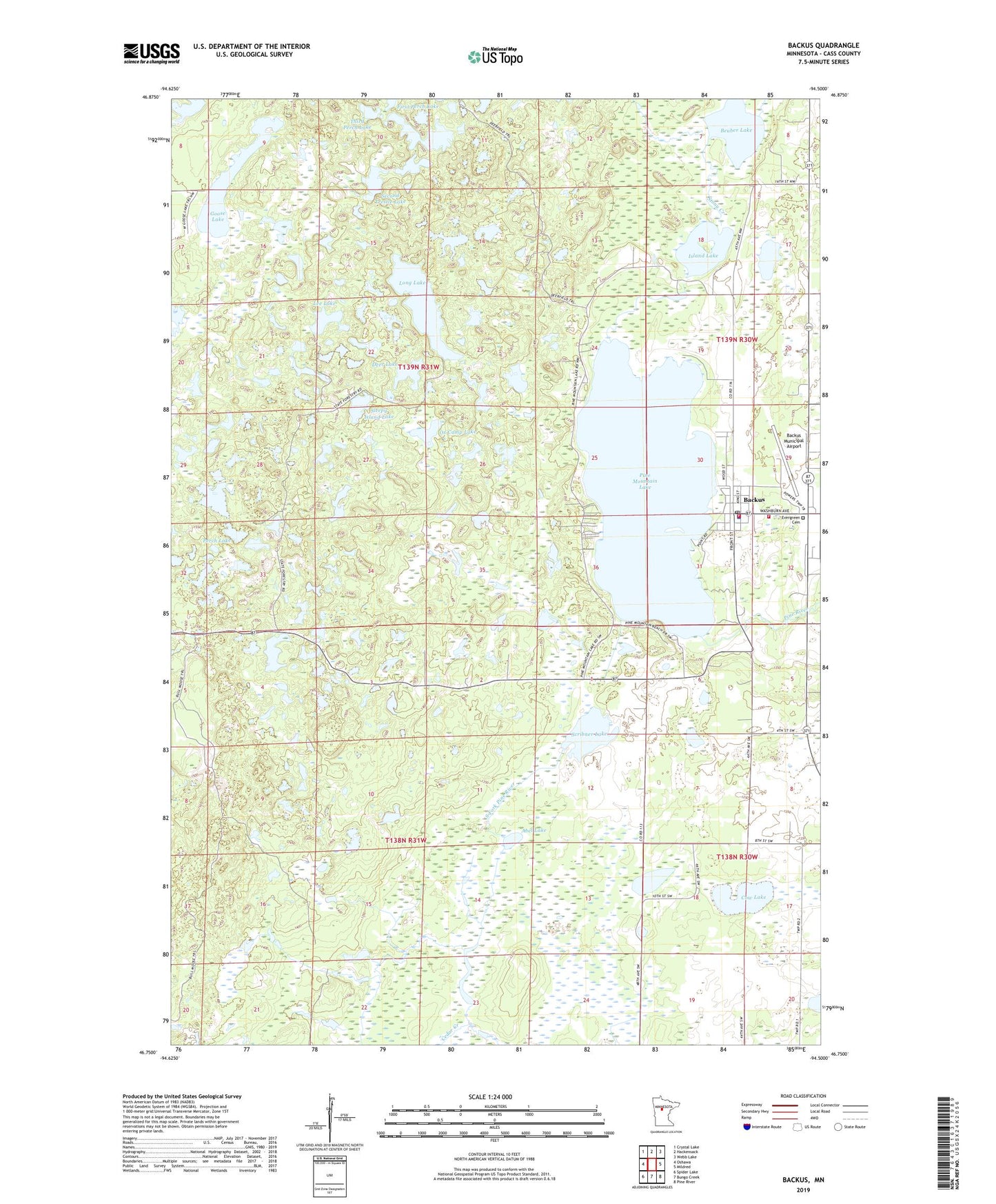
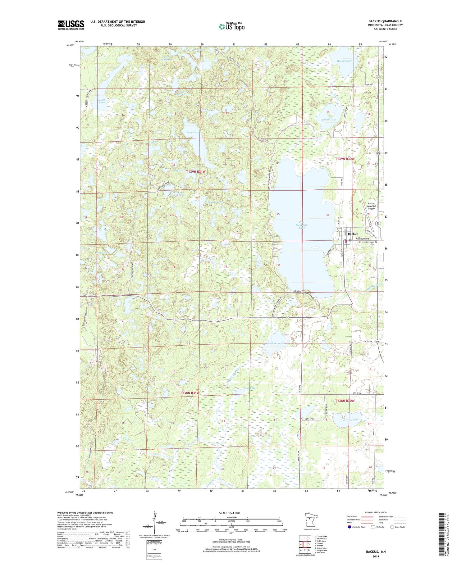
2019 topographic map quadrangle Backus in the state of Minnesota. Scale: 1:24000. Based on the newly updated USGS 7.5' US Topo map series, this map is in the following counties: Cass. The map contains contour data, water features, and other items you are used to seeing on USGS maps, but also has updated roads and other features. This is the next generation of topographic maps. Printed on high-quality waterproof paper with UV fade-resistant inks.
Quads adjacent to this one:
West: Oshawa
Northwest: Crystal Lake
North: Hackensack
Northeast: Webb Lake
East: Mildred
Southeast: Pine River
South: Bungo Creek
Southwest: Spider Lake
Contains the following named places: Abel Lake, Backus, Backus Elementary School, Backus Municipal Airport, Backus Police Department, Backus Post Office, Backus Volunteer Fire Department, Beuber Lake, Cedar Creek, Church of the Nazarene, City of Backus, Cow Lake, Cranberry Lake, Deer Lake, Deerfield Trail, Department of Natural Resources Division of Forestry - Backus Forestry Fire Office, Emmanuel Lutheran Church, Evergreen Cemetery, First Perch Lake, Goose Lake, Island Lake, Lakeside Baptist Church, Lee Lake, Long Lake, Ox Camp Lake, Perch Lake, Pine Mountain Campground, Pine Mountain Lake, Pine Mountain Lake Dam, Pine Mountain Lookout Tower, Scribner Lake, Second Perch Lake, Second Trestle Lake, Seventh Day Adventist Church, Sleepy Island Lake, South Fork Pine River Dam, Stony Creek, Third Perch Lake, Township of Bull Moose, Township of Deerfield, ZIP Code: 56435