MyTopo
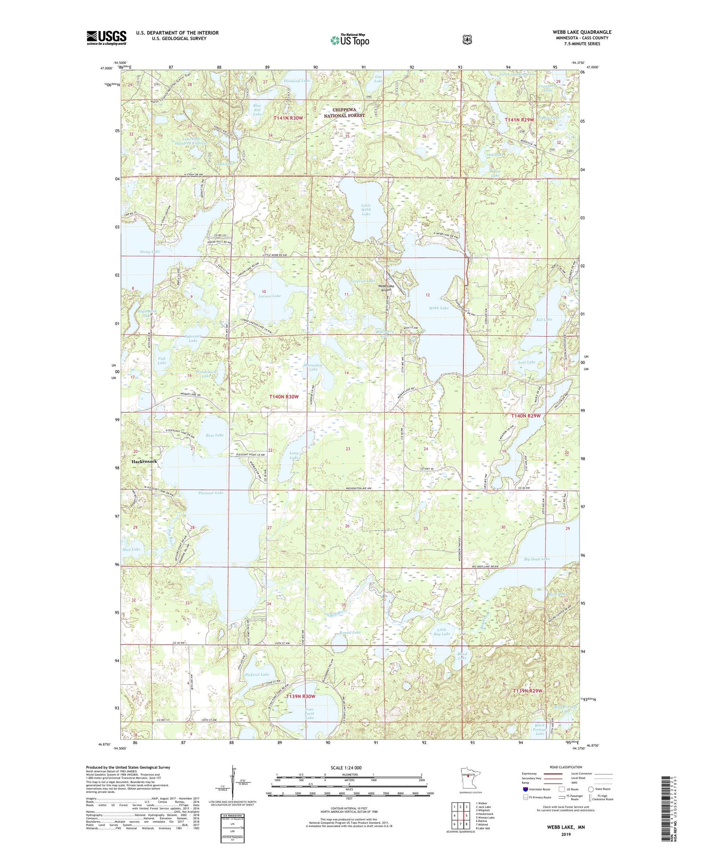
Webb Lake Minnesota US Topo Map
Couldn't load pickup availability
Also explore the Webb Lake Forest Service Topo of this same quad for updated USFS data
2022 topographic map quadrangle Webb Lake in the state of Minnesota. Scale: 1:24000. Based on the newly updated USGS 7.5' US Topo map series, this map is in the following counties: Cass. The map contains contour data, water features, and other items you are used to seeing on USGS maps, but also has updated roads and other features. This is the next generation of topographic maps. Printed on high-quality waterproof paper with UV fade-resistant inks.
Quads adjacent to this one:
West: Hackensack
Northwest: Walker
North: Jack Lake
Northeast: Whipholt
East: Woman Lake
Southeast: Lake Ada
South: Mildred
Southwest: Backus
This map covers the same area as the classic USGS quad with code o46094h4.
Contains the following named places: Bass Pond, Big Deep Lake, Black Portage Lake, Blind Lake, Blue Bill Lake, Blueberry Lake, Boss Lake, Cranberry Lake, Cub Lake, Diamond Lake, Fish Lake, Four Point Lake, High Bank Lake, Horseshoe Lake, KCCW-TV (Walker), Kid Lake, KZPX-FM (Nisswa), Lake Four Hundred Eighteen, Larson Lake, Little Boy Lake, Little Webb Lake, Long Lake, Lost Lake, Mascot Campgrounds, Mud Lake, Mud Portage Lake, Oak Lake, Pickerel Lake, Pleasant Lake, Popple Lake, Round Lake, South Stocking Lake, Stony Lake, Surprise Lake, Sylvester Lake, Three Island Lake, Township of Birch Lake, Trillium Lake, Webb Lake, Webb Lake Airport, Weed Lake, Woodchuck Lake, ZIP Code: 56452