MyTopo
Bungo Creek Minnesota US Topo Map
Couldn't load pickup availability
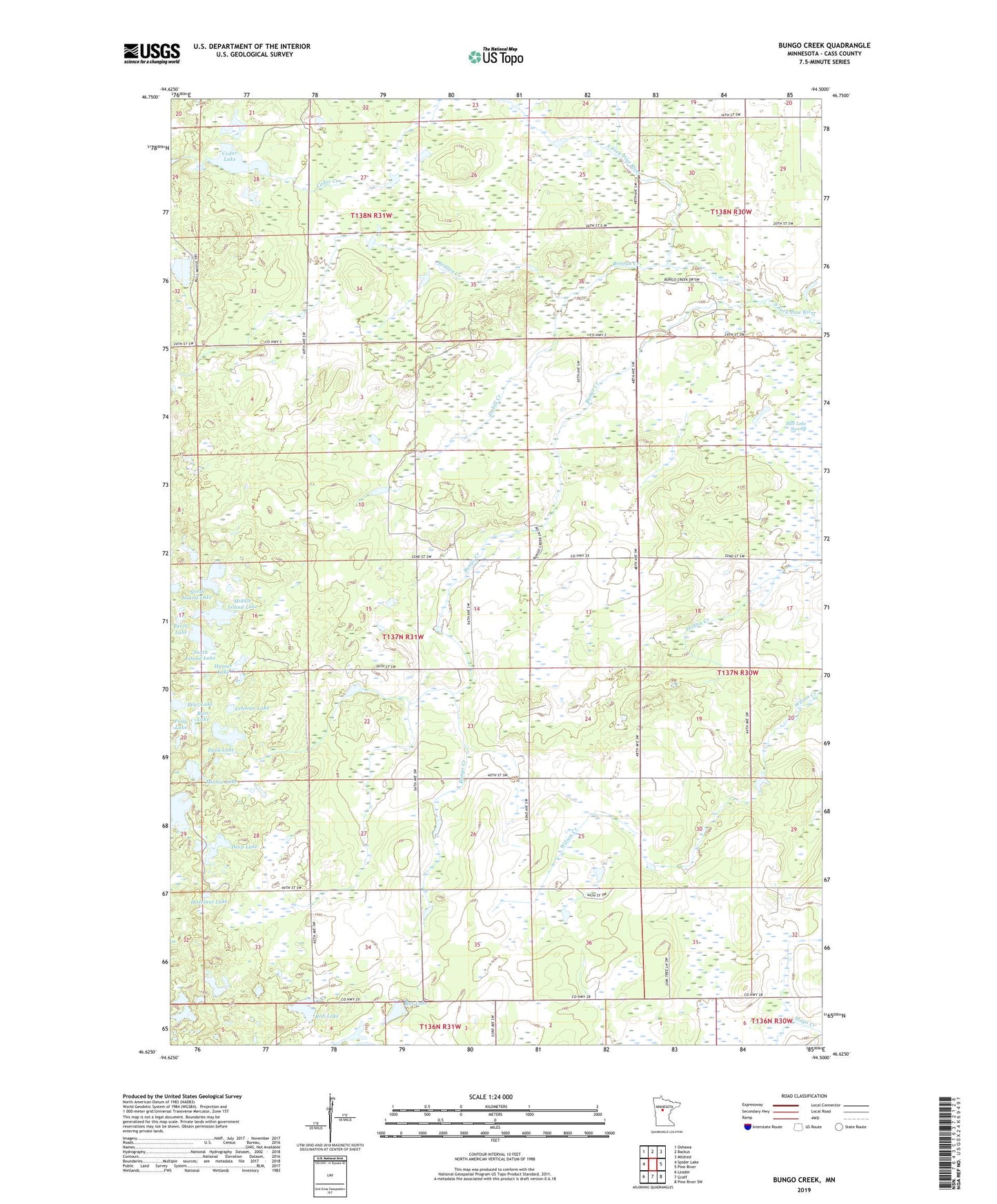
2022 topographic map quadrangle Bungo Creek in the state of Minnesota. Scale: 1:24000. Based on the newly updated USGS 7.5' US Topo map series, this map is in the following counties: Cass. The map contains contour data, water features, and other items you are used to seeing on USGS maps, but also has updated roads and other features. This is the next generation of topographic maps. Printed on high-quality waterproof paper with UV fade-resistant inks.
Quads adjacent to this one:
West: Spider Lake
Northwest: Oshawa
North: Backus
Northeast: Mildred
East: Pine River
Southeast: Pine River SW
South: Graff
Southwest: Leader
This map covers the same area as the classic USGS quad with code o46094f5.
Contains the following named places: Bass Lake, Bear Lake, Brittan Creek, Bungo Creek, Bungo Post Office, Cedar Lake, Dabill Creek, Deep Lake, Duck Lake, Fish Lake, Hazelnut Lake, Hunter Lake, Lehman Lake, Middle Island Lake, Minnie Lake, North Island Lake, Perch Lake, Pony Lake, Rat Lake, Rice Lake Swamp, Rob Lake, South Island Lake, Township of Bungo