
MyTopo
Bagley Minnesota US Topo Map
Couldn't load pickup availability
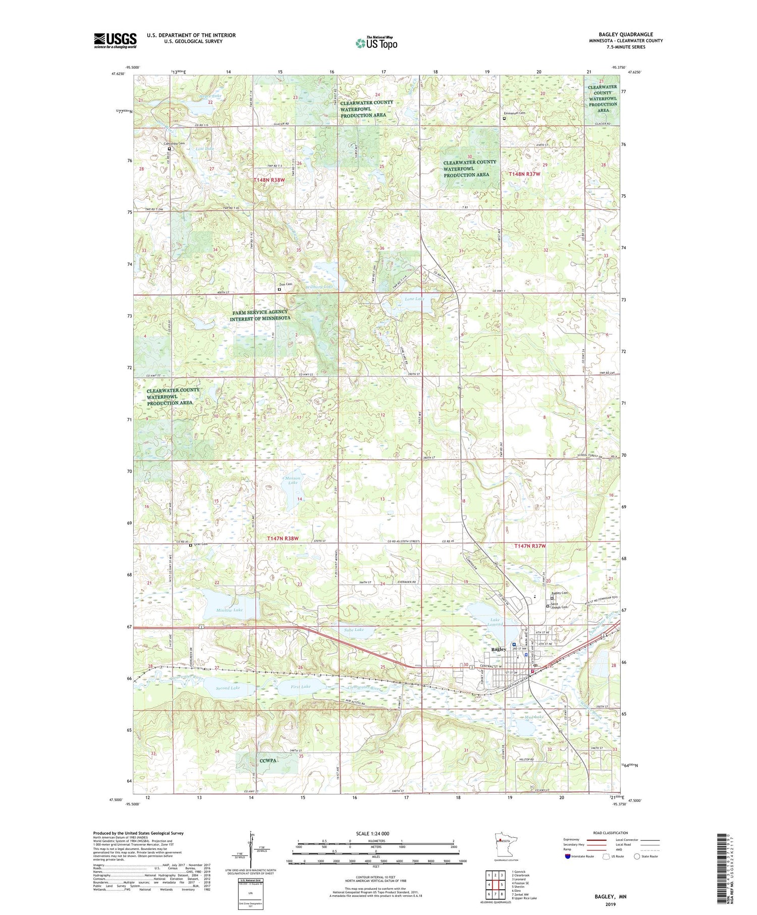
2019 topographic map quadrangle Bagley in the state of Minnesota. Scale: 1:24000. Based on the newly updated USGS 7.5' US Topo map series, this map is in the following counties: Clearwater. The map contains contour data, water features, and other items you are used to seeing on USGS maps, but also has updated roads and other features. This is the next generation of topographic maps. Printed on high-quality waterproof paper with UV fade-resistant inks.
Quads adjacent to this one:
West: Fosston SE
Northwest: Gonvick
North: Clearbrook
Northeast: Leonard
East: Shevlin
Southeast: Upper Rice Lake
South: Zerkel NW
Southwest: Ebro
Contains the following named places: Bagley, Bagley Cemetery, Bagley Country Club, Bagley Fire Department, Bagley Police Department, Bagley Post Office, Bagley Public Library, Calvary Evangelical Free Church, City of Bagley, Clearwater Clinic, Clearwater County, Clearwater County Courthouse, Clearwater County Fairground, Clearwater County Jail, Clearwater County Sheriff's Office, Concordia Cemetery, Concordia Church, Emmanuel Cemetery, Emmanuel Church, Faith Hill Assembly of God Church, Faith Lutheran Church, First Lake, Grace Lutheran Church, Gran Cemetery, Greensview Care Center, Hegre Lake, Kingdom Hall of Jehovah's Witnesses, Lake Lomond, Lone Lake, Lost Lake, MeritCare Clinic, Minnow Lake, Monson Lake, Mud Lake, Redeemer Lutheran Church, Rice Free Lutheran Church, Rusten Post Office, Sabe Lake, Saint Joseph Cemetery, Saint Joseph's Church, Saint Phillips Church, Sanford Bagley Medical Center, Second Lake, Stinar Whispering Pines Mobile Home Park, Township of Popple, Walker Brook, Willborg Lake, Zion Cemetery, Zion Church


