MyTopo
Ebro Minnesota US Topo Map
Couldn't load pickup availability
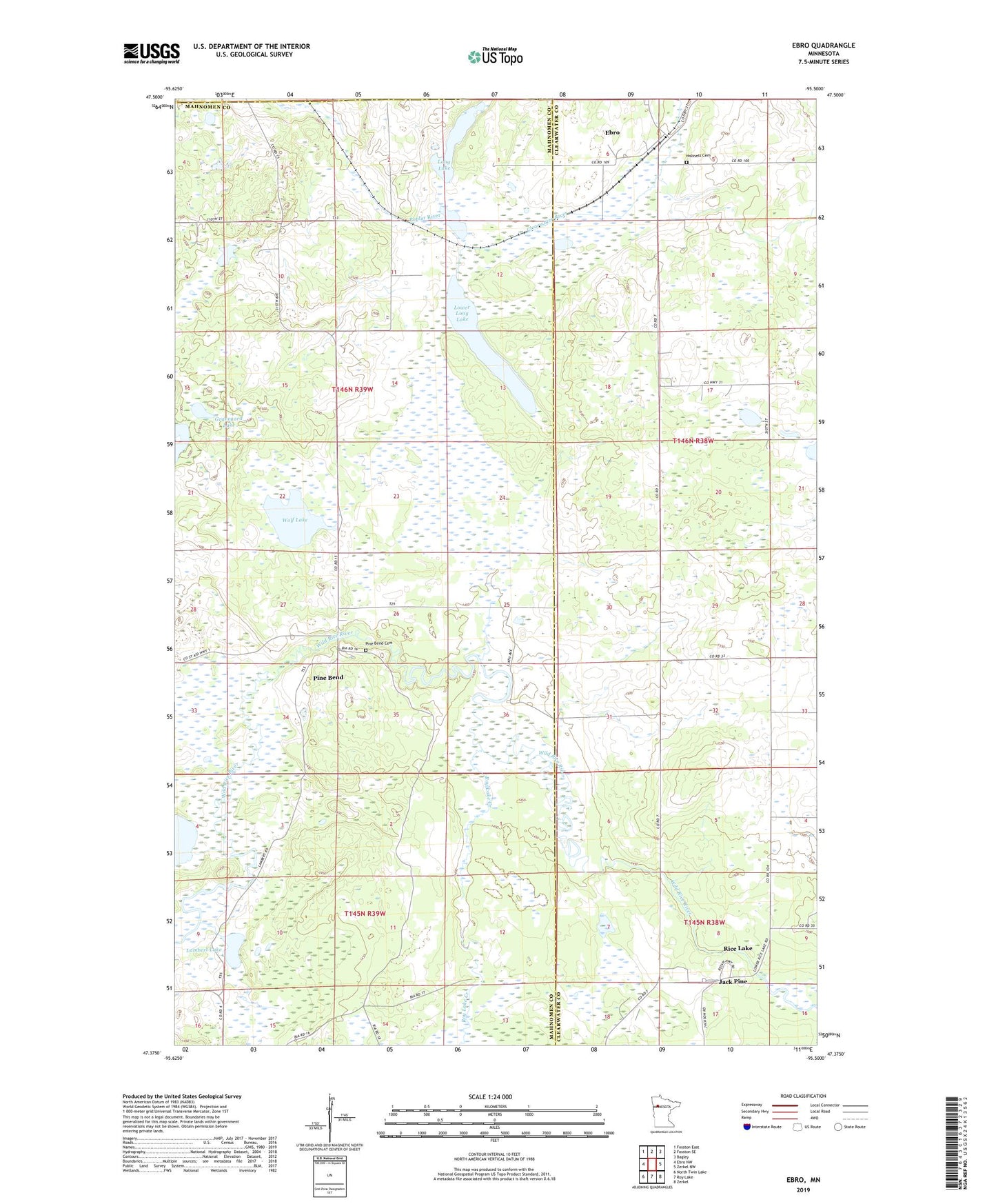
2022 topographic map quadrangle Ebro in the state of Minnesota. Scale: 1:24000. Based on the newly updated USGS 7.5' US Topo map series, this map is in the following counties: Mahnomen, Clearwater, Polk. The map contains contour data, water features, and other items you are used to seeing on USGS maps, but also has updated roads and other features. This is the next generation of topographic maps. Printed on high-quality waterproof paper with UV fade-resistant inks.
Quads adjacent to this one:
West: Ebro NW
Northwest: Fosston East
North: Fosston SE
Northeast: Bagley
East: Zerkel NW
Southeast: Zerkel
South: Roy Lake
Southwest: North Twin Lake
This map covers the same area as the classic USGS quad with code o47095d5.
Contains the following named places: Ebro, Ebro Census Designated Place, Ebro Post Office, Graveyard Lake, Holiness Cemetery, Holiness Church, Jack Pine, Lambert Lake, Long Lake, Lower Long Lake, Pine Bend, Pine Bend Cemetery, Pine Bend Census Designated Place, Rice Lake, Rice Lake Census Designated Place, Roy Lake Creek, Township of Island Lake, Wolf Lake, ZIP Code: 56651