MyTopo
Shevlin Minnesota US Topo Map
Couldn't load pickup availability
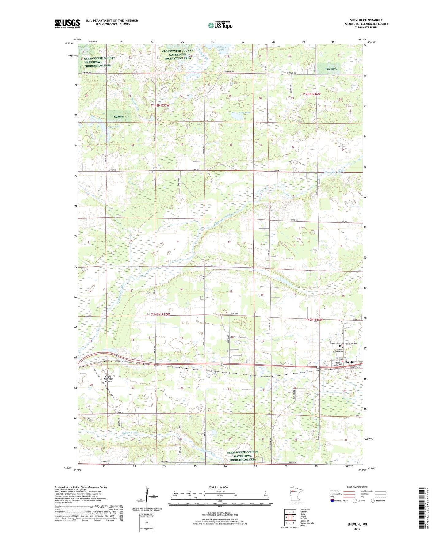
2022 topographic map quadrangle Shevlin in the state of Minnesota. Scale: 1:24000. Based on the newly updated USGS 7.5' US Topo map series, this map is in the following counties: Clearwater. The map contains contour data, water features, and other items you are used to seeing on USGS maps, but also has updated roads and other features. This is the next generation of topographic maps. Printed on high-quality waterproof paper with UV fade-resistant inks.
Quads adjacent to this one:
West: Bagley
Northwest: Clearbrook
North: Leonard
Northeast: Debs
East: Solway
Southeast: Alida
South: Upper Rice Lake
Southwest: Zerkel NW
This map covers the same area as the classic USGS quad with code o47095e3.
Contains the following named places: Bagley Municipal Airport, Berg Lake, Blair Lake, City of Shevlin, Clearwater Cemetery, Clearwater Lutheran Church, Landstad Cemetery, O J Mathison Mobile Home Park, Old Red Lake Trail State Wildlife Management, Our Lady of Victory Cemetery, Shevlin, Shevlin Cemetery, Shevlin Fire Department, Shevlin Post Office, Solberg Lake, Summit Lookout Tower, The Last Resort Airport, Township of Copley, Trinity Lutheran Church