MyTopo
Hill City Minnesota US Topo Map
Couldn't load pickup availability
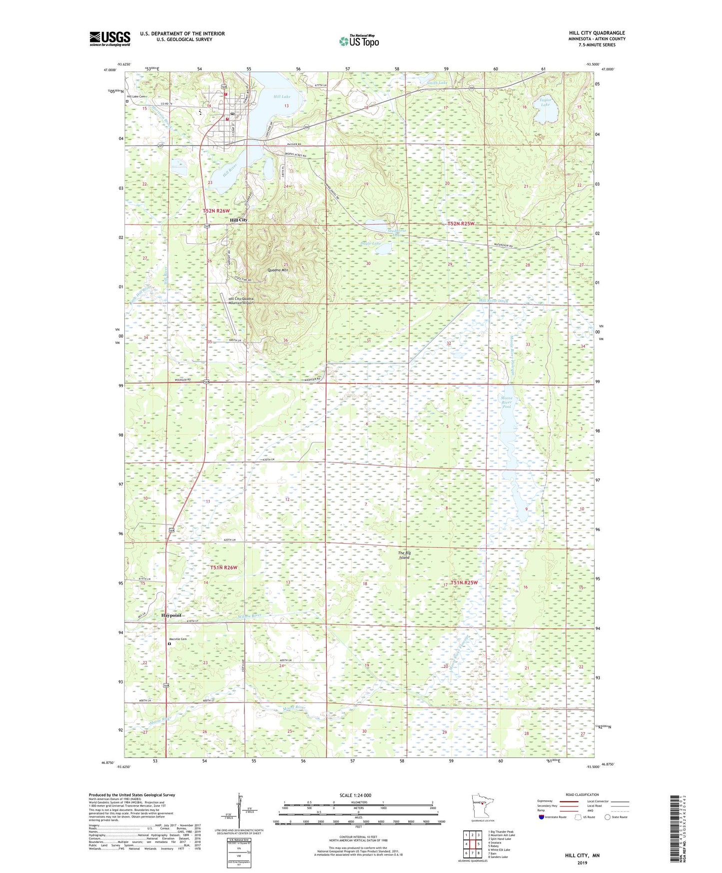
2022 topographic map quadrangle Hill City in the state of Minnesota. Scale: 1:24000. Based on the newly updated USGS 7.5' US Topo map series, this map is in the following counties: Aitkin. The map contains contour data, water features, and other items you are used to seeing on USGS maps, but also has updated roads and other features. This is the next generation of topographic maps. Printed on high-quality waterproof paper with UV fade-resistant inks.
Quads adjacent to this one:
West: Swatara
Northwest: Big Thunder Peak
North: Mountain Ash Lake
Northeast: Split Hand Lake
East: Rabey
Southeast: Sanders Lake
South: Bain
Southwest: White Elk Lake
This map covers the same area as the classic USGS quad with code o46093h5.
Contains the following named places: City of Hill City, Dagle Lake, Grace Lutheran Church, Haypoint, Hill City, Hill City Fire Department, Hill City Methodist Church, Hill City Police Department, Hill City Post Office, Hill City School, Hill City Wayside Park, Hill City-Quadna Mountain Airport, Hill Lake Cemetery, Hill River, Little Hill River, Macville Cemetery, Minnesota Department of Natural Resources Hill City Field Station, Moose River, Moose River Flowage, Moose River Pool, Moose-Willow Number 1 Dam, Moose-Willow Number 2 Dam, Moose-Willow River Reservoir, Morrison Brook, Quadna Mountain, Saint John's Catholic Church, Smith Lake, Studhorse Lake, Taylor Lake, The Big Island, Willow River Ditch, Willow River Pool