MyTopo
Beardsley NW Minnesota US Topo Map
Couldn't load pickup availability
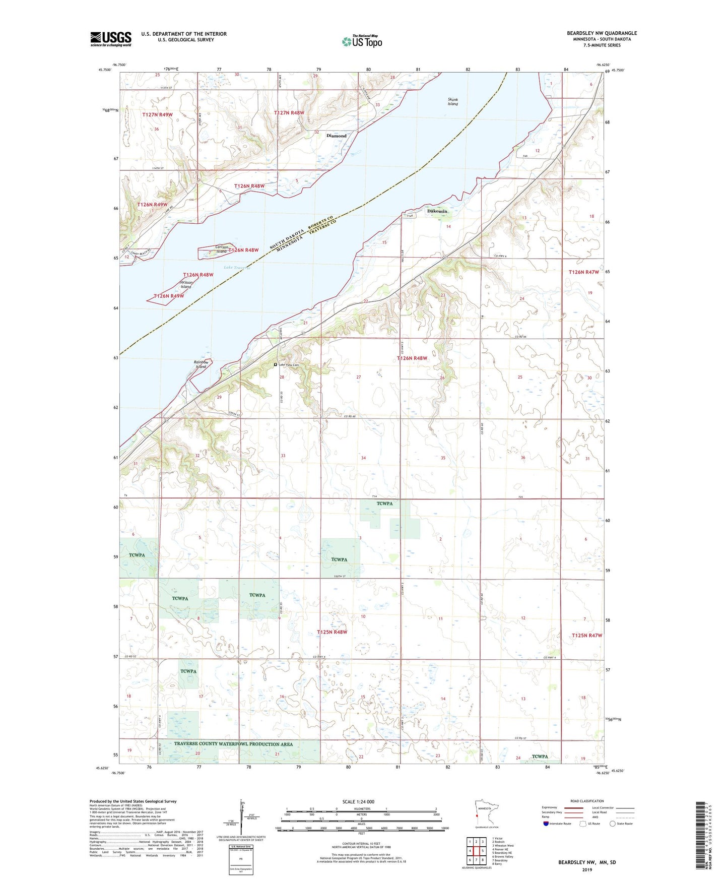
2022 topographic map quadrangle Beardsley NW in the states of Minnesota, South Dakota. Scale: 1:24000. Based on the newly updated USGS 7.5' US Topo map series, this map is in the following counties: Traverse, Roberts. The map contains contour data, water features, and other items you are used to seeing on USGS maps, but also has updated roads and other features. This is the next generation of topographic maps. Printed on high-quality waterproof paper with UV fade-resistant inks.
Quads adjacent to this one:
West: Peever NE
Northwest: Victor
North: Rosholt
Northeast: Wheaton West
East: Beardsley NE
Southeast: Barry
South: Beardsley
Contains the following named places: Avery School, Carlson Island, Dakomin, Dakomin Post Office, Diamond, Jackson Island, Kaufman Resort, Lake Traverse, Lake View Cemetery, Rainbow Island, Round Mound School, School Number 2, Skunk Island, Township of Arthur, Township of Windsor