MyTopo
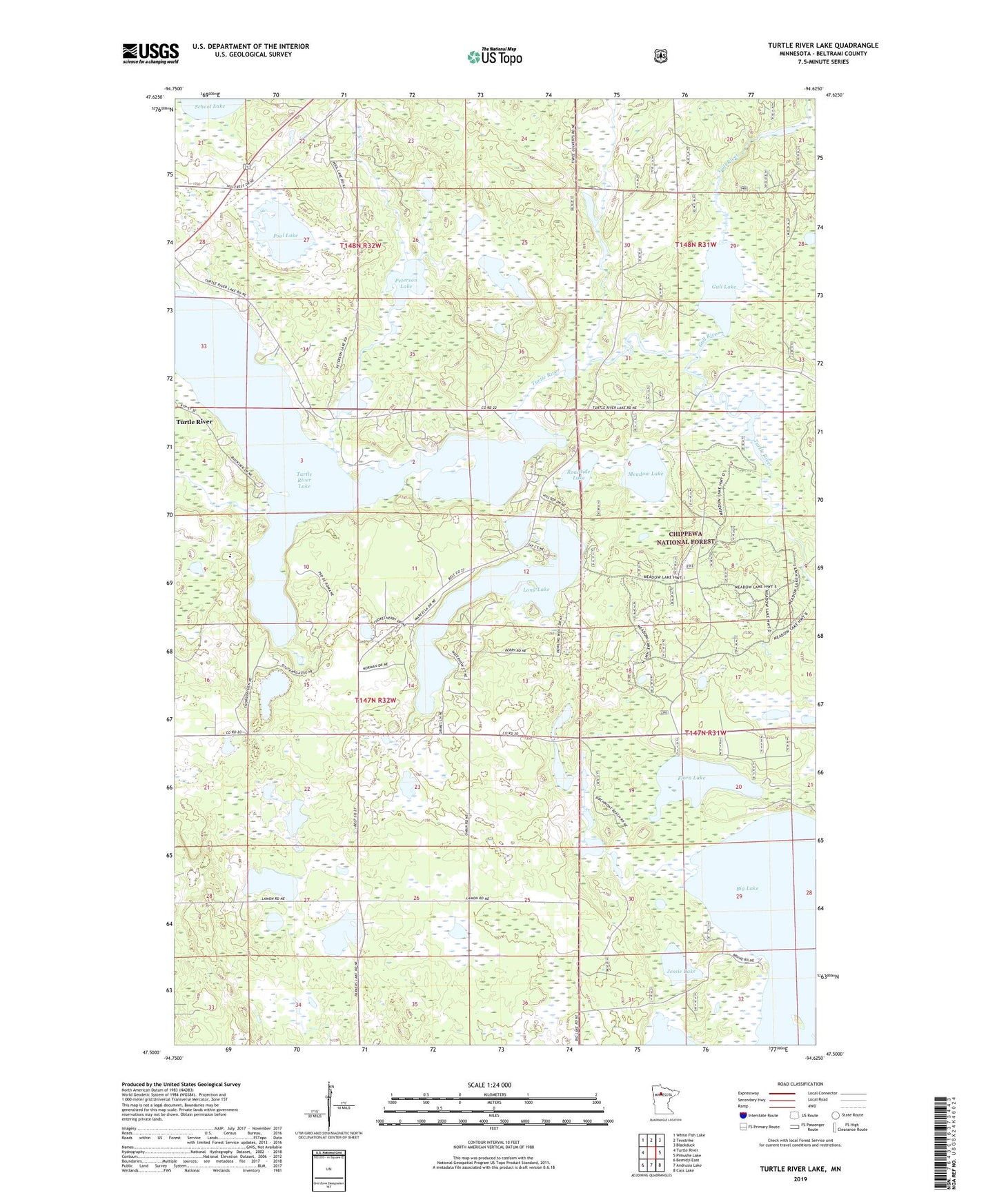
Turtle River Lake Minnesota US Topo Map
Couldn't load pickup availability
Also explore the Turtle River Lake Forest Service Topo of this same quad for updated USFS data
2022 topographic map quadrangle Turtle River Lake in the state of Minnesota. Scale: 1:24000. Based on the newly updated USGS 7.5' US Topo map series, this map is in the following counties: Beltrami. The map contains contour data, water features, and other items you are used to seeing on USGS maps, but also has updated roads and other features. This is the next generation of topographic maps. Printed on high-quality waterproof paper with UV fade-resistant inks.
Quads adjacent to this one:
West: Turtle River
Northwest: White Fish Lake
North: Tenstrike
Northeast: Blackduck
East: Pimushe Lake
Southeast: Cass Lake
South: Andrusia Lake
Southwest: Bemidji East
This map covers the same area as the classic USGS quad with code o47094e6.
Contains the following named places: Buena Vista State Forest, Farley, Farley Post Office, Farley Station, Flora Lake, Gallager Lake, Gull Lake, Gull River, Jessie Lake, Long Lake, Meadow Lake, Meadow Lake Trail System, Peterson Lake, Pool Lake, Roadside Lake, Township of Turtle River, Turtle River Lake