MyTopo
Biwabik NE Minnesota US Topo Map
Couldn't load pickup availability
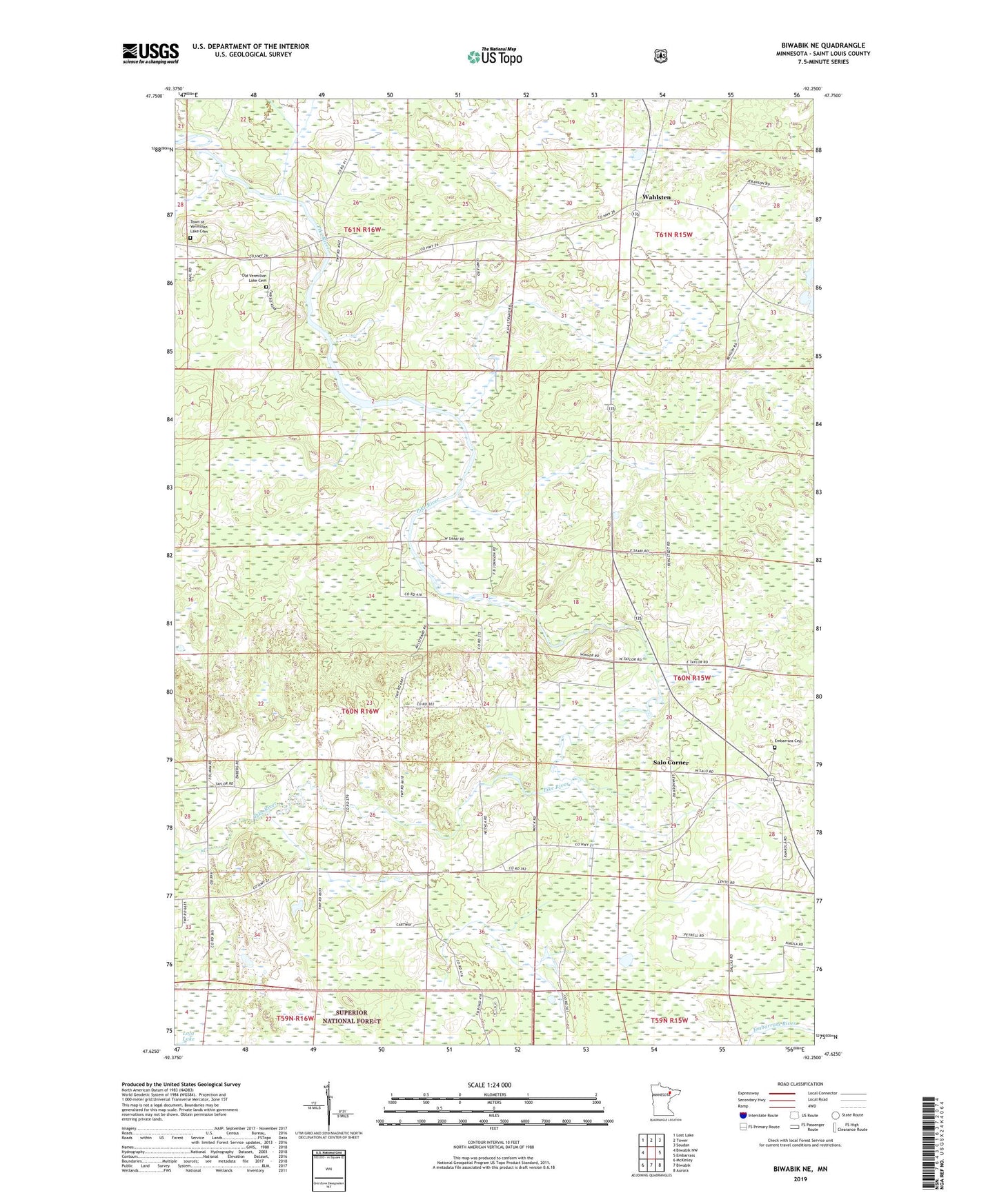
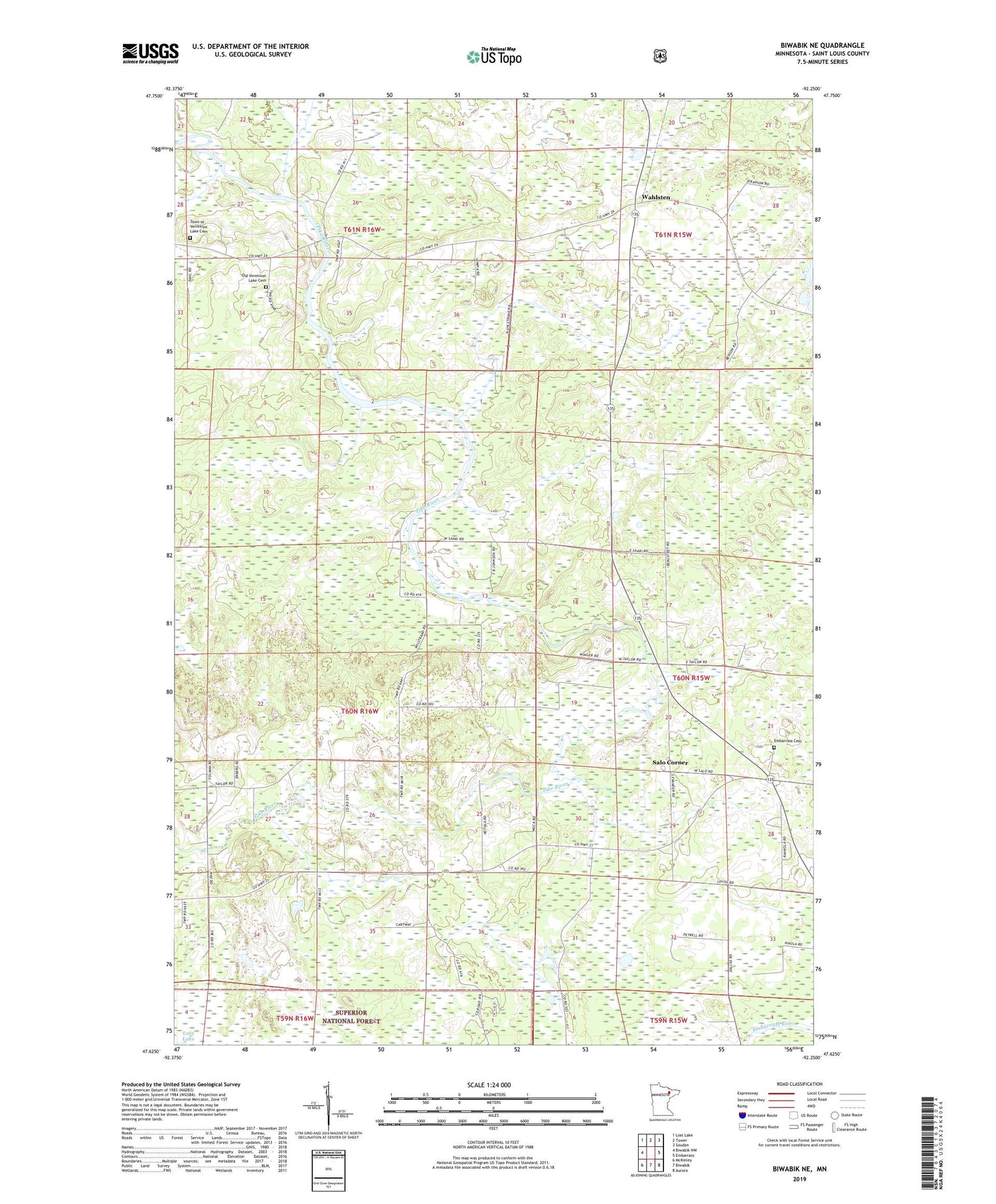
2019 topographic map quadrangle Biwabik NE in the state of Minnesota. Scale: 1:24000. Based on the newly updated USGS 7.5' US Topo map series, this map is in the following counties: St. Louis. The map contains contour data, water features, and other items you are used to seeing on USGS maps, but also has updated roads and other features. This is the next generation of topographic maps. Printed on high-quality waterproof paper with UV fade-resistant inks.
Quads adjacent to this one:
West: Biwabik NW
Northwest: Lost Lake
North: Tower
Northeast: Soudan
East: Embarrass
Southeast: Aurora
South: Biwabik
Southwest: McKinley
Contains the following named places: Embarrass Cemetery, Old Vermilion Lake Cemetery, Pike River Cemetery, Pike River Church, Pike River Recreation Site, Pike River Wayside Park, Salo Corner, School Number 40, Town of Vermilion Lake Cemetery, Township of Pike, Wahlsten