MyTopo
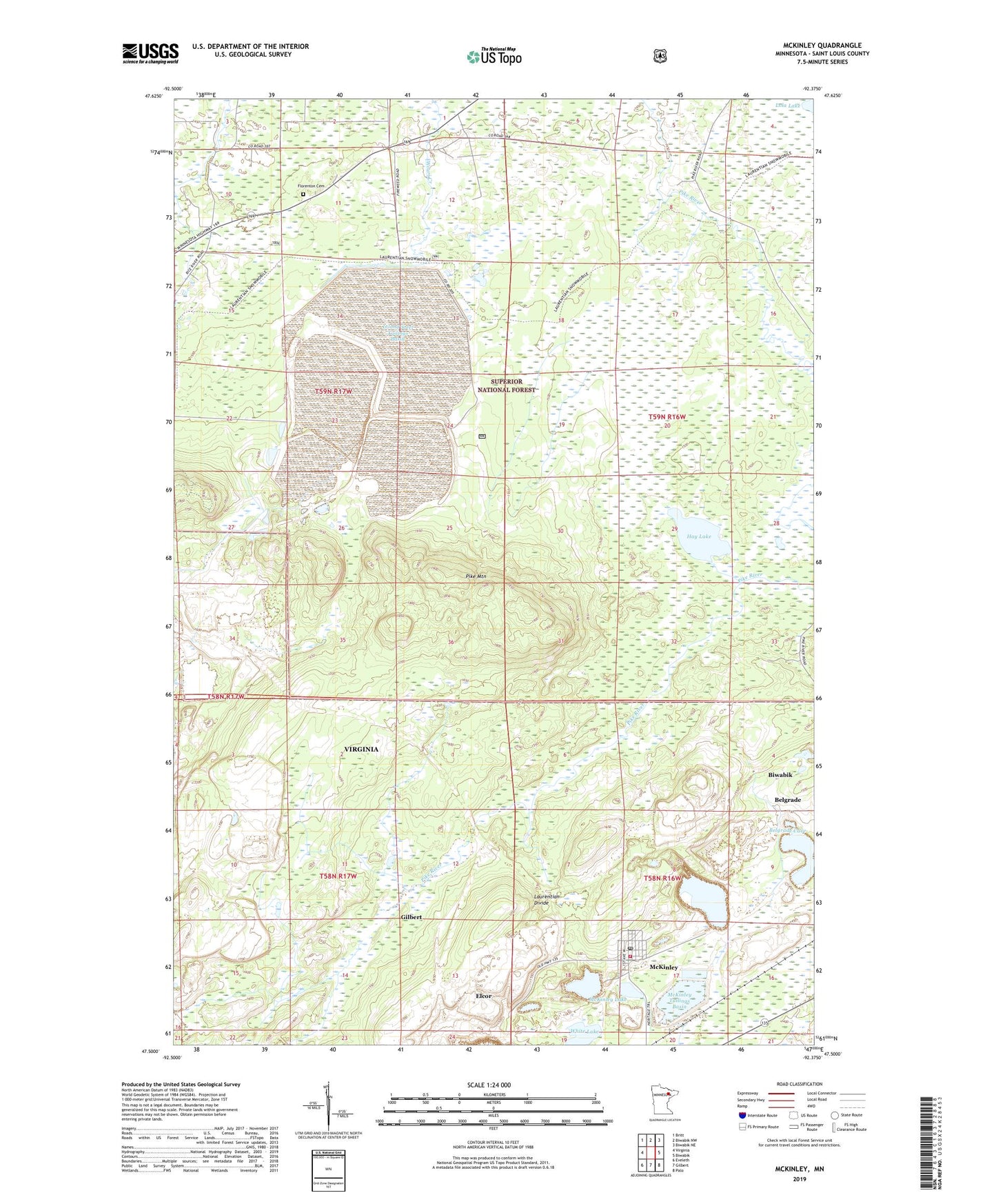
McKinley Minnesota US Topo Map
Couldn't load pickup availability
Also explore the McKinley Forest Service Topo of this same quad for updated USFS data
2022 topographic map quadrangle McKinley in the state of Minnesota. Scale: 1:24000. Based on the newly updated USGS 7.5' US Topo map series, this map is in the following counties: St. Louis. The map contains contour data, water features, and other items you are used to seeing on USGS maps, but also has updated roads and other features. This is the next generation of topographic maps. Printed on high-quality waterproof paper with UV fade-resistant inks.
Quads adjacent to this one:
West: Virginia
Northwest: Britt
North: Biwabik NW
Northeast: Biwabik NE
East: Biwabik
Southeast: Palo
South: Gilbert
Southwest: Eveleth
This map covers the same area as the classic USGS quad with code o47092e4.
Contains the following named places: Belgrade Cave, City of McKinley, Elcor, Elcor Post Office, Elcore Station, Florenton Cemetery, Hay Lake, Inland Steel Tailings Basin, Inland Steel Tailings Dike, Lola Lake, McKinley, McKinley Clearwater Dike, McKinley Clearwater Pond, McKinley Lake, McKinley Post Office, McKinley Station, McKinley Tailings Basin, McKinley Tailings Dike, McKinley Volunteer Fire Department, Pike Mountain, Saint Louis County, Sauntry Creek Settling Basin, Sauntry Creek Settling Dike, Township of Wuori, Unorganized Territory of Hay Lake, White Lake, ZIP Code: 55792