MyTopo
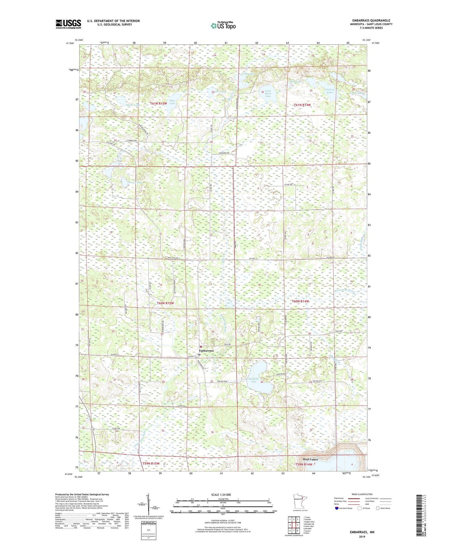
Embarrass Minnesota US Topo Map
Couldn't load pickup availability
Also explore the Embarrass Forest Service Topo of this same quad for updated USFS data
2022 topographic map quadrangle Embarrass in the state of Minnesota. Scale: 1:24000. Based on the newly updated USGS 7.5' US Topo map series, this map is in the following counties: St. Louis. The map contains contour data, water features, and other items you are used to seeing on USGS maps, but also has updated roads and other features. This is the next generation of topographic maps. Printed on high-quality waterproof paper with UV fade-resistant inks.
Quads adjacent to this one:
West: Biwabik NE
Northwest: Tower
North: Soudan
Northeast: Eagles Nest
East: Isaac Lake
Southeast: Allen
South: Aurora
Southwest: Biwabik
This map covers the same area as the classic USGS quad with code o47092f2.
Contains the following named places: Bear Creek, Beaver Lake, Duck Lake, Embarrass, Embarrass Police Department, Embarrass Post Office, Embarrass Region Volunteer Fire Department, Embarrass Station, Falls Lakes, Fishing Lakes, Fiver Lake, Hay Lake, Heikkilla Lake, Lempia Lakes, Little Birch Lake, Moose Lake, Mud Lake, School Number 70, Township of Embarrass, Trimble Creek, ZIP Code: 55732