MyTopo
Soudan Minnesota US Topo Map
Couldn't load pickup availability
Also explore the Soudan Forest Service Topo of this same quad for updated USFS data
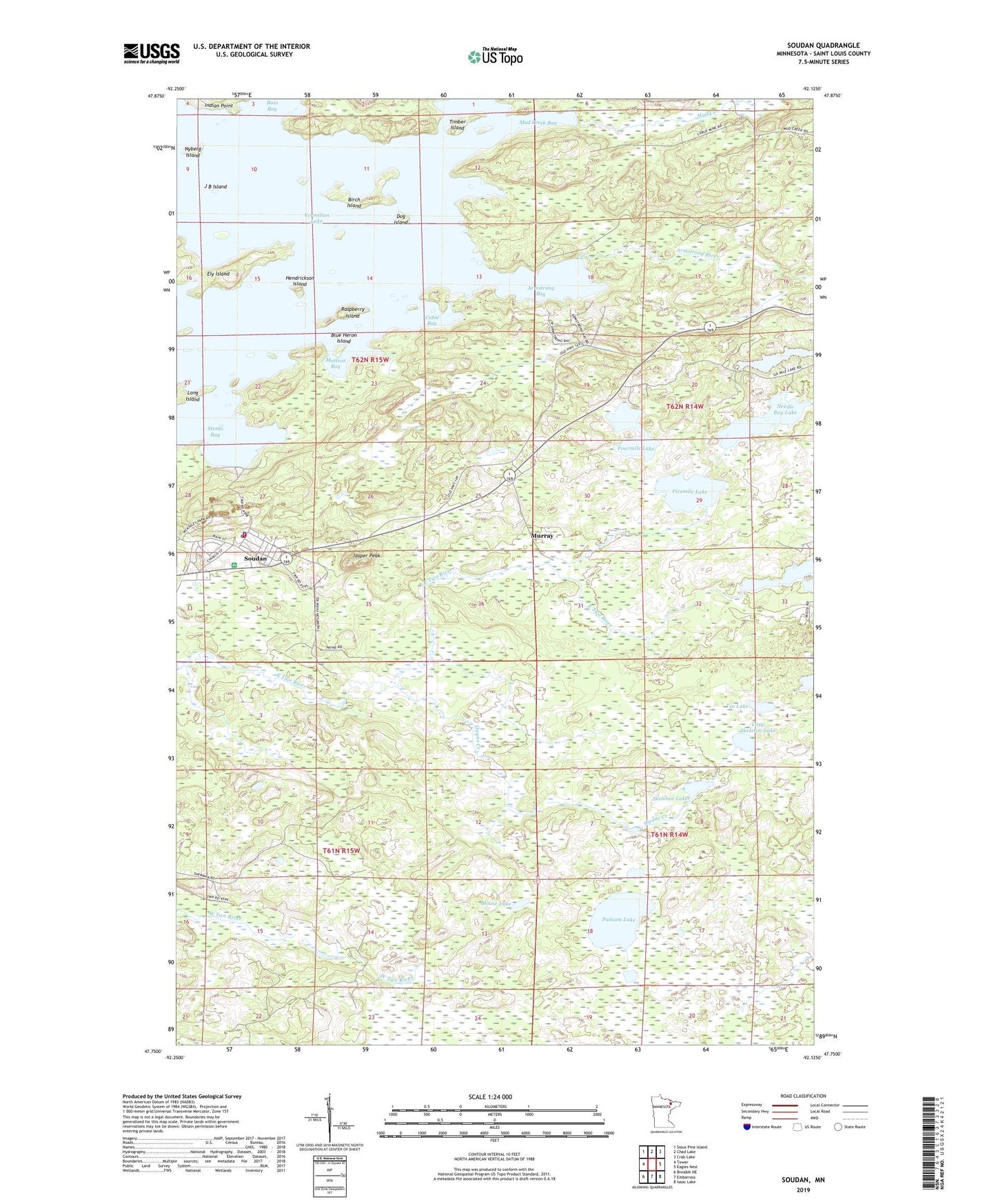
2022 topographic map quadrangle Soudan in the state of Minnesota. Scale: 1:24000. Based on the newly updated USGS 7.5' US Topo map series, this map is in the following counties: St. Louis. The map contains contour data, water features, and other items you are used to seeing on USGS maps, but also has updated roads and other features. This is the next generation of topographic maps. Printed on high-quality waterproof paper with UV fade-resistant inks.
Quads adjacent to this one:
West: Tower
Northwest: Sioux Pine Island
North: Chad Lake
Northeast: Crab Lake
East: Eagles Nest
Southeast: Isaac Lake
South: Embarrass
Southwest: Biwabik NE
This map covers the same area as the classic USGS quad with code o47092g2.
Contains the following named places: Armstrong Bay, Armstrong River, Birch Island, Blue Heron Island, Breitung Fire Department, Breitung Township Police Department, Cable Bay, Dog Island, Fivemile Lake, Fourmile Lake, Hendrickson Island, J B Island, Jasper Peak, Jasper Peak Wayside Park, LaRue Mine, Little Skeleton Lake, Long Island, Mattson Bay, Moose Lake, Mud Creek, Mud Creek Bay, Murray, Needle Boy Lake, Nyberg Island, Owens Creek, Putnam Lake, Raspberry Island, Saint Pauls Lutheran Church, Seven Sisters Islands, Sixmile Lake, Skeleton Lake, Soudan, Soudan Baptist Church, Soudan Census Designated Place, Soudan Mine, Soudan Mine Historical Marker, Soudan Mine Overlook Rest Area, Soudan Post Office, Soudan Station, Soudan Underground Mine Park, Stuntz Bay, Tee Lake, Timber Island, Township of Breitung, Township of Kugler, ZIP Code: 55782