MyTopo
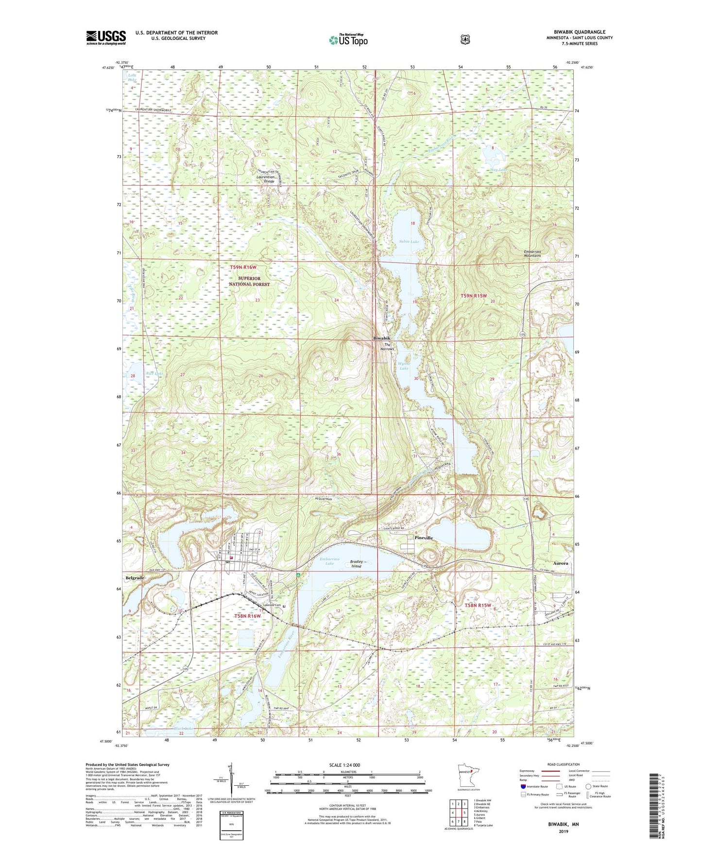
Biwabik Minnesota US Topo Map
Couldn't load pickup availability
Also explore the Biwabik Forest Service Topo of this same quad for updated USFS data
2022 topographic map quadrangle Biwabik in the state of Minnesota. Scale: 1:24000. Based on the newly updated USGS 7.5' US Topo map series, this map is in the following counties: St. Louis. The map contains contour data, water features, and other items you are used to seeing on USGS maps, but also has updated roads and other features. This is the next generation of topographic maps. Printed on high-quality waterproof paper with UV fade-resistant inks.
Quads adjacent to this one:
West: McKinley
Northwest: Biwabik NW
North: Biwabik NE
Northeast: Embarrass
East: Aurora
Southeast: Turpela Lake
South: Palo
Southwest: Gilbert
This map covers the same area as the classic USGS quad with code o47092e3.
Contains the following named places: Ajax Mine, Belgrade, Biwabik, Biwabik City Hall, Biwabik Covenant Church, Biwabik Mine, Biwabik Police Department, Biwabik Post Office, Biwabik Station, Biwabik Volunteer Fire Department, Black Lake, Bradley Island, Canton Mine, City of Biwabik, Community United Church of Christ, Embarrass Lake, Embarrass Lake (1) Wayside Park, Embarrass Lake (2) Wayside Park, Embarrass Lake (3) Wayside Park, Embarrass Mine, Erie Mine, Giants Ridge Ski Area, Hay Lake, Hudson Pit, Lakeside Cemetery, Mary Ellen Pit, Merritt Post Office, Pineville, Pineville Post Office, Pineville Station, Rice Lake, Sabin Lake, Saint Johns Church of Biwabik, The Narrows, Wynne Lake, Wynne Lake Dam, Wynne Lake Lookout Tower, ZIP Code: 55708