MyTopo
Rosholt South Dakota US Topo Map
Couldn't load pickup availability
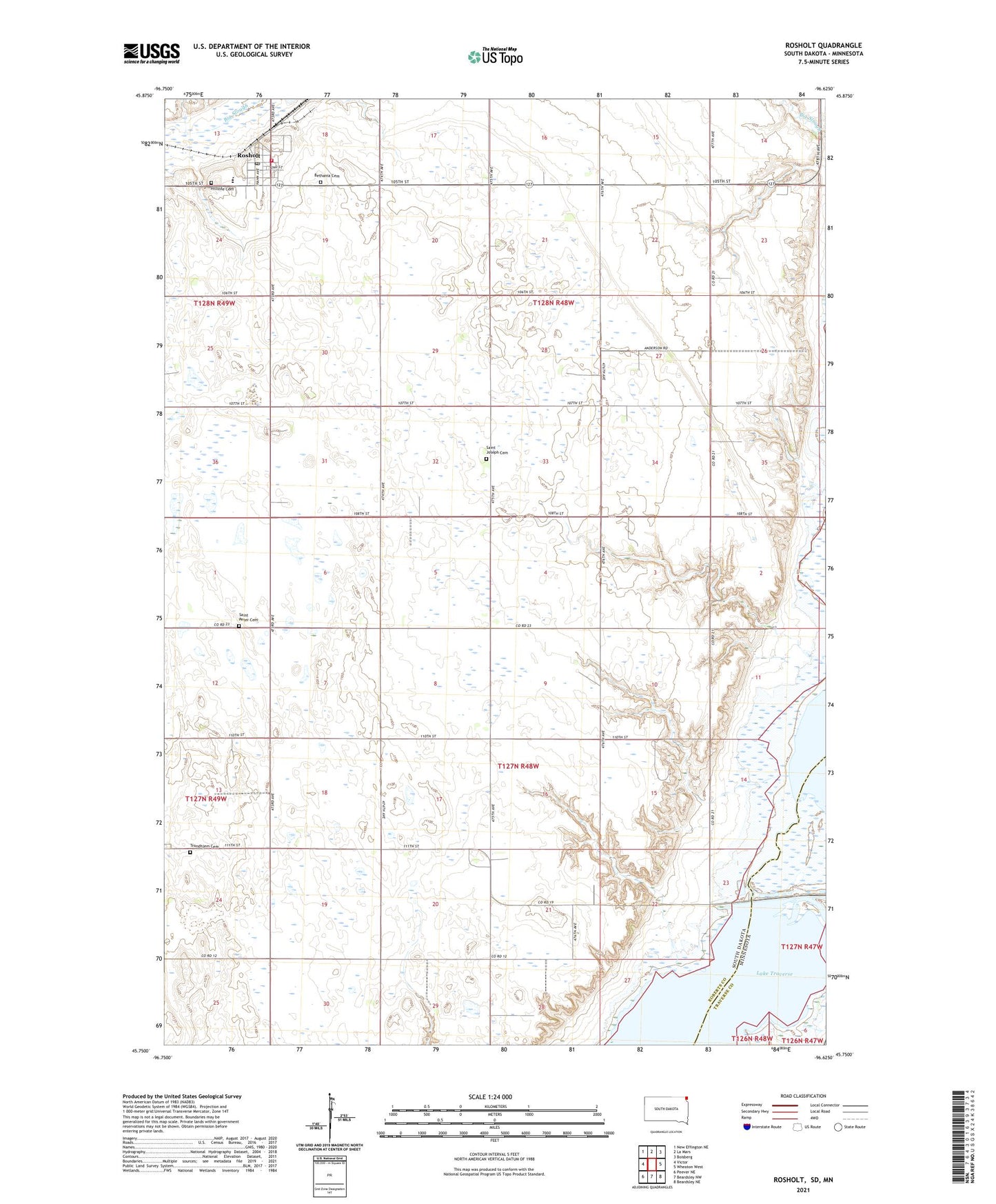
2021 topographic map quadrangle Rosholt in the states of South Dakota, Minnesota. Scale: 1:24000. Based on the newly updated USGS 7.5' US Topo map series, this map is in the following counties: Roberts, Traverse. The map contains contour data, water features, and other items you are used to seeing on USGS maps, but also has updated roads and other features. This is the next generation of topographic maps. Printed on high-quality waterproof paper with UV fade-resistant inks.
Quads adjacent to this one:
West: Victor
Northwest: New Effington NE
North: La Mars
Northeast: Boisberg
East: Wheaton West
Southeast: Beardsley NE
South: Beardsley NW
Southwest: Peever NE
This map covers the same area as the classic USGS quad with code o45096g6.
Contains the following named places: Bethania Cemetery, Hahns Airport, Harmon Township Hall, Hillside Cemetery, Modern Woodmen of America Hall, Northeast Ambulance Service, Reservation Dam, Reservation Dam State Wildlife Management Ar, Reservation Highway Dam, Rosholt, Rosholt Elementary School, Rosholt Fire Department, Rosholt High School, Rosholt Junior High School, Rosholt Police Department, Rosholt Post Office, Saint Joseph Cemetery, Saint Joseph Church, Saint Peter Cemetery, School Number 1, School Number 2, School Number 5, School Number 6, Town of Rosholt, Township of Harmon, Trondhjem Cemetery, Trondhjem Church, West Coteau Lake, ZIP Code: 57260