MyTopo
Wheaton West Minnesota US Topo Map
Couldn't load pickup availability
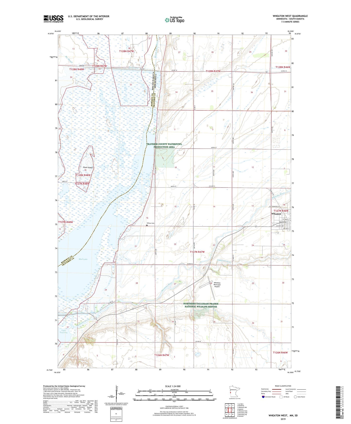
2022 topographic map quadrangle Wheaton West in the states of Minnesota, South Dakota. Scale: 1:24000. Based on the newly updated USGS 7.5' US Topo map series, this map is in the following counties: Traverse, Roberts. The map contains contour data, water features, and other items you are used to seeing on USGS maps, but also has updated roads and other features. This is the next generation of topographic maps. Printed on high-quality waterproof paper with UV fade-resistant inks.
Quads adjacent to this one:
West: Rosholt
Northwest: La Mars
North: Boisberg
Northeast: Wheaton NW
East: Wheaton East
Southeast: Dumont
South: Beardsley NE
Southwest: Beardsley NW
Contains the following named places: Big Slough, Calvary Worship Center, Eighteenmile Creek, Larsens Camp, Lincoln School, Mud Lake, Mustinka River, Nelson Cemetery, Plum Island, Saint John's Lutheran Church, Sanford Wheaton Medical Center, School Number 15, School Number 47, School Number 53, Wheaton Community Health Center, Wheaton Country Club, Wheaton High School, Wheaton Municipal Airport, White Rock Dam, White Rock Dam State Wildlife Management Area