MyTopo
Boyd Minnesota US Topo Map
Couldn't load pickup availability
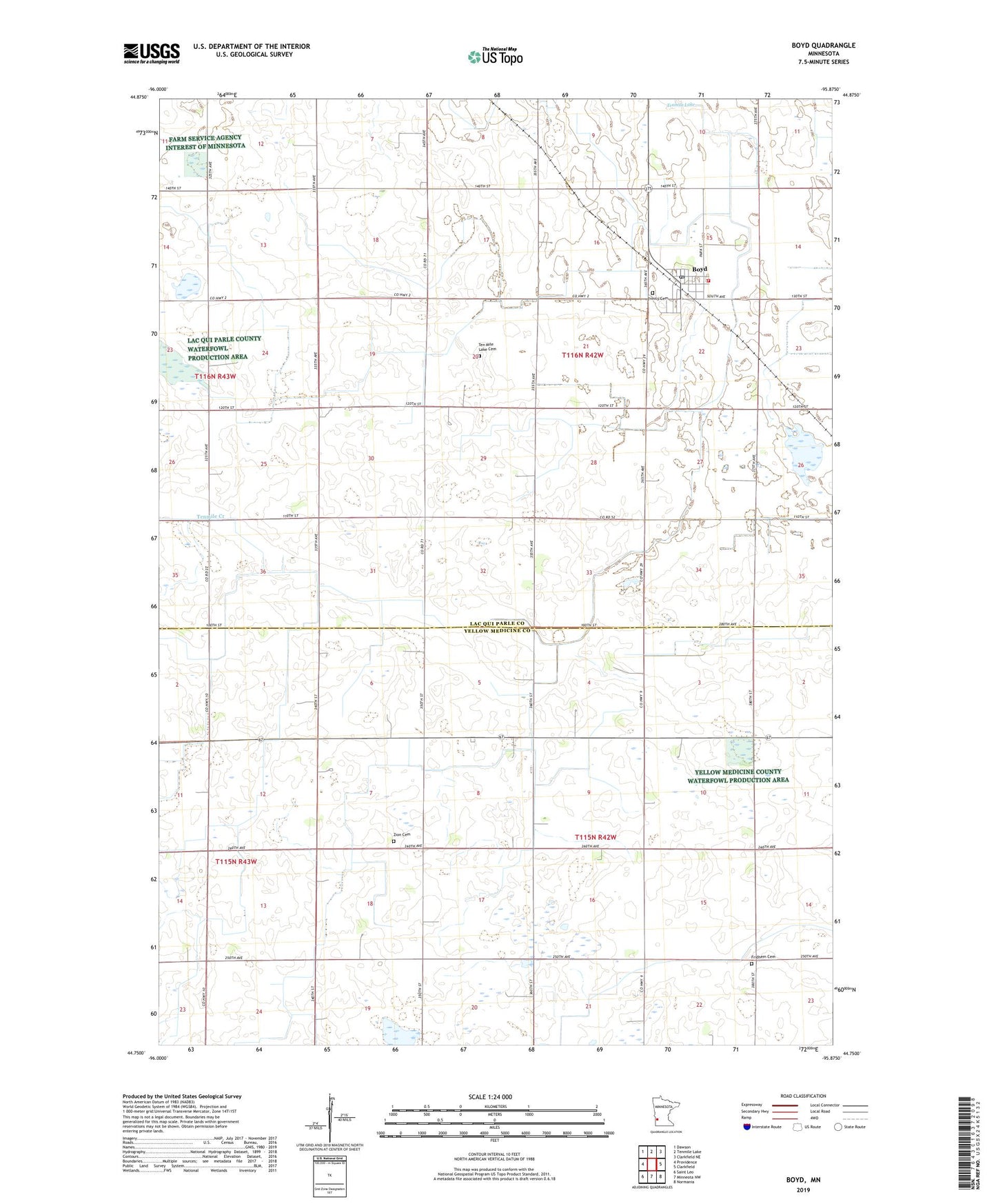
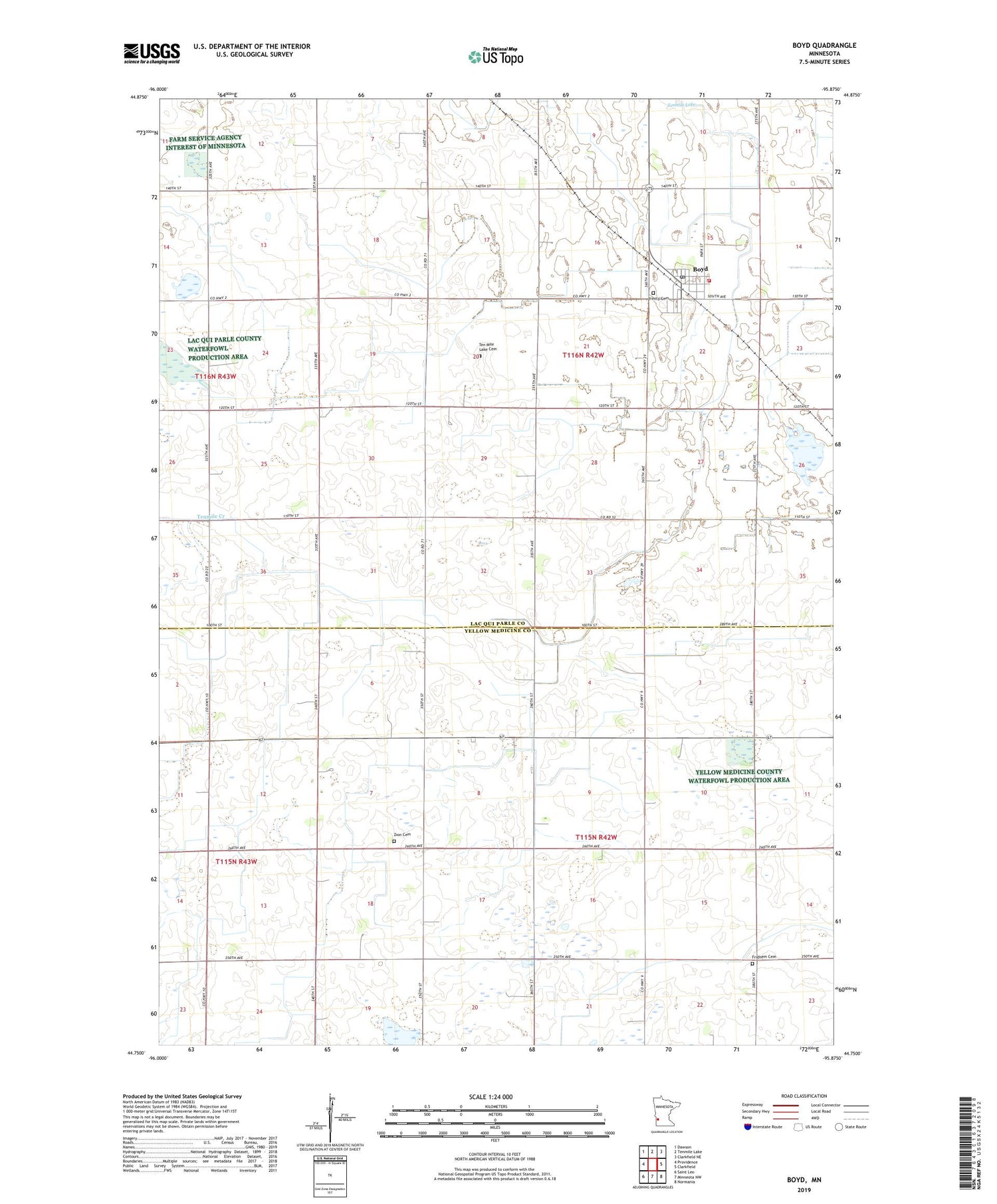
2019 topographic map quadrangle Boyd in the state of Minnesota. Scale: 1:24000. Based on the newly updated USGS 7.5' US Topo map series, this map is in the following counties: Lac qui Parle, Yellow Medicine. The map contains contour data, water features, and other items you are used to seeing on USGS maps, but also has updated roads and other features. This is the next generation of topographic maps. Printed on high-quality waterproof paper with UV fade-resistant inks.
Quads adjacent to this one:
West: Providence
Northwest: Dawson
North: Tenmile Lake
Northeast: Clarkfield NE
East: Clarkfield
Southeast: Normania
South: Minneota NW
Southwest: Saint Leo
Contains the following named places: Boyd, Boyd Post Office, Boyd Volunteer Fire Department, Case Lake, Church State Wildlife Management Area, City of Boyd, County Ditch Number Nine, Fridhem Cemetery, Jessen Farms, Judicial Ditch Number One, Larson Slough, Saint John Lutheran Church, Ten Mile Lake Cemetery, Township of Ten Mile Lake, Township of Tyro, Trinity Cemetery, Trinity Lutheran Church, Tyro State Wildlife Management Area, Zion Cemetery, ZIP Code: 56218