MyTopo
Clarkfield NE Minnesota US Topo Map
Couldn't load pickup availability
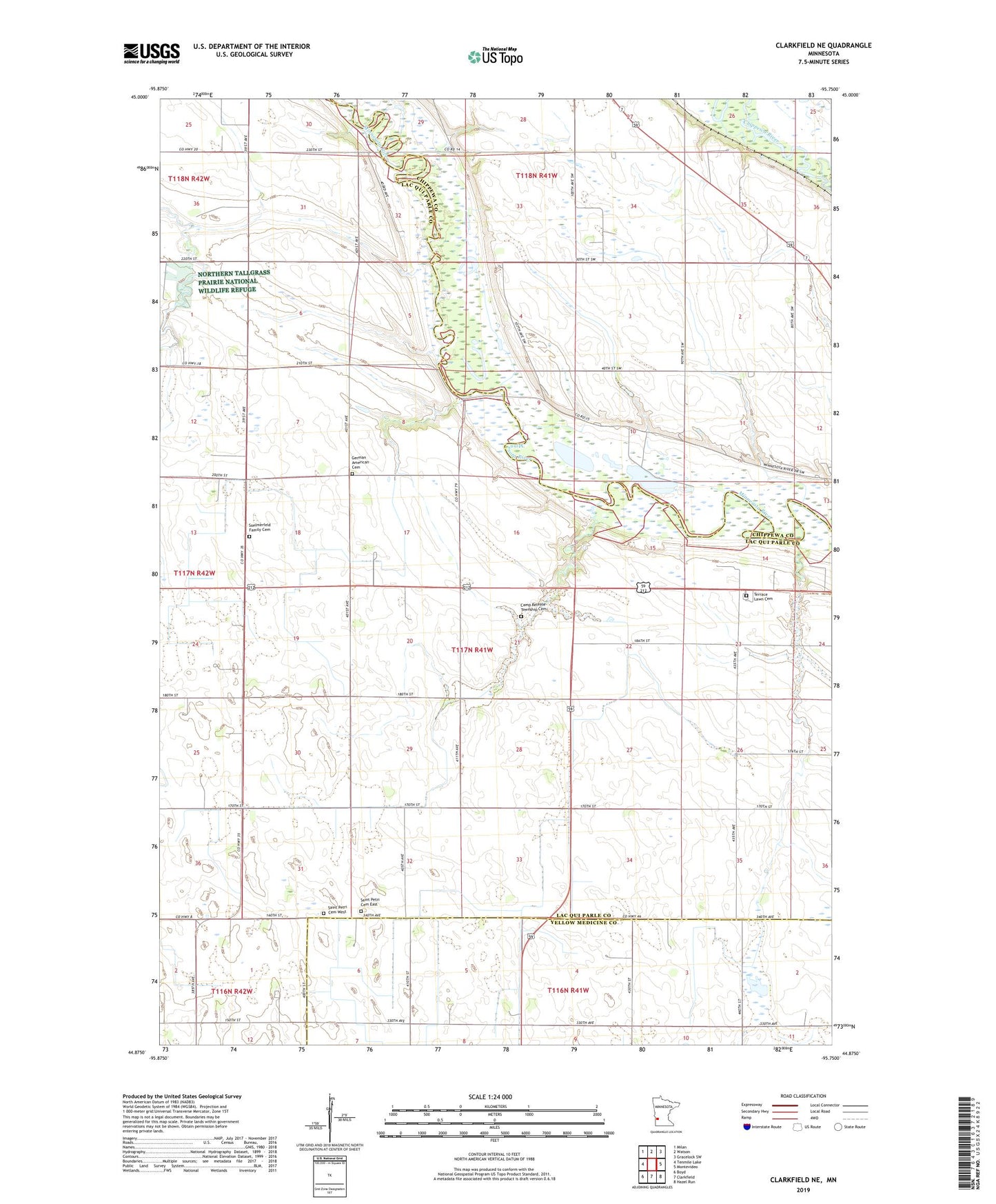
2022 topographic map quadrangle Clarkfield NE in the state of Minnesota. Scale: 1:24000. Based on the newly updated USGS 7.5' US Topo map series, this map is in the following counties: Lac qui Parle, Chippewa, Yellow Medicine. The map contains contour data, water features, and other items you are used to seeing on USGS maps, but also has updated roads and other features. This is the next generation of topographic maps. Printed on high-quality waterproof paper with UV fade-resistant inks.
Quads adjacent to this one:
West: Tenmile Lake
Northwest: Milan
North: Watson
Northeast: Gracelock SW
East: Montevideo
Southeast: Hazel Run
South: Clarkfield
Southwest: Boyd
This map covers the same area as the classic USGS quad with code o44095h7.
Contains the following named places: Camp Release Township Cemetery, County Ditch Number Eightyseven, County Ditch Number Ninty, German American Cemetery, Handeen-Jahn Group Pond Dam, Judicial Ditch Number Twentythree, Saint Petri Cemetery East, Saint Petri Cemetery West, School Number 839, Sommerfeld Family Cemetery, Terrace Lawn Cemetery, Township of Camp Release