MyTopo
Providence Minnesota US Topo Map
Couldn't load pickup availability
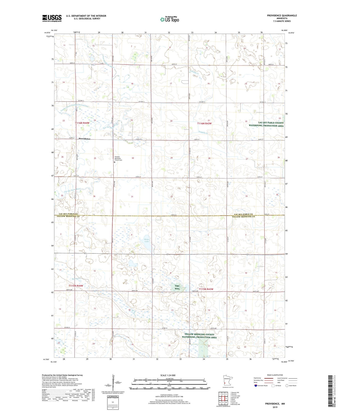
2022 topographic map quadrangle Providence in the state of Minnesota. Scale: 1:24000. Based on the newly updated USGS 7.5' US Topo map series, this map is in the following counties: Lac qui Parle, Yellow Medicine. The map contains contour data, water features, and other items you are used to seeing on USGS maps, but also has updated roads and other features. This is the next generation of topographic maps. Printed on high-quality waterproof paper with UV fade-resistant inks.
Quads adjacent to this one:
West: Dawson SW
Northwest: Dawson NW
North: Dawson
Northeast: Tenmile Lake
East: Boyd
Southeast: Minneota NW
South: Saint Leo
Southwest: Porter
This map covers the same area as the classic USGS quad with code o44096g1.
Contains the following named places: Big Rock State Wildlife Management Area, Judicial Ditch Number Eight, Medicine Pipe State Wildlife Management Area, Miller Lake, Miller-Richter State Wildlife Management Ar, Mission Covenant Church, Oshkosh State Wildlife Management Area, Providence, Providence Post Office, Providence State Wildlife Management Area, Saint Johns School, Saint Leo State Wildlife Management Areas, Swedish Methodist Church Cemetery, Township of Maxwell, Township of Omro, Wild Wings State Wildlife Management Area