MyTopo
Minneota NW Minnesota US Topo Map
Couldn't load pickup availability
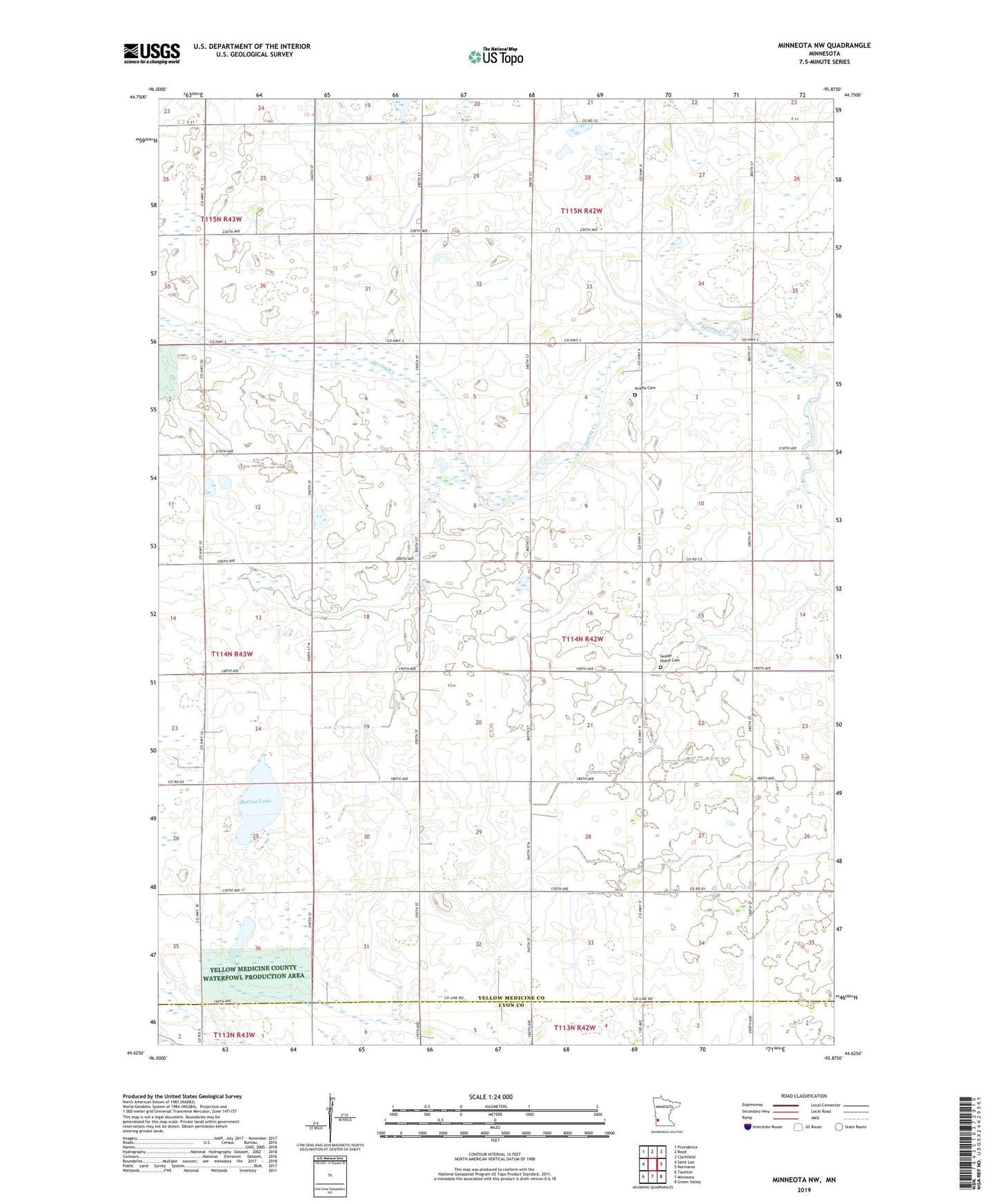
2022 topographic map quadrangle Minneota NW in the state of Minnesota. Scale: 1:24000. Based on the newly updated USGS 7.5' US Topo map series, this map is in the following counties: Yellow Medicine, Lyon. The map contains contour data, water features, and other items you are used to seeing on USGS maps, but also has updated roads and other features. This is the next generation of topographic maps. Printed on high-quality waterproof paper with UV fade-resistant inks.
Quads adjacent to this one:
West: Saint Leo
Northwest: Providence
North: Boyd
Northeast: Clarkfield
East: Normania
Southeast: Green Valley
South: Minneota
Southwest: Taunton
This map covers the same area as the classic USGS quad with code o44095f8.
Contains the following named places: Burton Lake, County Ditch Number Fortyeight, County Ditch Number Fortyfive, Israels Cemetery, Israels Church, Judicial Ditch Number Twenty, Swede Home Cemetery, Swede Home Church, Township of Swede Prairie