MyTopo
Pine River SW Minnesota US Topo Map
Couldn't load pickup availability
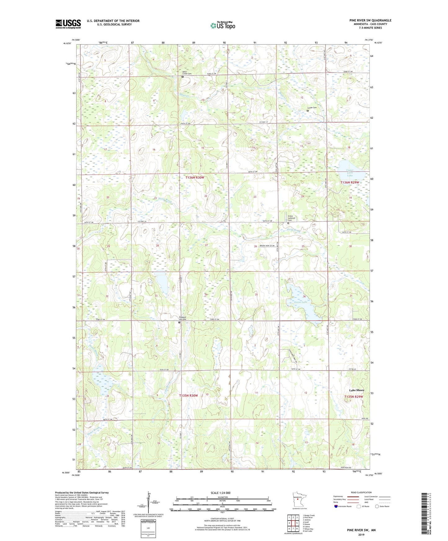
2022 topographic map quadrangle Pine River SW in the state of Minnesota. Scale: 1:24000. Based on the newly updated USGS 7.5' US Topo map series, this map is in the following counties: Cass. The map contains contour data, water features, and other items you are used to seeing on USGS maps, but also has updated roads and other features. This is the next generation of topographic maps. Printed on high-quality waterproof paper with UV fade-resistant inks.
Quads adjacent to this one:
West: Graff
Northwest: Bungo Creek
North: Pine River
Northeast: Jenkins
East: Nisswa
Southeast: Gull Lake
South: Wilson Bay
Southwest: Casino
This map covers the same area as the classic USGS quad with code o46094e4.
Contains the following named places: Bethlehem Church, Goose Lake, Grace Church, Grace Lutheran Cemetery, Lunde Cemetery, Mayo Creek Cemetery, Pleasant Hill Cemetery, Pleasant Hill Church, Stony Brook School, Stonybrook Post Office, Township of Home Brook, Township of Maple, Upper Loon Lake, ZIP Code: 56472