MyTopo
Byron Minnesota US Topo Map
Couldn't load pickup availability
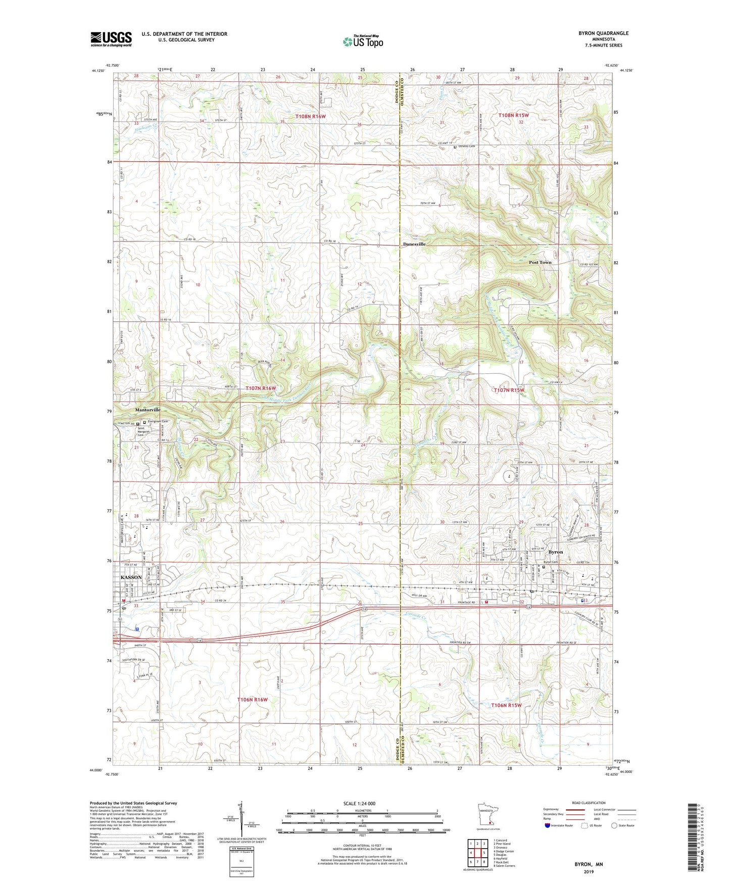
2019 topographic map quadrangle Byron in the state of Minnesota. Scale: 1:24000. Based on the newly updated USGS 7.5' US Topo map series, this map is in the following counties: Dodge, Olmsted. The map contains contour data, water features, and other items you are used to seeing on USGS maps, but also has updated roads and other features. This is the next generation of topographic maps. Printed on high-quality waterproof paper with UV fade-resistant inks.
Quads adjacent to this one:
West: Dodge Center
Northwest: Concord
North: Pine Island
Northeast: Oronoco
East: Douglas
Southeast: Salem Corners
South: Rock Dell
Southwest: Hayfield
Contains the following named places: Byron, Byron Cemetery, Byron Elementary School, Byron Fire Department, Byron High School, Byron Intermediate School, Byron Post Office, Christ Lutheran Church, Christ the King Catholic Church, City of Byron, City of Kasson, Community Celebration Church, Danesville, Double B Farms, Evergreen Cemetery, Holy Family Catholic Church, Kasson, Kasson Police Department, Kasson Post Office, Kasson Public Library, Kasson-Mantorville Elementary School, Kasson-Mantorville Senior High, KRCH-FM (Rochester), Masten Creek, Mount Moriah Lutheran Church, Mount Sion Independent Lutheran Church, Olmsted Medical Group Center, Othello Cemetery, Oxbow Park, Post Town, Saint Margaret Cemetery, Saint Peter's Episcopal Church, Tompkins Creek, Township of Mantorville, United Methodist Church, Zumbro Ridge Farms, ZIP Code: 55955