MyTopo
Oronoco Minnesota US Topo Map
Couldn't load pickup availability
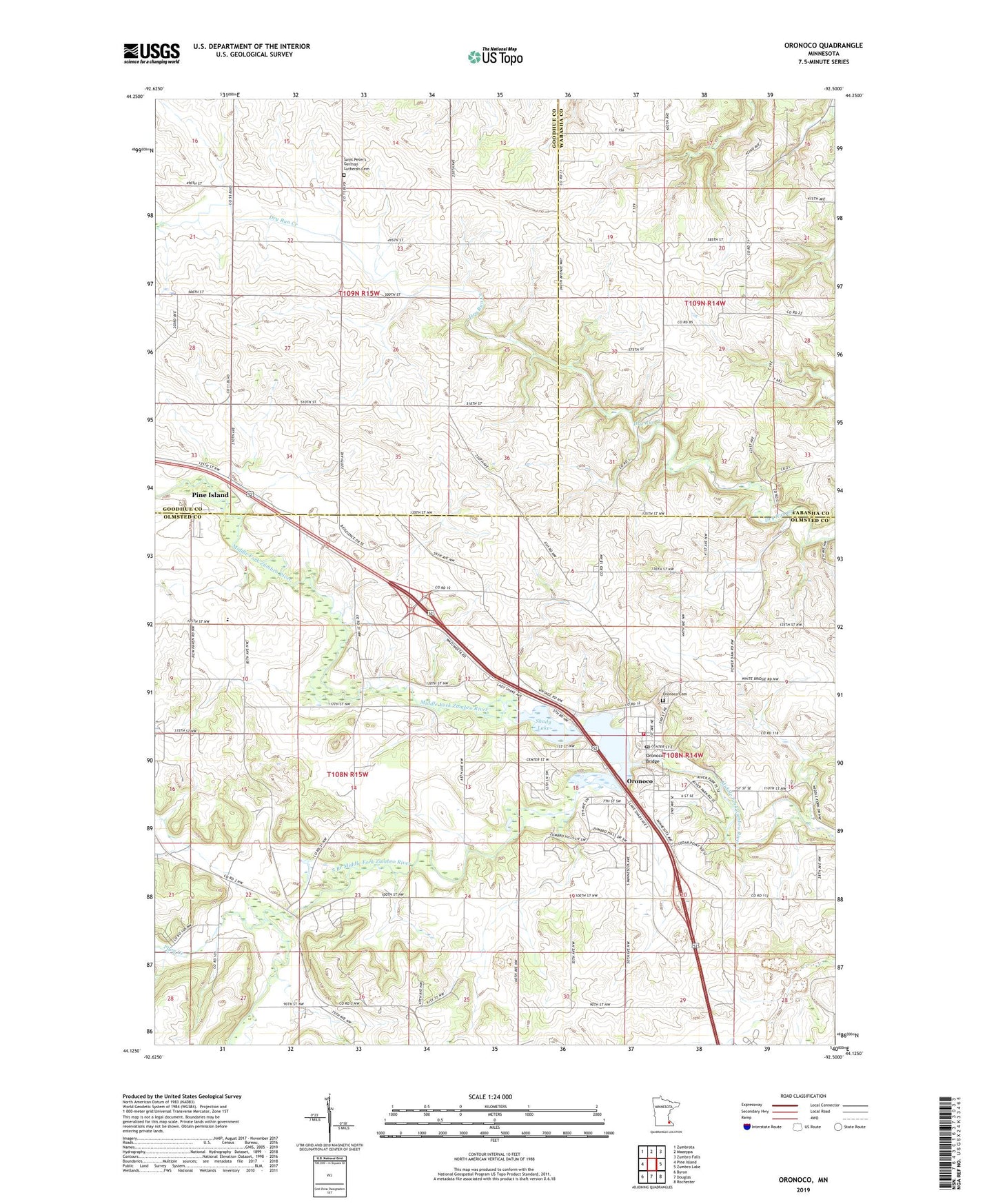
2022 topographic map quadrangle Oronoco in the state of Minnesota. Scale: 1:24000. Based on the newly updated USGS 7.5' US Topo map series, this map is in the following counties: Olmsted, Goodhue, Wabasha. The map contains contour data, water features, and other items you are used to seeing on USGS maps, but also has updated roads and other features. This is the next generation of topographic maps. Printed on high-quality waterproof paper with UV fade-resistant inks.
Quads adjacent to this one:
West: Pine Island
Northwest: Zumbrota
North: Mazeppa
Northeast: Zumbro Falls
East: Zumbro Lake
Southeast: Rochester
South: Douglas
Southwest: Byron
This map covers the same area as the classic USGS quad with code o44092b5.
Contains the following named places: City of Oronoco, City of Pine Island, Grace Lutheran Church, Hoehne Brothers Dam, J Sibley Dam, Oronoco, Oronoco Bridge, Oronoco Cemetery, Oronoco Fire Department, Oronoco Gold Rush Historical Marker, Oronoco Post Office, Oronoco State Park, Pine Island Golf Course, Plum Creek, Presbyterian Church, Rehoboth Adult and Elderly Care Center, Saint Peters Church, Saint Peter's German Lutheran Cemetery, Shady Lake, South Branch Middle Fork Zumbro River, Township of Mazeppa, Township of New Haven, Township of Pine Island, Wazionja Campground, ZIP Code: 55960