MyTopo
Pine Island Minnesota US Topo Map
Couldn't load pickup availability
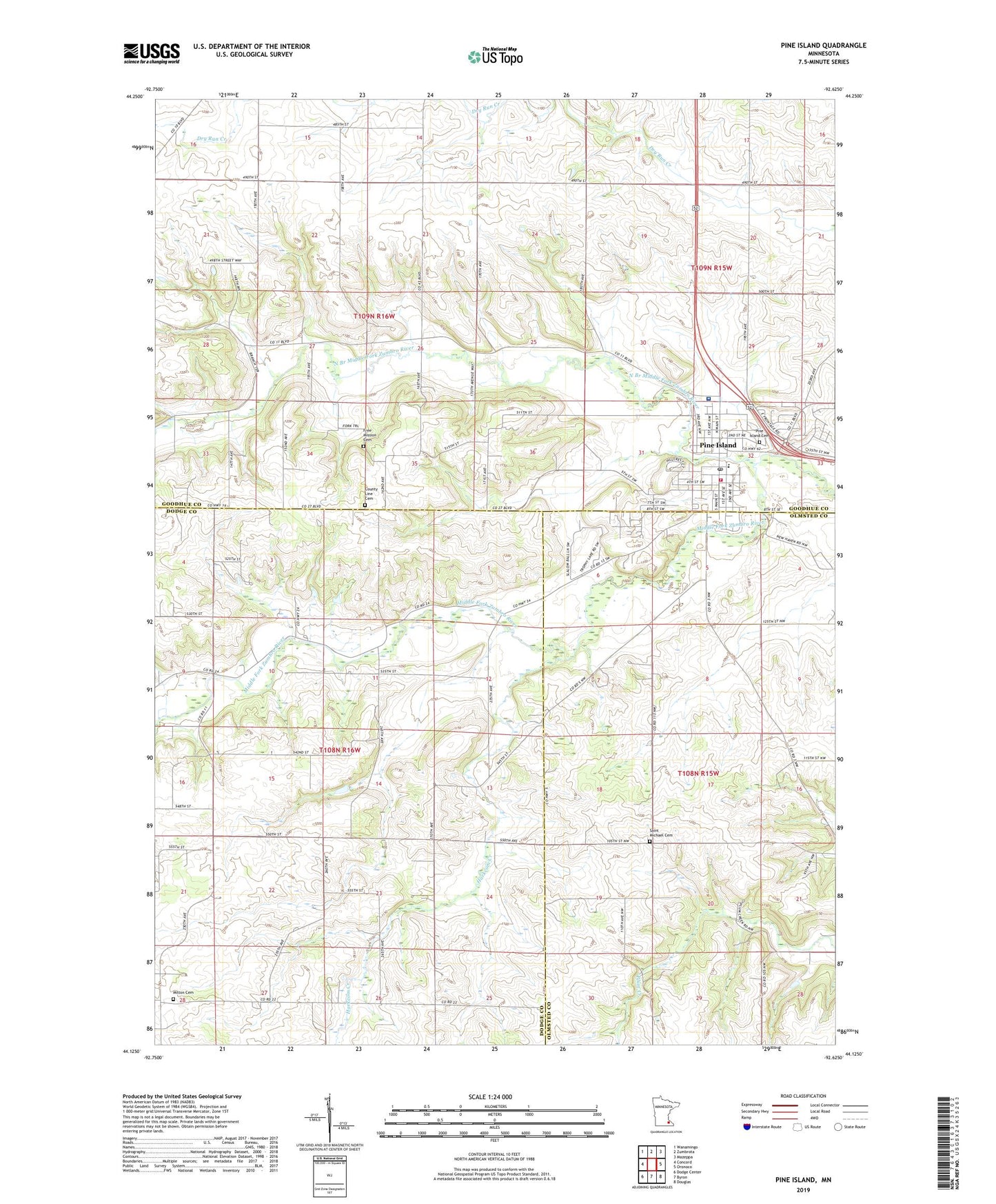
2022 topographic map quadrangle Pine Island in the state of Minnesota. Scale: 1:24000. Based on the newly updated USGS 7.5' US Topo map series, this map is in the following counties: Goodhue, Dodge, Olmsted. The map contains contour data, water features, and other items you are used to seeing on USGS maps, but also has updated roads and other features. This is the next generation of topographic maps. Printed on high-quality waterproof paper with UV fade-resistant inks.
Quads adjacent to this one:
West: Concord
Northwest: Wanamingo
North: Zumbrota
Northeast: Mazeppa
East: Oronoco
Southeast: Douglas
South: Byron
Southwest: Dodge Center
This map covers the same area as the classic USGS quad with code o44092b6.
Contains the following named places: Alberts-Rueg Group Dam, Baptist Church, County Line Cemetery, Free Mission Cemetery, Goodnews Evangelical Free Church, Harkcom Creek, La Moyne Bruce Detention Dam, Milton Cemetery, North Branch Middle Fork Zumbro River, Olmsted Medical Center, Overland Pond Dam, Pine Haven Care Center, Pine Island, Pine Island Assembly of God Church, Pine Island Cemetery, Pine Island Elementary School, Pine Island Fire Department, Pine Island High School, Pine Island Post Office, Pine Island Wayside Park, Saint Michael Cemetery, Saint Michael's Catholic Church, Saint Paul's Lutheran Church, Township of Milton, Township of Roscoe, United Methodist Church, Van Horn Library, ZIP Code: 55963