MyTopo
Dodge Center Minnesota US Topo Map
Couldn't load pickup availability
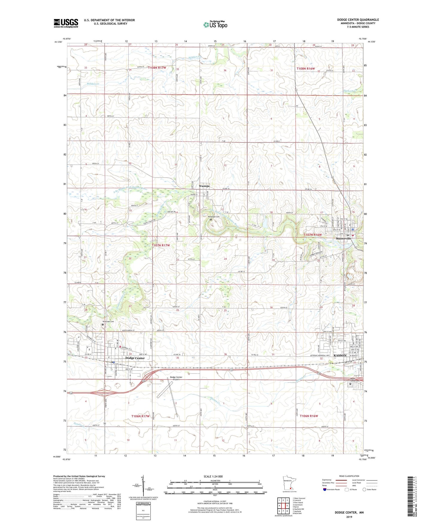
2022 topographic map quadrangle Dodge Center in the state of Minnesota. Scale: 1:24000. Based on the newly updated USGS 7.5' US Topo map series, this map is in the following counties: Dodge. The map contains contour data, water features, and other items you are used to seeing on USGS maps, but also has updated roads and other features. This is the next generation of topographic maps. Printed on high-quality waterproof paper with UV fade-resistant inks.
Quads adjacent to this one:
West: Claremont
Northwest: West Concord
North: Concord
Northeast: Pine Island
East: Byron
Southeast: Rock Dell
South: Hayfield
Southwest: Hayfield NW
This map covers the same area as the classic USGS quad with code o44092a7.
Contains the following named places: Assembly of God Church, Bethel Baptist Church, City of Dodge Center, City of Mantorville, Congregational Church, Dodge Center, Dodge Center Airport, Dodge Center Ambulance Service, Dodge Center Creek, Dodge Center Fire Department, Dodge Center Library, Dodge Center Police Department, Dodge Center Post Office, Dodge Center Sheriff's Office, Dodge County, Dodge County Courthouse, Dodge County Historical Society Library, Fairview Nursing Home, Faith Lutheran Church, First Baptist Church, First Congregational Church, First Presbyterian Church, Fryers Mobile Home Park, Grace Lutheran Church, Heritage Estates, Kasson, Kasson Mayo Family Practice Center, Mantorville, Mantorville City Hall, Mantorville Dam, Mantorville Fire Station, Mantorville Intermediate School, Mantorville Police Department, Mantorville Post Office, Mantorville Retaining Walls Park, Maple Grove Cemetery, Maranatha Adventist School, Our Savior Evangelical Lutheran Church, Our Saviour Evangelical Lutheran Church, Pleasant Corners Church, Praise Fellowship Church, Riverside Cemetery, Saint Johns Catholic Church, Saint John's Lutheran Church, Schletty State Wildlife Management Area, Seventh Day Adventist Church, South Fork Homes, The Church of Jesus Christ of Latter Day Saints, Township of Wasioja, Triton High School, United Methodist Church, Valley View Park, Walter and Ester Stussy Memorial RV Park, Wasioja, Wasioja Post Office, Wasioja Seminary Historical Marker, Wildwood Cemetery, Zumbro River Reservoir, ZIP Code: 55927