MyTopo
Caledonia Minnesota US Topo Map
Couldn't load pickup availability
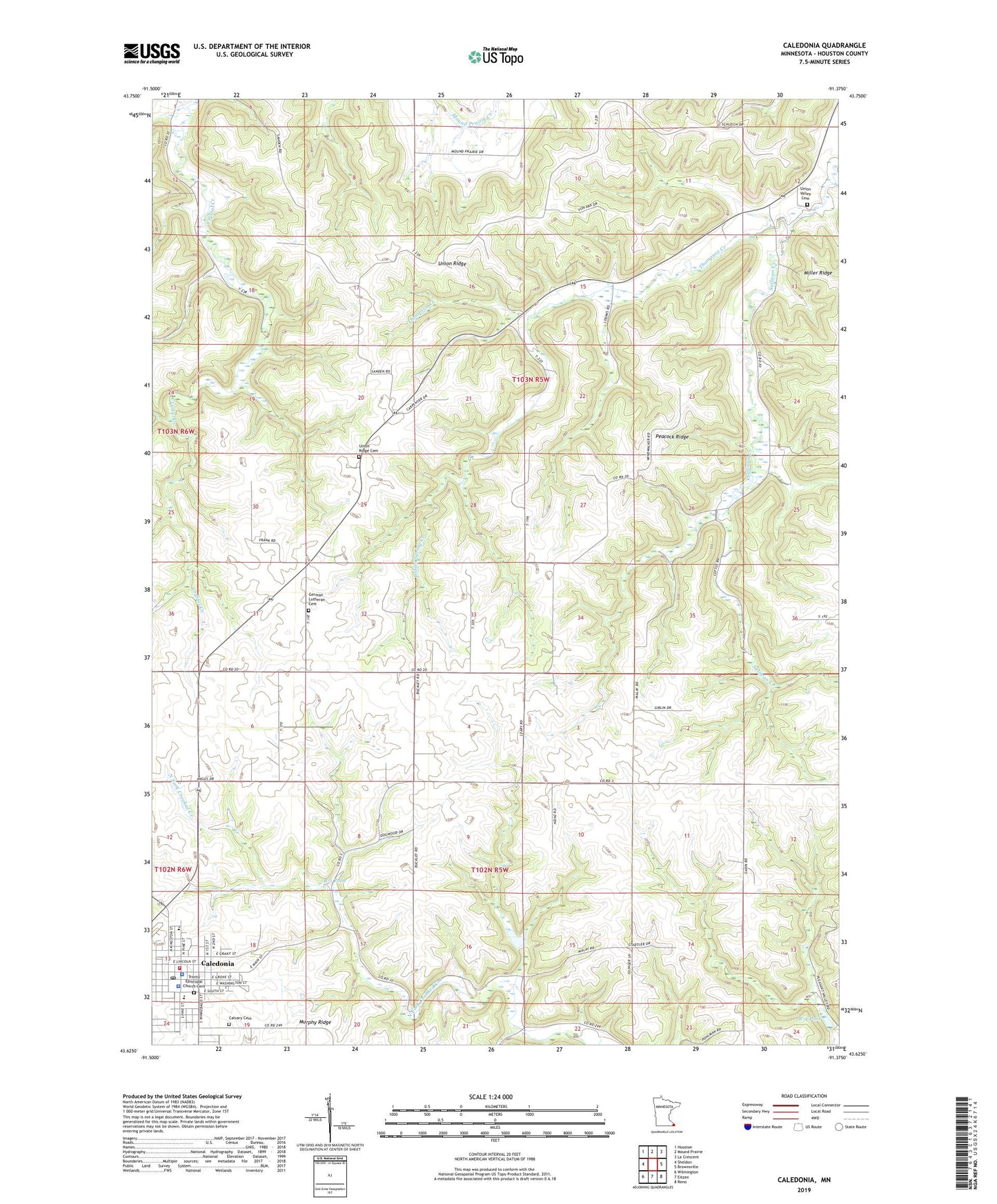
2019 topographic map quadrangle Caledonia in the state of Minnesota. Scale: 1:24000. Based on the newly updated USGS 7.5' US Topo map series, this map is in the following counties: Houston. The map contains contour data, water features, and other items you are used to seeing on USGS maps, but also has updated roads and other features. This is the next generation of topographic maps. Printed on high-quality waterproof paper with UV fade-resistant inks.
Quads adjacent to this one:
West: Sheldon
Northwest: Houston
North: Mound Prairie
Northeast: La Crescent
East: Brownsville
Southeast: Reno
South: Eitzen
Southwest: Wilmington
Contains the following named places: Caledonia, Caledonia Ambulance Service, Caledonia City Hall, Caledonia Fire Department, Caledonia Lutheran Home, Caledonia Mobile Home Park, Caledonia Police Department, Caledonia Post Office, Caledonia Public Library, Calvary Cemetery, Crooked Creek R-2 Dam, Crooked Creek S1-B Dam, Eastside Mobile Home Park, Gazebo Park, German Lutheran Cemetery, Highland Park Estates, Houston County, Houston County Courthouse, Houston County Jail, Houston County Sheriff's Office, Immanuel Lutheran Church, Indian Spring Creek, KKOO-FM (Caledonia), North Park, Peacock Ridge, Pine Estates, R-1 Pool, R-4 Pool, Saint John Evangelical Lutheran Church, Saint John Evangelical Lutheran School, Saint Mary's Catholic School, Saint Mary's Church, Saint Peters Church, Structure R-1 Dam, Sullivan Creek, Township of Mayville, Township of Union, Trinity Episcopal Church Cemetery, Union Ridge, Union Ridge Cemetery, Union Ridge Church, Union Valley Cemetery, United Methodist Church, Veterans Recreation Area, Vineyard Christian Church, ZIP Code: 55921