MyTopo
Brownsville Minnesota US Topo Map
Couldn't load pickup availability
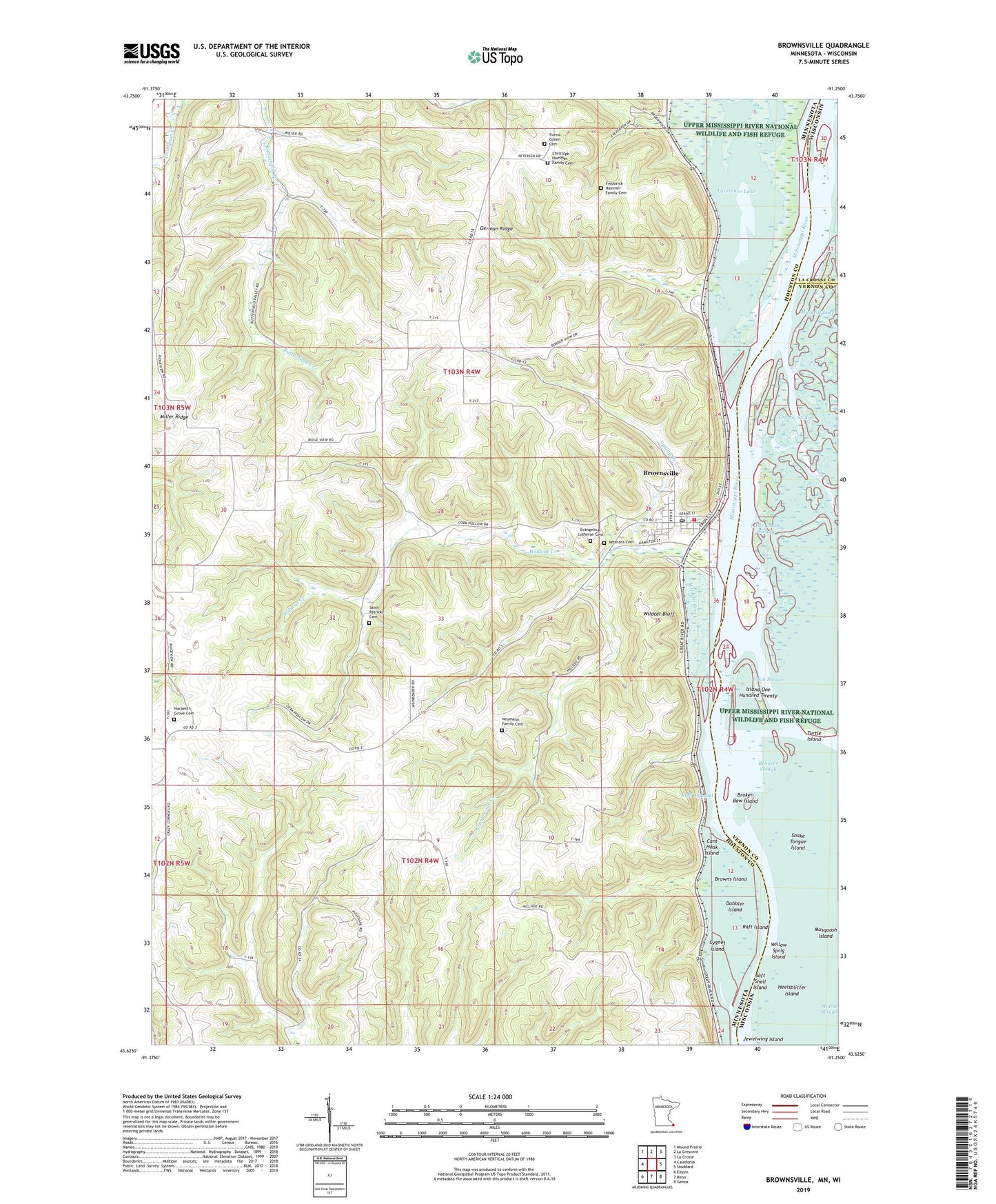
2022 topographic map quadrangle Brownsville in the states of Minnesota, Wisconsin. Scale: 1:24000. Based on the newly updated USGS 7.5' US Topo map series, this map is in the following counties: Houston, Vernon, La Crosse. The map contains contour data, water features, and other items you are used to seeing on USGS maps, but also has updated roads and other features. This is the next generation of topographic maps. Printed on high-quality waterproof paper with UV fade-resistant inks.
Quads adjacent to this one:
West: Caledonia
Northwest: Mound Prairie
North: La Crescent
Northeast: La Crosse
East: Stoddard
Southeast: Genoa
South: Reno
Southwest: Eitzen
Contains the following named places: Benover Slough, Bluff View Farm, Broken Bow Island, Browns Island, Brownsville, Brownsville City Hall, Brownsville Creek, Brownsville Fire and Rescue Department, Brownsville Post Office, Cant Hook Island, Christoph Hammer Family Cemetery, City of Brownsville, Coon Slough, Crosby Slough, Cygnet Island, Dabbler Island, Evangelical Lutheran Cemetery, Forest Green Cemetery, Frederick Hammer Family Cemetery, German Ridge, Hackett's Grove Cemetery, Heelsplitter Island, Island One Hundred Twenty, Jewelwing Island, KKOO-FM (Caledonia), Lawrence Lake, Little Crosby Slough, Miller Ridge, Muskrat Lake, Musquash Island, Neumann Family Cemetery, Raft Channel, Raft Island, Rediske Dairy, Saint Patrick Parish, Saint Patricks Cemetery, Snake Tongue Island, Soft Shell Island, Spring Branch, Township of Brownsville, Turtle Island, Veterans Cemetery, Ward Lee Mobile Home Park, Warner Post Light, Wildcat Bluff, Wildcat Creek, Wildcat Landing Campground, Wildcat Landing Public Access, Wildcat Park, Willow Sprig Island, Zion Evangelical Church, ZIP Code: 55941