MyTopo
Sheldon Minnesota US Topo Map
Couldn't load pickup availability
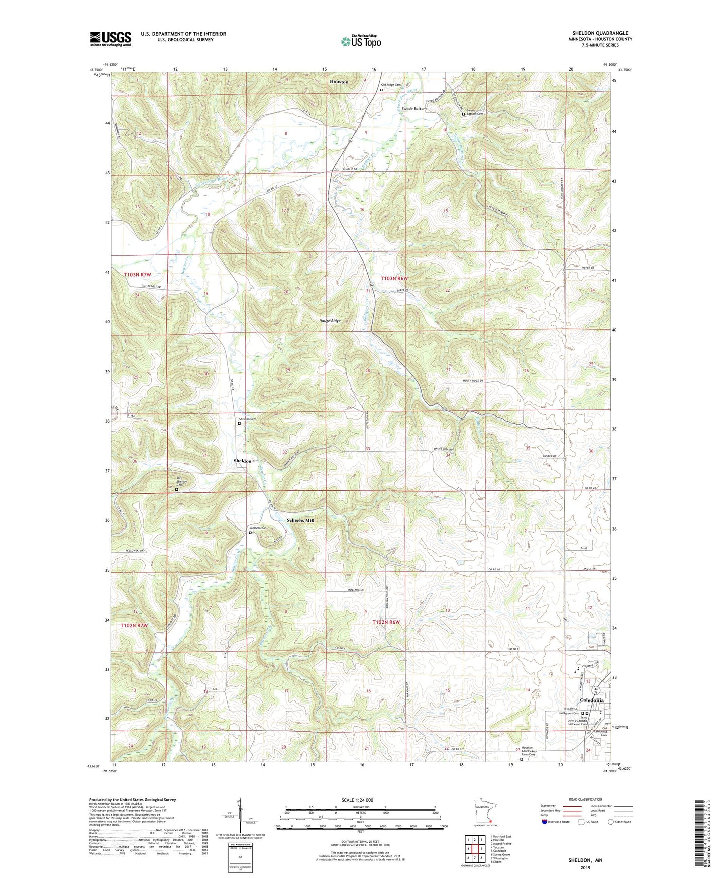
2022 topographic map quadrangle Sheldon in the state of Minnesota. Scale: 1:24000. Based on the newly updated USGS 7.5' US Topo map series, this map is in the following counties: Houston. The map contains contour data, water features, and other items you are used to seeing on USGS maps, but also has updated roads and other features. This is the next generation of topographic maps. Printed on high-quality waterproof paper with UV fade-resistant inks.
Quads adjacent to this one:
West: Yucatan
Northwest: Rushford East
North: Houston
Northeast: Mound Prairie
East: Caledonia
Southeast: Eitzen
South: Wilmington
Southwest: Spring Grove
This map covers the same area as the classic USGS quad with code o43091f5.
Contains the following named places: Badger Creek, Beaver Creek, Beaver Creek East, Beaver Creek Valley State Park, Beaver Creek West, Big Spring Historical Marker, Caledonia Cemetery, Caledonia Elementary School, Caledonia HIgh School, Caledonia Wayside Park, City of Caledonia, Evergreen Cemetery, Franciscan Skemp Healthcare Center, Hauge Ridge, Houston County Poor Farm Cemetery, Messeral Cemetery, Mill Pond, Old Ridge Cemetery, Old Sheldon Cemetery, Saint Johns German Lutheran Cemetery, Schechs Mill, Schechs Mill Dam, Sheldon, Sheldon Cemetery, Sheldon Post Office, Swede Bottom, Swede Bottom Cemetery, Swede Bottom Creek, Township of Caledonia, Township of Sheldon