MyTopo
Vermillion Minnesota US Topo Map
Couldn't load pickup availability
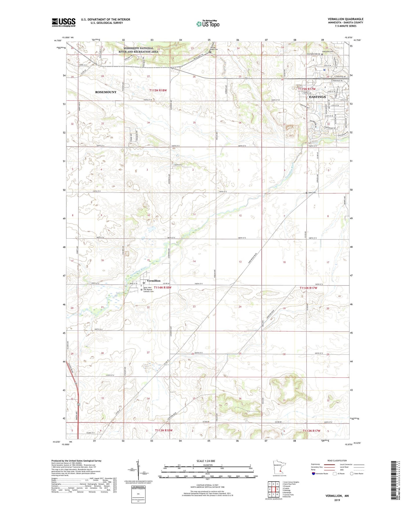
2022 topographic map quadrangle Vermillion in the state of Minnesota. Scale: 1:24000. Based on the newly updated USGS 7.5' US Topo map series, this map is in the following counties: Dakota. The map contains contour data, water features, and other items you are used to seeing on USGS maps, but also has updated roads and other features. This is the next generation of topographic maps. Printed on high-quality waterproof paper with UV fade-resistant inks.
Quads adjacent to this one:
West: Coates
Northwest: Inver Grove Heights
North: Saint Paul Park
Northeast: Prescott
East: Hastings
Southeast: Miesville
South: Cannon Falls
Southwest: Randolph
This map covers the same area as the classic USGS quad with code o44092f8.
Contains the following named places: Christa McAuliffe Elementary School, City of Vermillion, Crestview Park, Crista McAuliffe Elementary School, Dakota County Government Center, Dakota County Sheriff's Office, Dakota Hills Park, Emerald Greens Golf Course, Featherstone Ponding Basin, Hastings High School, Hope Lutheran Church, KTCJ-AM (Minneapolis), Lyon Cemetery, Midtown Shopping Center, Oakwood Cemetery, Pleasant Hill Library, Pleasant Park, Rosemary Pond Basin, Saint Elizabeth Ann Seton Church, Saint John The Baptist Catholic Cemetery, Saint John the Baptist Catholic School, Saint John's Catholic Church, Saint Johns School, Saint Philips Lutheran Church, Shepherd of the Valley Lutheran Church, Spring Lake Cemetery, Tierney Park, Township of Nininger, Township of Vermillion, Vermillion, Vermillion City Hall, Vermillion Post Office, Wallin Park, Westview Shopping Center, ZIP Code: 55085