MyTopo
Coates Minnesota US Topo Map
Couldn't load pickup availability
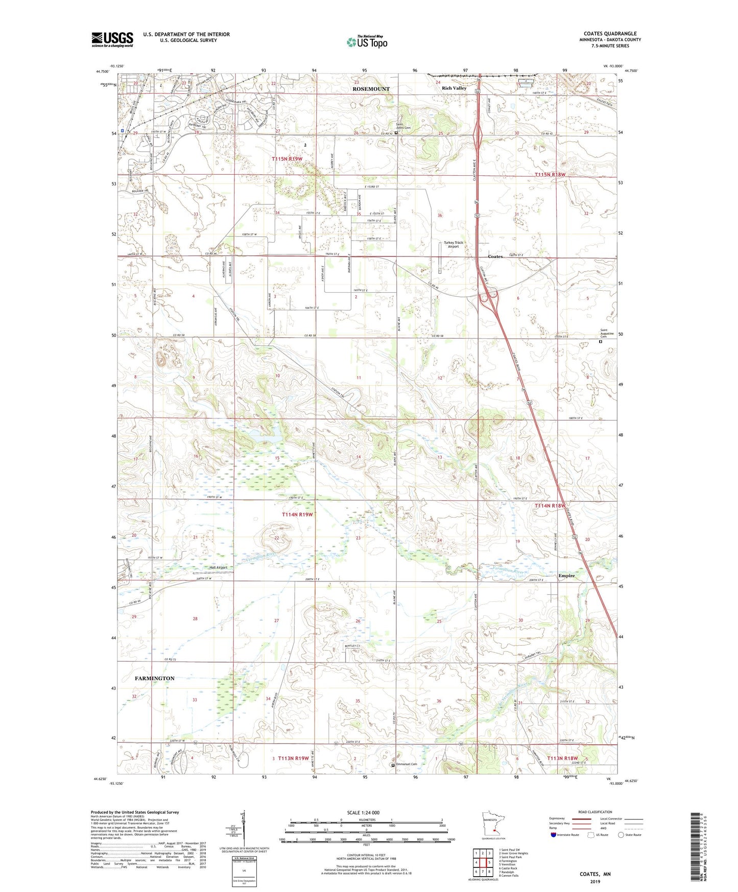
2022 topographic map quadrangle Coates in the state of Minnesota. Scale: 1:24000. Based on the newly updated USGS 7.5' US Topo map series, this map is in the following counties: Dakota. The map contains contour data, water features, and other items you are used to seeing on USGS maps, but also has updated roads and other features. This is the next generation of topographic maps. Printed on high-quality waterproof paper with UV fade-resistant inks.
Quads adjacent to this one:
West: Farmington
Northwest: Saint Paul SW
North: Inver Grove Heights
Northeast: Saint Paul Park
East: Vermillion
Southeast: Cannon Falls
South: Randolph
Southwest: Castle Rock
This map covers the same area as the classic USGS quad with code o44093f1.
Contains the following named places: Birch Park, Biscayne Park, Bloomfield Park, Central Park, City of Coates, City of Rosemount, Coates, Coates City Park, Coates Post Office, Dakota County, Dakota County Technical College, Emmanuel Cemetery, Empire, Empire City, Empire City Post Office, Erickson Park, Fountain Valley Golf Club, Hall Airport, KUOM-AM (Minneapolis), Old City Hall Park, Rich Valley, Rich Valley Golf Course, Rich Valley Post Office, Rich Valley Railroad Station, Rosemount City Police Department, Rosemount Township, Saint Augustine Cemetery, Saint Johns Cemetery, Saint Johns Church, Saint Joseph School, South Branch Vermillion River, Sowieja Airport, Township of Empire, Turkey Track Airport, University of Minnesota Rosemount Research Center, WCAL-FM (Northfield), ZIP Code: 55068