
MyTopo
Central Lakes Minnesota US Topo Map
Couldn't load pickup availability
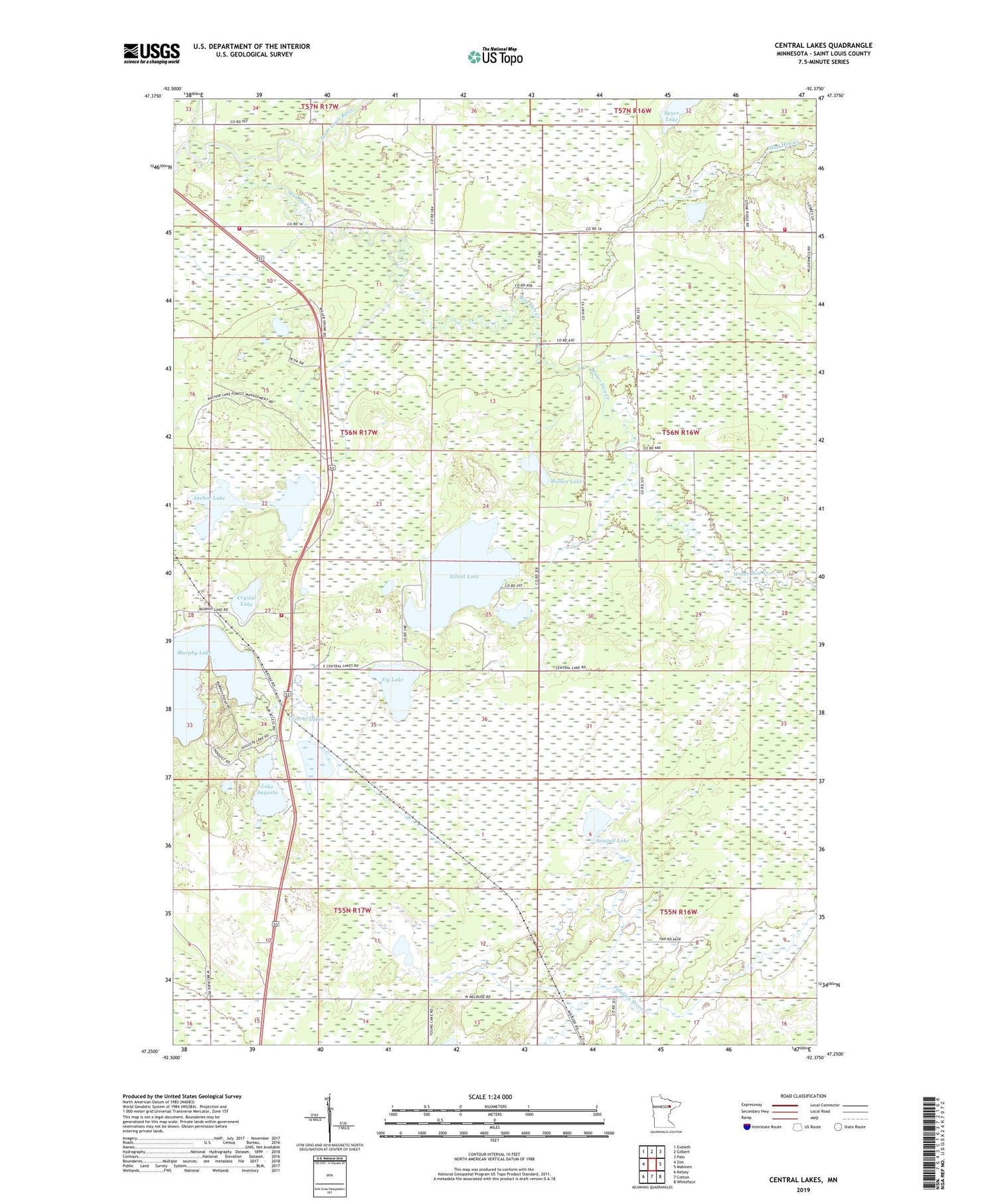
2019 topographic map quadrangle Central Lakes in the state of Minnesota. Scale: 1:24000. Based on the newly updated USGS 7.5' US Topo map series, this map is in the following counties: St. Louis. The map contains contour data, water features, and other items you are used to seeing on USGS maps, but also has updated roads and other features. This is the next generation of topographic maps. Printed on high-quality waterproof paper with UV fade-resistant inks.
Quads adjacent to this one:
West: Zim
Northwest: Eveleth
North: Gilbert
Northeast: Palo
East: Makinen
Southeast: Whiteface
South: Cotton
Southwest: Kelsey
Contains the following named places: Anchor Lake, Anchor Lake Travel Information Center, Central Lakes, Central Lakes Fire Department and Community Organization Station 1, Central Lakes Fire Department and Community Organization Station 2, Central Lakes Post Office, Central Lakes Station, Crystal Lake, Elliott Lake, Fig Lake, Lake Augusta, Makinen Fire Department, Moilan Lake, Mud Hen Creek, Murphy Lake, Paleface Creek, Sayer Lake, Seasted Lake, Three-Way Continental Divide Historical Marker, Unorganized Territory of Heikkala Lake, Unorganized Territory of Makinen, Water Hen Creek, ZIP Codes: 55734, 55766


