MyTopo
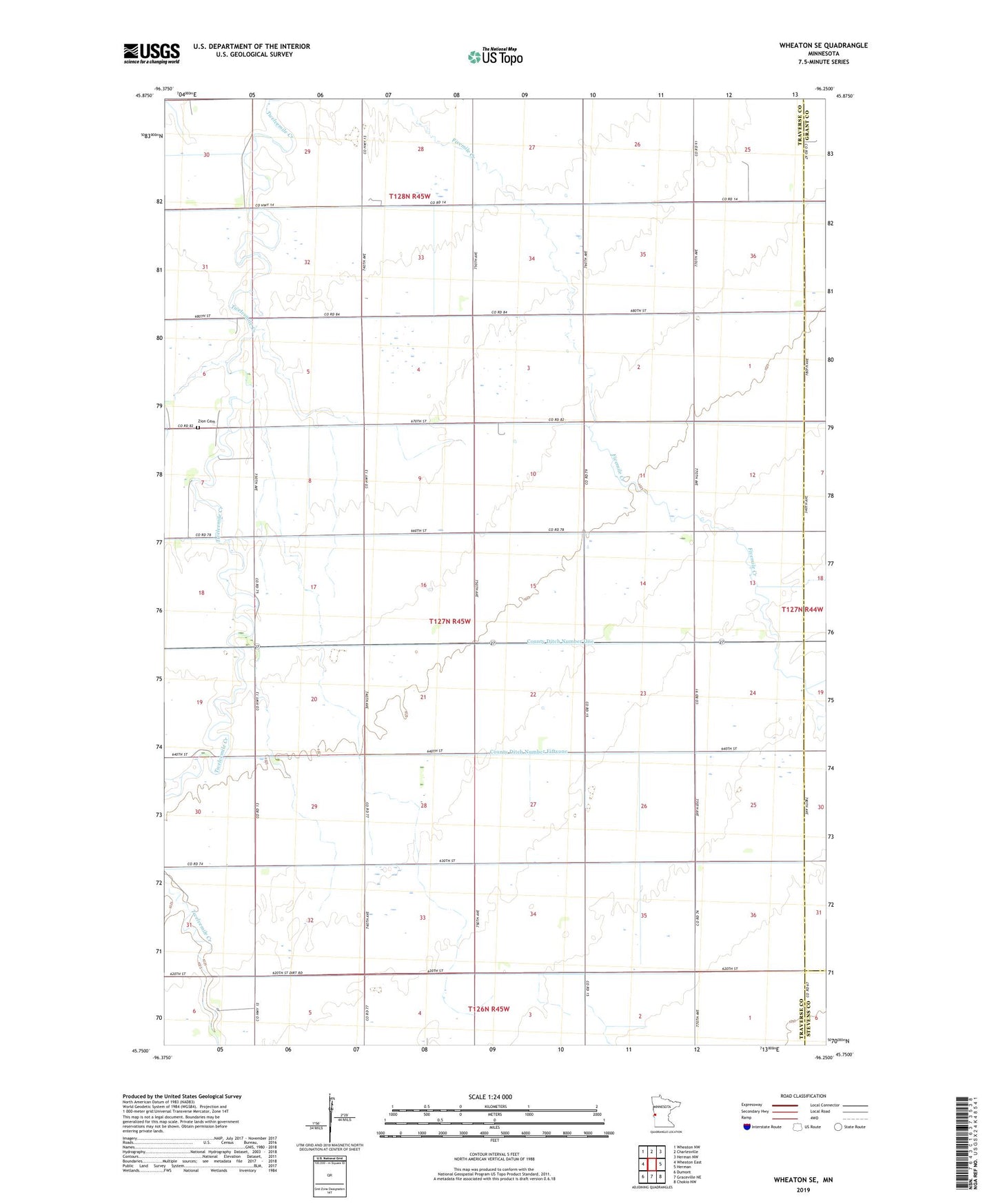
Wheaton SE Minnesota US Topo Map
Couldn't load pickup availability
2022 topographic map quadrangle Wheaton SE in the state of Minnesota. Scale: 1:24000. Based on the newly updated USGS 7.5' US Topo map series, this map is in the following counties: Traverse, Grant, Stevens. The map contains contour data, water features, and other items you are used to seeing on USGS maps, but also has updated roads and other features. This is the next generation of topographic maps. Printed on high-quality waterproof paper with UV fade-resistant inks.
Quads adjacent to this one:
West: Wheaton East
Northwest: Wheaton NW
North: Charlesville
Northeast: Herman NW
East: Herman
Southeast: Chokio NW
South: Graceville NE
Southwest: Dumont
This map covers the same area as the classic USGS quad with code o45096g3.
Contains the following named places: County Ditch Number Fiftyone, County Ditch Number Forty, County Ditch Number Fortytwo, County Ditch Number Four, County Ditch Number One, County Ditch Number Seven, County Ditch Number Twentythree, County Ditch Number Two, School Number 34, School Number 38, School Number 48, School Number 51, School Number 57, Simpson Landing Strip, Township of Clifton, Zimmerman Airport, Zion Cemetery