MyTopo
Clements SE Minnesota US Topo Map
Couldn't load pickup availability
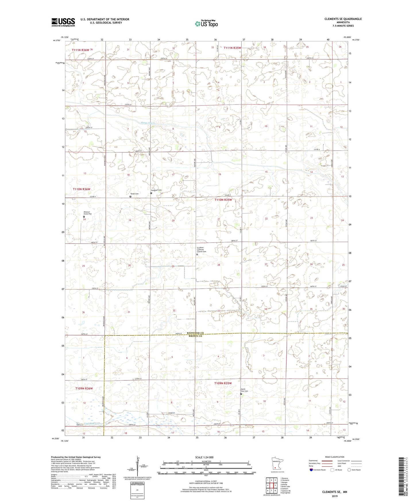
2022 topographic map quadrangle Clements SE in the state of Minnesota. Scale: 1:24000. Based on the newly updated USGS 7.5' US Topo map series, this map is in the following counties: Redwood, Brown. The map contains contour data, water features, and other items you are used to seeing on USGS maps, but also has updated roads and other features. This is the next generation of topographic maps. Printed on high-quality waterproof paper with UV fade-resistant inks.
Quads adjacent to this one:
West: Wanda
Northwest: Rowena
North: Clements
Northeast: Morgan
East: Boise Lake
Southeast: Springfield
South: Sanborn NE
Southwest: Sanborn
This map covers the same area as the classic USGS quad with code o44095c1.
Contains the following named places: Bellig Farm, County Ditch Number Eightyfive, County Ditch Number Thirtyeight, Judicial Ditch Number Thirtyfive, Missouri Evans Plot, North Star Cemetery, School Number 1242, Sundown Cemetery, Sundown Church, Sundown Lutheran Church Cemetery, Sundown School, Tonak Cemetery, Township of Sundown, ZIP Code: 56224