MyTopo
Wanda Minnesota US Topo Map
Couldn't load pickup availability
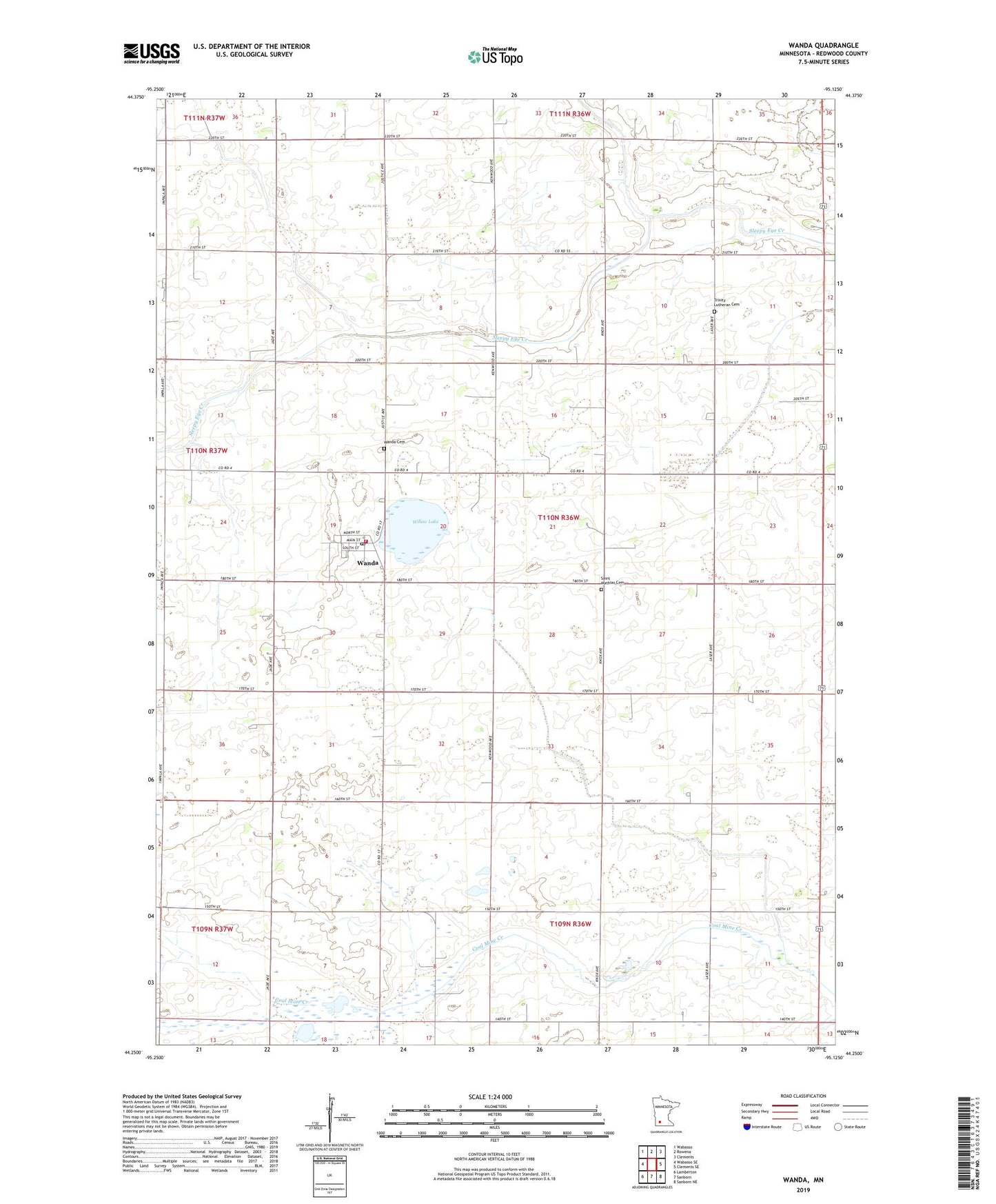
2022 topographic map quadrangle Wanda in the state of Minnesota. Scale: 1:24000. Based on the newly updated USGS 7.5' US Topo map series, this map is in the following counties: Redwood. The map contains contour data, water features, and other items you are used to seeing on USGS maps, but also has updated roads and other features. This is the next generation of topographic maps. Printed on high-quality waterproof paper with UV fade-resistant inks.
Quads adjacent to this one:
West: Wabasso SE
Northwest: Wabasso
North: Rowena
Northeast: Clements
East: Clements SE
Southeast: Sanborn NE
South: Sanborn
Southwest: Lamberton
This map covers the same area as the classic USGS quad with code o44095c2.
Contains the following named places: City of Wanda, County Ditch Number Fortynine, County Ditch Number One Hundred Two, County Ditch Number Sixtyeight, Judicial Ditch Number Thirtysix, Lamberton State Wildlife Management Area, Legion Field, Saint Mathias Cemetery, Saint Mathias Church, Schoo Park, Township of Willow Lake, Trinity Church, Trinity Lutheran Cemetery, Wanda, Wanda Cemetery, Wanda Post Office, Wanda Town Hall, Wanda Volunteer Fire Department, Willow Lake, Willow Lake State Wildlife Management Area, ZIP Code: 56294