MyTopo
Siseebakwet Lake Minnesota US Topo Map
Couldn't load pickup availability
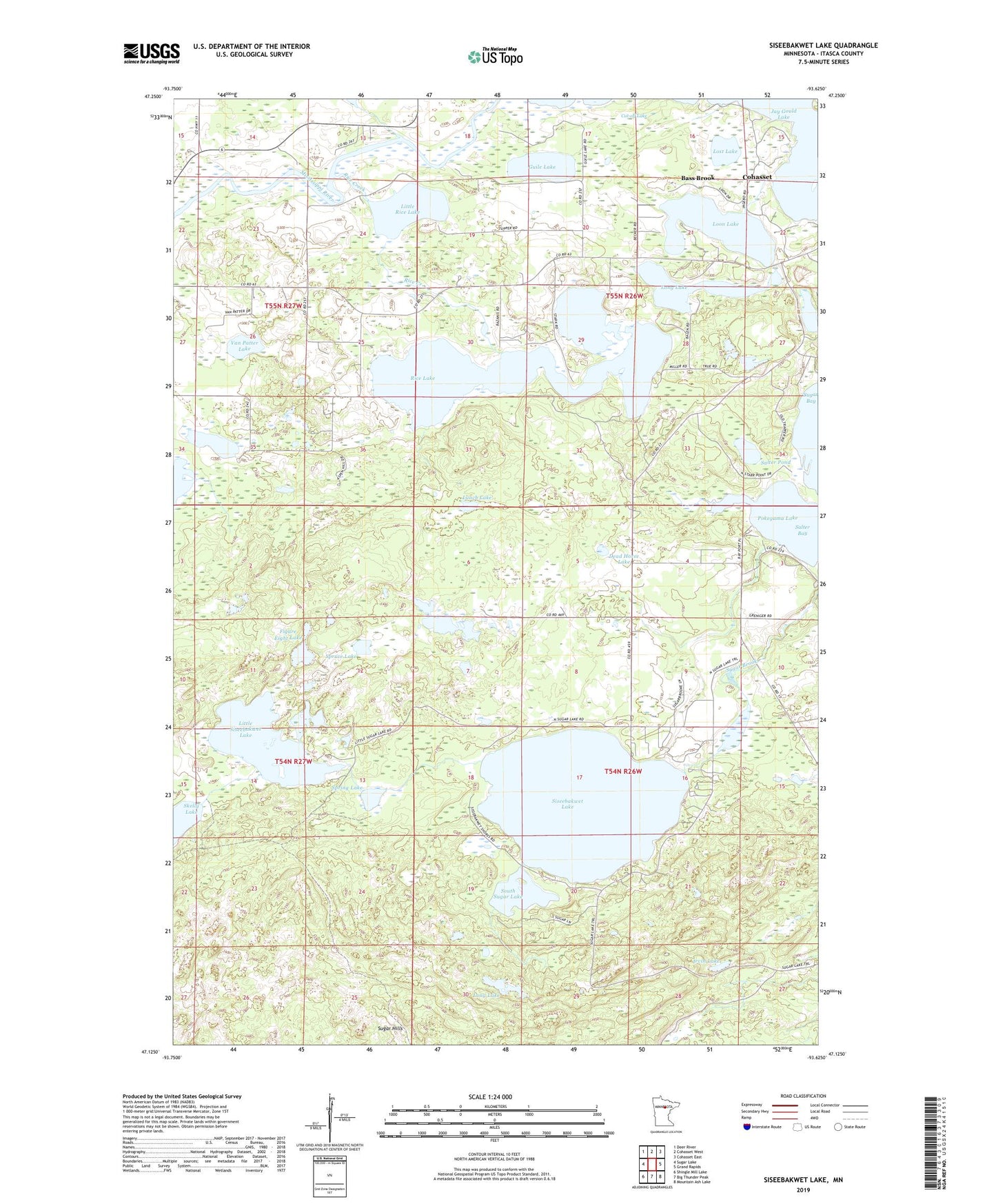
2022 topographic map quadrangle Siseebakwet Lake in the state of Minnesota. Scale: 1:24000. Based on the newly updated USGS 7.5' US Topo map series, this map is in the following counties: Itasca. The map contains contour data, water features, and other items you are used to seeing on USGS maps, but also has updated roads and other features. This is the next generation of topographic maps. Printed on high-quality waterproof paper with UV fade-resistant inks.
Quads adjacent to this one:
West: Sugar Lake
Northwest: Deer River
North: Cohasset West
Northeast: Cohasset East
East: Grand Rapids
Southeast: Mountain Ash Lake
South: Big Thunder Peak
Southwest: Shingle Mill Lake
This map covers the same area as the classic USGS quad with code o47093b6.
Contains the following named places: Bass Brook, City of Bass Brook, City of Cohasset, Compton Post Office, Cut-off Lake, Dead Horse Lake, Figure Eight Lake, Guile Lake, Irvin Lake, Little Leighton Lake, Little Rice Lake, Little Siseebakwet Lake, Long Lake, Loon Lake, Lost Lake, Lunch Lake, Rice Creek, Rice Lake, Salter Bay, Salter Pond, Siseebakwet Lake, South Sugar Lake, Spring Lake, Spruce Lake, Sugar Bay Campground Resort, Sugarbrooke Golf Club, Township of Bass Brook, Van Patter Lake, ZIP Code: 55721