MyTopo
Vinje Iowa US Topo Map
Couldn't load pickup availability
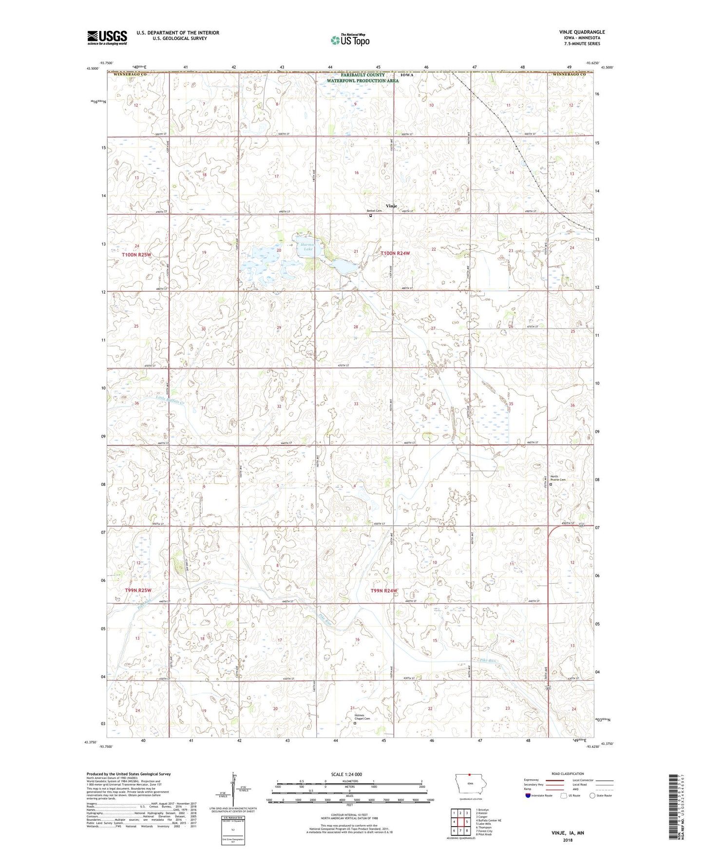
2022 topographic map quadrangle Vinje in the state of Iowa. Scale: 1:24000. Based on the newly updated USGS 7.5' US Topo map series, this map is in the following counties: Winnebago, Faribault, Freeborn. The map contains contour data, water features, and other items you are used to seeing on USGS maps, but also has updated roads and other features. This is the next generation of topographic maps. Printed on high-quality waterproof paper with UV fade-resistant inks.
Quads adjacent to this one:
West: Buffalo Center NE
Northwest: Bricelyn
North: Kiester
Northeast: Conger
East: Lake Mills
Southeast: Pilot Knob
South: Forest City
Southwest: Thompson
Contains the following named places: Bethel Cemetery, Bethel Church, Deering Post Office, Grytte Post Office, Harmon Lake, Harmon Lake State Game Management Area, Holmes Chapel Cemetery, Nasheim Post Office, North Prairie Cemetery, North Prairie Church, Township of Logan, Township of Newton, Tweten Post Office, Vinje, Vinje Post Office, Winnebago County, ZIP Code: 50473