MyTopo
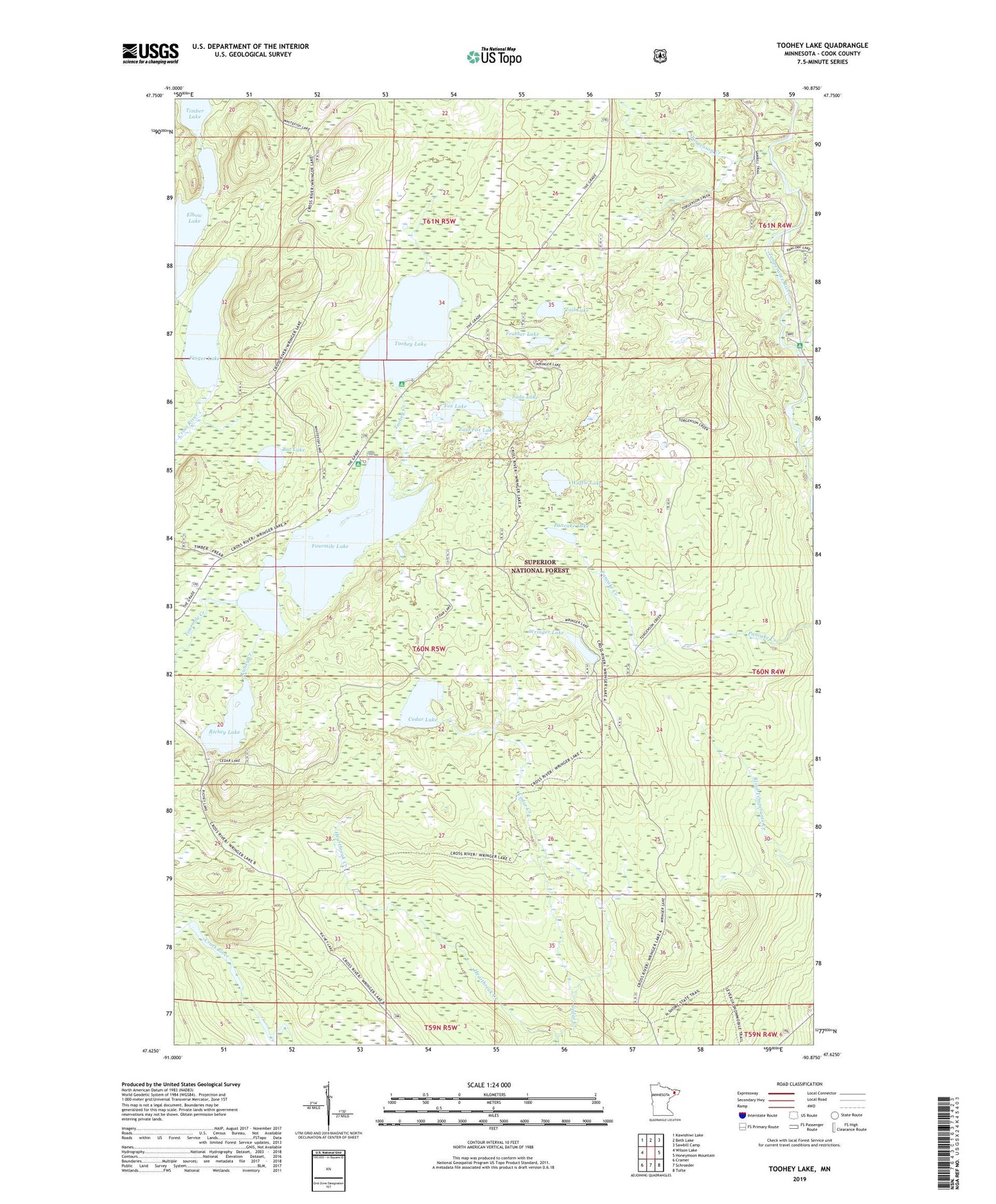
Toohey Lake Minnesota US Topo Map
Couldn't load pickup availability
Also explore the Toohey Lake Forest Service Topo of this same quad for updated USFS data
2022 topographic map quadrangle Toohey Lake in the state of Minnesota. Scale: 1:24000. Based on the newly updated USGS 7.5' US Topo map series, this map is in the following counties: Cook. The map contains contour data, water features, and other items you are used to seeing on USGS maps, but also has updated roads and other features. This is the next generation of topographic maps. Printed on high-quality waterproof paper with UV fade-resistant inks.
Quads adjacent to this one:
West: Wilson Lake
Northwest: Kawishiwi Lake
North: Beth Lake
Northeast: Sawbill Camp
East: Honeymoon Mountain
Southeast: Tofte
South: Schroeder
Southwest: Cramer
This map covers the same area as the classic USGS quad with code o47090f8.
Contains the following named places: Bat Lake, Cedar Creek, Cedar Lake, East Fox Lake, Feather Lake, Finger Lake, Fourmile Lake, Fox Lake, Honeymoon Creek, Pancake Lake, Richey Creek, Richey Lake, Soda Lake, Tail Lake, Temperance River Campground, Toohey Creek, Toohey Lake, Torgenson Creek, Township of Schroeder, Waffle Lake, Wringer Lake