MyTopo
Delhi Minnesota US Topo Map
Couldn't load pickup availability
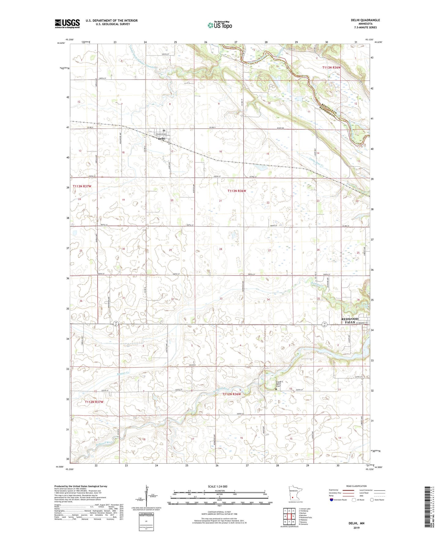
2022 topographic map quadrangle Delhi in the state of Minnesota. Scale: 1:24000. Based on the newly updated USGS 7.5' US Topo map series, this map is in the following counties: Redwood, Renville. The map contains contour data, water features, and other items you are used to seeing on USGS maps, but also has updated roads and other features. This is the next generation of topographic maps. Printed on high-quality waterproof paper with UV fade-resistant inks.
Quads adjacent to this one:
West: Belview
Northwest: Iverson Lake
North: Vicksburg
Northeast: Bechyn
East: Redwood Falls
Southeast: Clements
South: Rowena
Southwest: Wabasso
This map covers the same area as the classic USGS quad with code o44095e2.
Contains the following named places: Alexander Ramsey State Park, Cedar Rock Farms, Cedar Rock Wildlife Management A, City of Delhi, County Ditch Number Twelve, Delhi, Delhi Farms, Delhi Post Office, Delhi Presbyterian Church, Delhi State Wildlife Management Area, Delhi Town Hall, Dike 1, Dike 2, G and M Farms, KLGR-AM (Redwood Falls), KLGR-FM (Redwood Falls), Lake Redwood, Mertens Dike, Middle Creek, Orange C Martin Grave, Ramsey Creek, Ramsey Falls, Redwood County Museum, School Number 53, School Number 61, Township of Delhi, Werner Farms, Westside Park, ZIP Code: 56283