MyTopo
Wabasso Minnesota US Topo Map
Couldn't load pickup availability
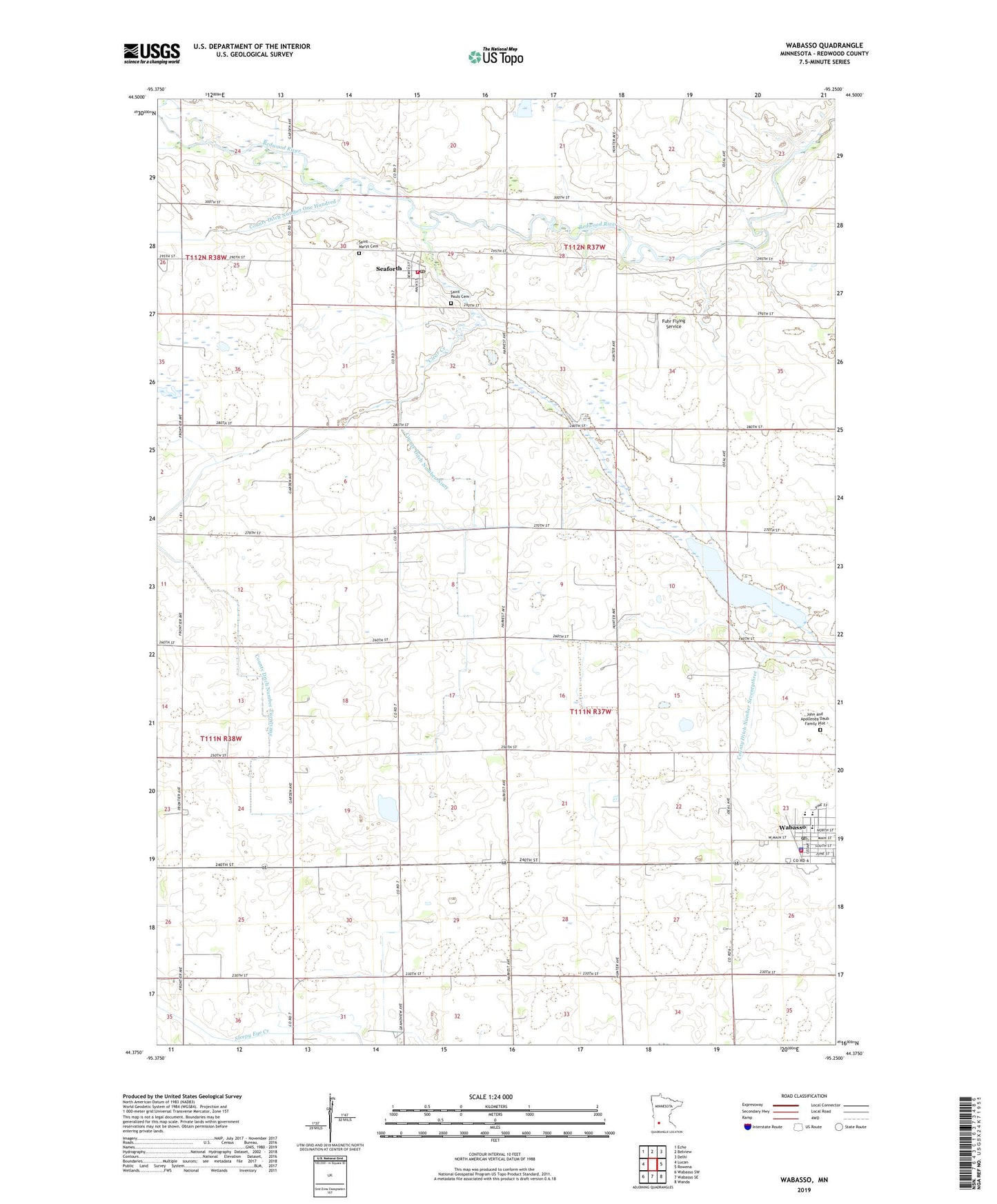
2022 topographic map quadrangle Wabasso in the state of Minnesota. Scale: 1:24000. Based on the newly updated USGS 7.5' US Topo map series, this map is in the following counties: Redwood. The map contains contour data, water features, and other items you are used to seeing on USGS maps, but also has updated roads and other features. This is the next generation of topographic maps. Printed on high-quality waterproof paper with UV fade-resistant inks.
Quads adjacent to this one:
West: Lucan
Northwest: Echo
North: Belview
Northeast: Delhi
East: Rowena
Southeast: Wanda
South: Wabasso SE
Southwest: Wabasso SW
This map covers the same area as the classic USGS quad with code o44095d3.
Contains the following named places: Bernard Farms, Bethany Evangelical Lutheran Church, City of Seaforth, City of Wabasso, Clear Creek, County Ditch Number Ninty, County Ditch Number One Hundred, County Ditch Number Seventythree, County Ditch Number Twentyone, Daubs Lake, Daubs Lake State Wildlife Management Area, Fuhr Flying Service, Jewish Burial Plot, John and Apollenea Daub Family Plot, Paul State Wildlife Management Area, Redwood County, Saint Anne's Elementary School, Saint Anne's Parish, Saint Marys Cemetery, Saint Pauls Cemetery, Seaforth, Seaforth Fire Department, Seaforth Post Office, Seaforth Town Hall, Township of Sheridan, Township of Vail, Wabasso, Wabasso Health Care Center, Wabasso Police Department, Wabasso Post Office, Wabasso Public Library, Wabasso Public School, Wabasso Volunteer Fire Department and Ambulance Association, ZIP Codes: 56287, 56293