MyTopo
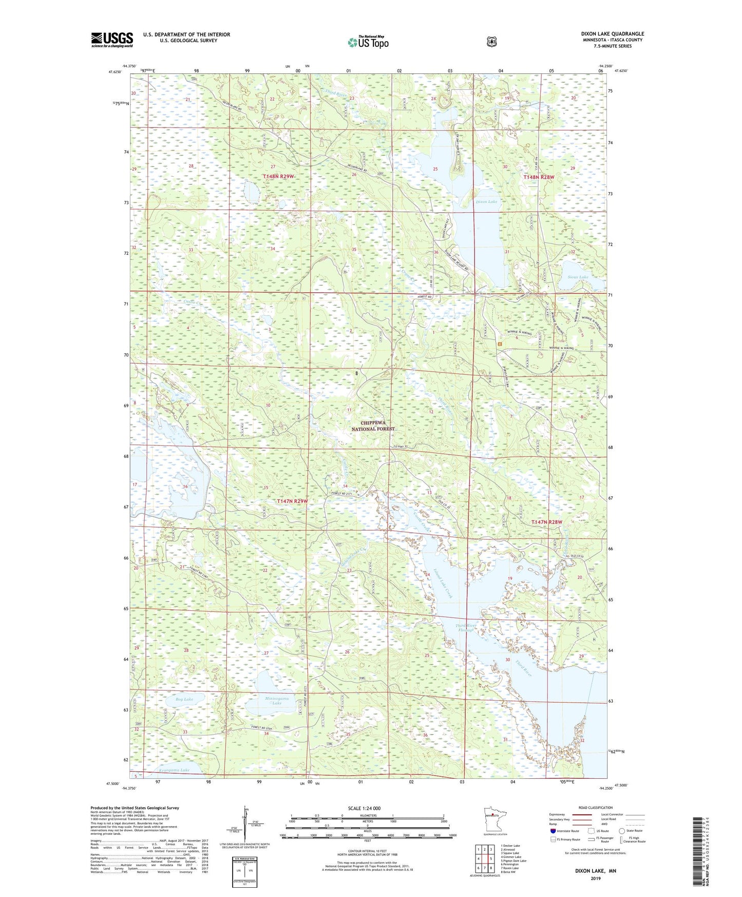
Dixon Lake Minnesota US Topo Map
Couldn't load pickup availability
Also explore the Dixon Lake Forest Service Topo of this same quad for updated USFS data
2022 topographic map quadrangle Dixon Lake in the state of Minnesota. Scale: 1:24000. Based on the newly updated USGS 7.5' US Topo map series, this map is in the following counties: Itasca. The map contains contour data, water features, and other items you are used to seeing on USGS maps, but also has updated roads and other features. This is the next generation of topographic maps. Printed on high-quality waterproof paper with UV fade-resistant inks.
Quads adjacent to this one:
West: Gimmer Lake
Northwest: Decker Lake
North: Alvwood
Northeast: Squaw Lake
East: Pigeon Dam Lake
Southeast: Bena NW
South: Raven Lake
Southwest: Pennington
This map covers the same area as the classic USGS quad with code o47094e3.
Contains the following named places: Bog Lake, Castle Creek, Crane Creek, Dixon Lake, Island Lake Creek, Minisogama Lake, Morph Lake, Otter Creek, Pinecrest Post Office, Sioux Lake, Third River, Third River Flowage, Third River Recreation Area