MyTopo
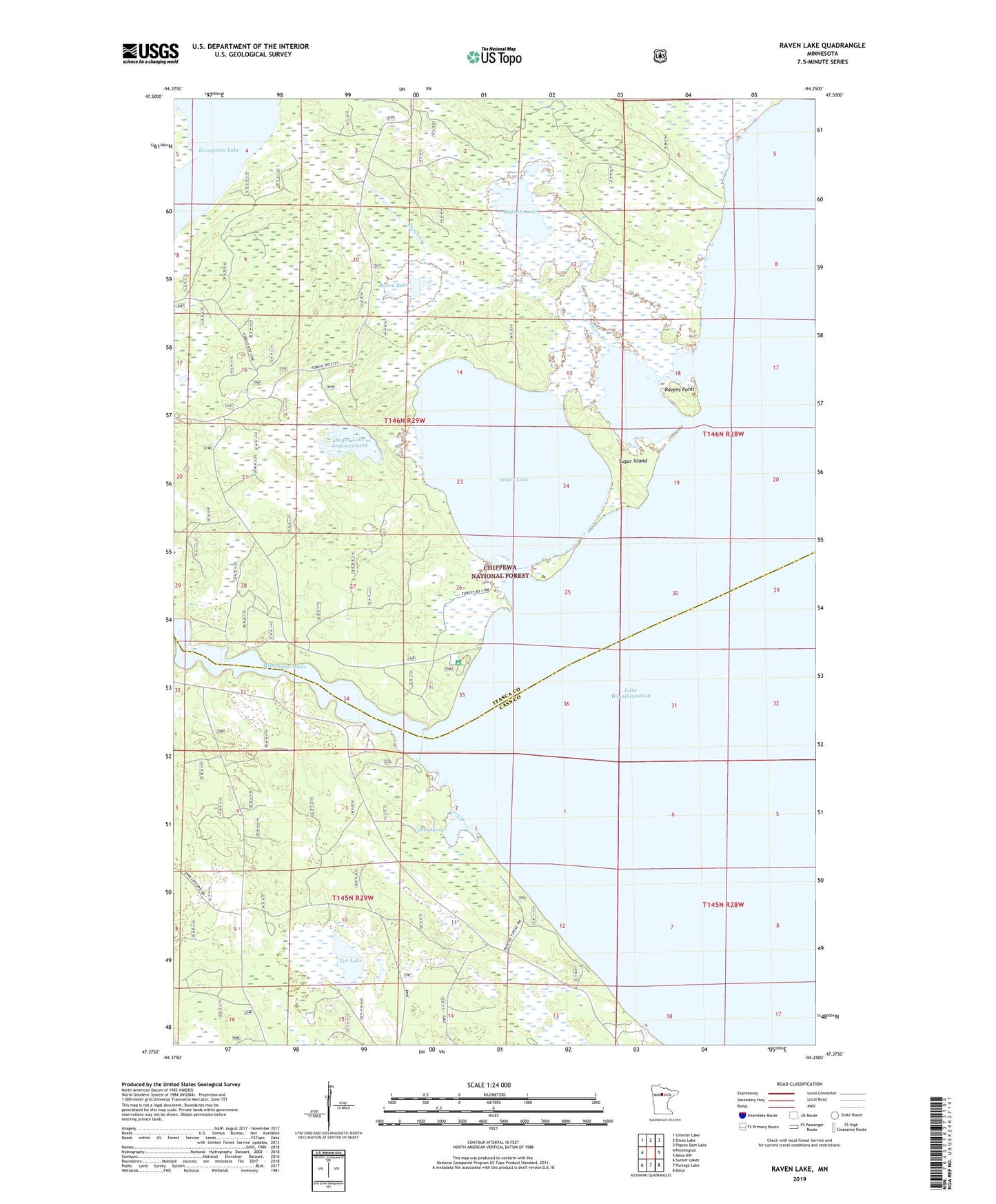
Raven Lake Minnesota US Topo Map
Couldn't load pickup availability
Also explore the Raven Lake Forest Service Topo of this same quad for updated USFS data
2022 topographic map quadrangle Raven Lake in the state of Minnesota. Scale: 1:24000. Based on the newly updated USGS 7.5' US Topo map series, this map is in the following counties: Itasca, Cass. The map contains contour data, water features, and other items you are used to seeing on USGS maps, but also has updated roads and other features. This is the next generation of topographic maps. Printed on high-quality waterproof paper with UV fade-resistant inks.
Quads adjacent to this one:
West: Pennington
Northwest: Gimmer Lake
North: Dixon Lake
Northeast: Pigeon Dam Lake
East: Bena NW
Southeast: Bena
South: Portage Lake
Southwest: Sucker Lakes
This map covers the same area as the classic USGS quad with code o47094d3.
Contains the following named places: Birch Hill Lookout Tower, Kenogama Lake, Lake Harry, Mississippi River Summer Homes, Rabbits Lake, Raven Creek, Raven Lake, Ravens Point, Reeses Landing Boat Access, South Winnie Recreation Residences, Sugar Island, Sugar Lake, Sugar Lake Impoundment, Ten Lake, Winnie Campground