MyTopo
Pennington Minnesota US Topo Map
Couldn't load pickup availability
Also explore the Pennington Forest Service Topo of this same quad for updated USFS data
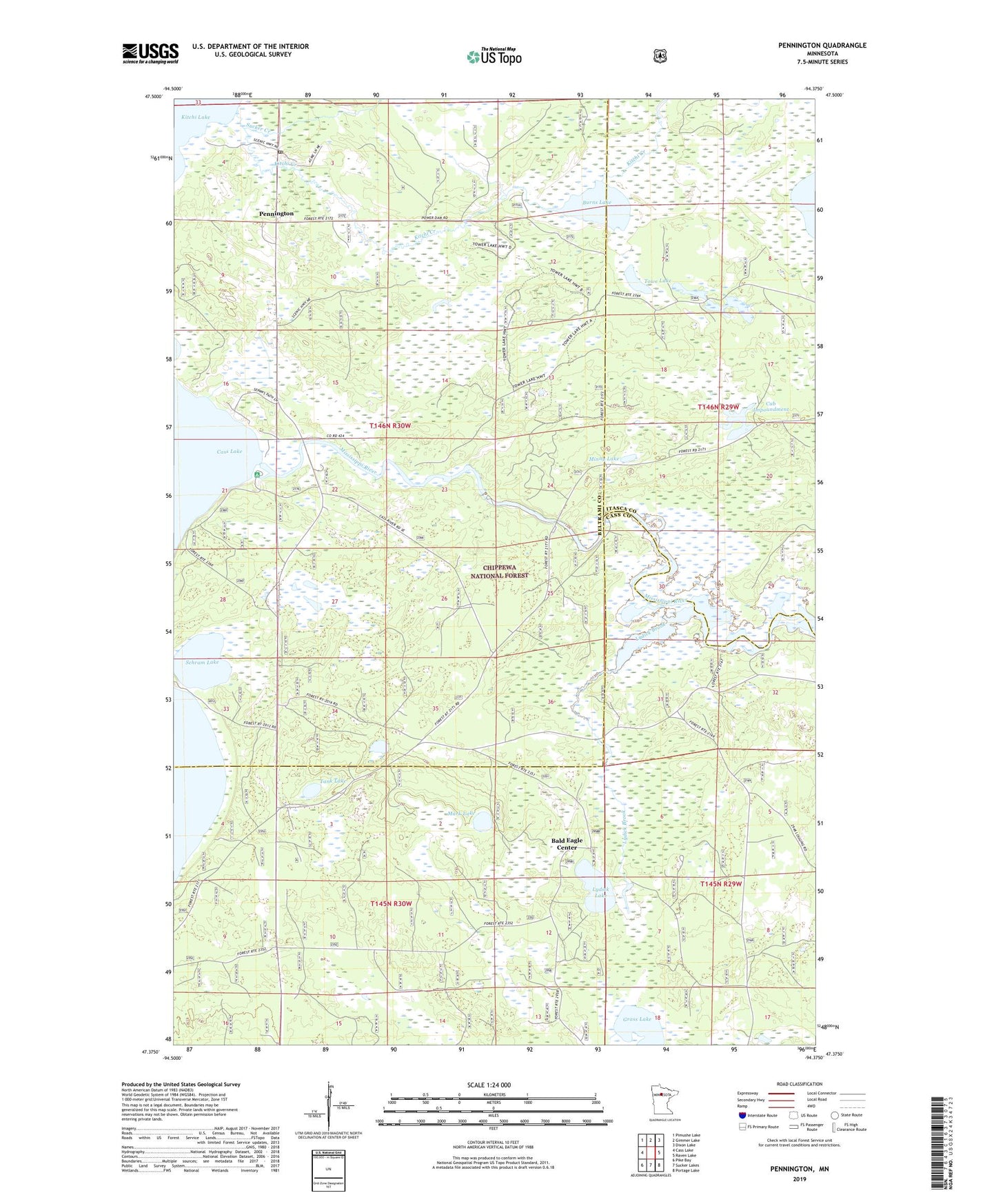
2022 topographic map quadrangle Pennington in the state of Minnesota. Scale: 1:24000. Based on the newly updated USGS 7.5' US Topo map series, this map is in the following counties: Beltrami, Cass, Itasca. The map contains contour data, water features, and other items you are used to seeing on USGS maps, but also has updated roads and other features. This is the next generation of topographic maps. Printed on high-quality waterproof paper with UV fade-resistant inks.
Quads adjacent to this one:
West: Cass Lake
Northwest: Pimushe Lake
North: Gimmer Lake
Northeast: Dixon Lake
East: Raven Lake
Southeast: Portage Lake
South: Sucker Lakes
Southwest: Pike Bay
This map covers the same area as the classic USGS quad with code o47094d4.
Contains the following named places: Bald Eagle Center, Burns Lake, Camp Cassaway, Canoe Campsite, Cassaway Camp, Cub Impoundment, Grass Lake, Grass Lake Impoundment, Kitchi Creek, Knutson Dam, Knutson Dam Recreation Area, Knutson Dam Summer Homes, Lydick Brook, Lydick Lake, Mark Lake, Minny Lake, Nushka Group Camp and Picnic Ground, Pennington, Pennington Post Office, Schram Lake, Sucker Creek, Tank Lake, Towe Lake, Tower Lake Hunter Walker Trails, Unorganized Territory of Brook Lake, ZIP Code: 56663