MyTopo
Donaldson Minnesota US Topo Map
Couldn't load pickup availability
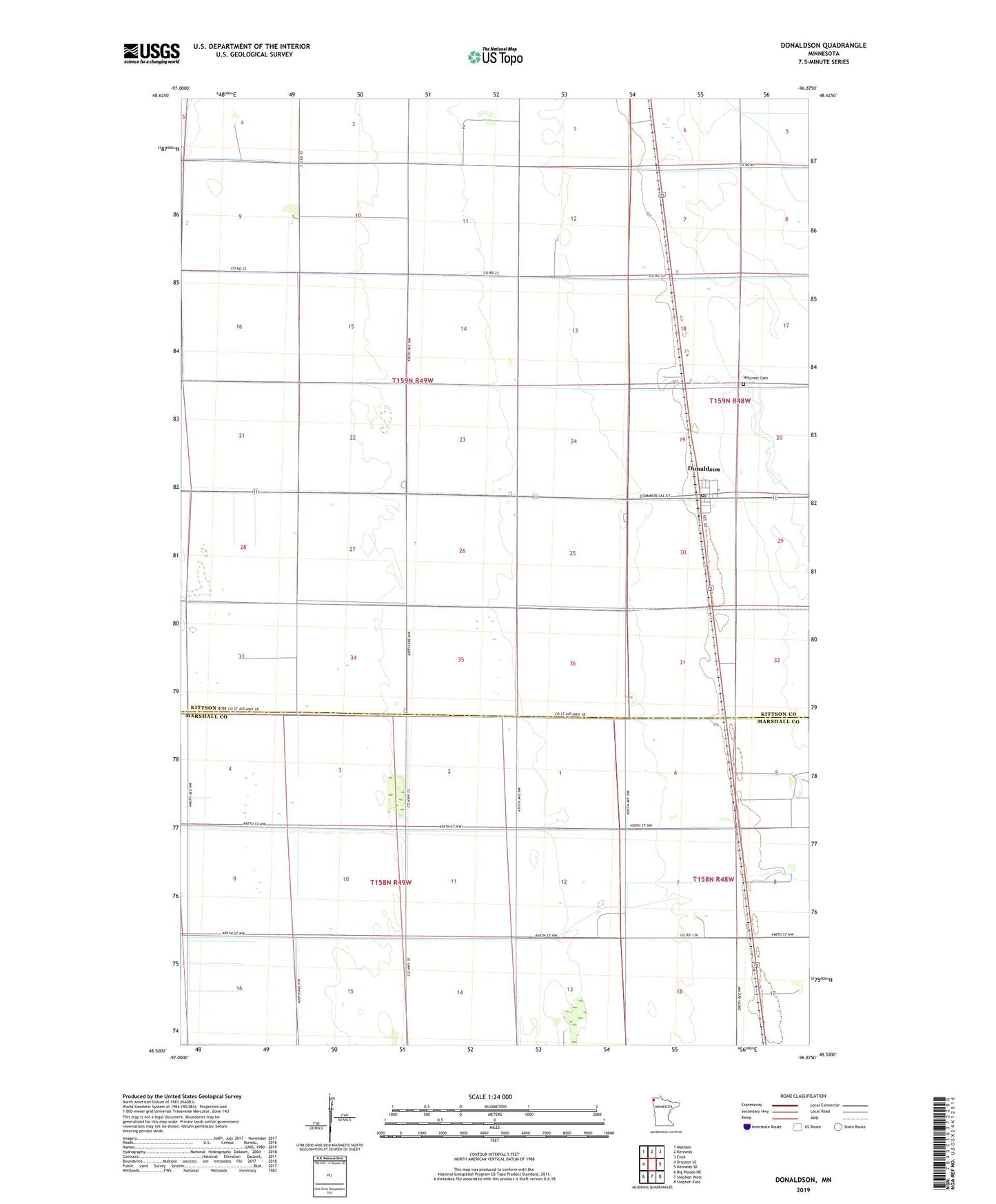
2022 topographic map quadrangle Donaldson in the state of Minnesota. Scale: 1:24000. Based on the newly updated USGS 7.5' US Topo map series, this map is in the following counties: Kittson, Marshall. The map contains contour data, water features, and other items you are used to seeing on USGS maps, but also has updated roads and other features. This is the next generation of topographic maps. Printed on high-quality waterproof paper with UV fade-resistant inks.
Quads adjacent to this one:
West: Drayton SE
Northwest: Mattson
North: Kennedy
Northeast: Enok
East: Kennedy SE
Southeast: Stephen East
South: Stephen West
This map covers the same area as the classic USGS quad with code o48096e8.
Contains the following named places: City of Donaldson, County Ditch Number Eleven, County Ditch Number Four, County Ditch Number Nineteen, County Ditch Number Seven, County Ditch Number Sixteen, Donaldson, Donaldson Post Office, Donaldson Station, Hillcrest Cemetery, Judicial Ditch Number Ten, Judicial Ditch Number Three, Judicial Ditch Number Twentyseven, Township of Donnelly, Township of Svea, ZIP Code: 56720