MyTopo
Dudley Minnesota US Topo Map
Couldn't load pickup availability
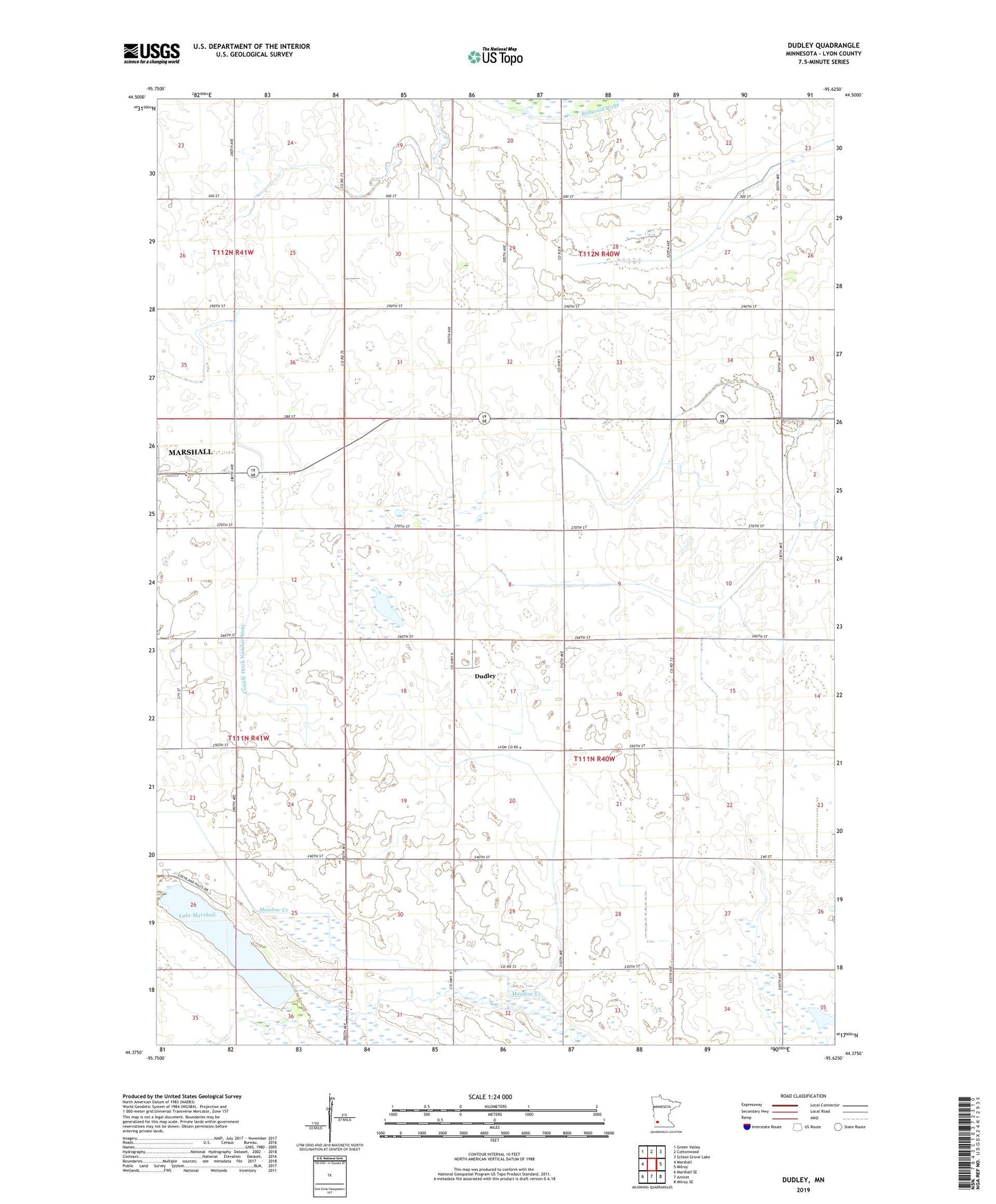
2022 topographic map quadrangle Dudley in the state of Minnesota. Scale: 1:24000. Based on the newly updated USGS 7.5' US Topo map series, this map is in the following counties: Lyon. The map contains contour data, water features, and other items you are used to seeing on USGS maps, but also has updated roads and other features. This is the next generation of topographic maps. Printed on high-quality waterproof paper with UV fade-resistant inks.
Quads adjacent to this one:
West: Marshall
Northwest: Green Valley
North: Cottonwood
Northeast: School Grove Lake
East: Milroy
Southeast: Milroy SE
South: Amiret
Southwest: Marshall SE
This map covers the same area as the classic USGS quad with code o44095d6.
Contains the following named places: County Ditch Number Sixty, Dudley, Dudley Post Office, Lake Marshall, Minnesota State Patrol District Headquarters 2300, Threemile Creek, Township of Clifton