MyTopo
Cottonwood Minnesota US Topo Map
Couldn't load pickup availability
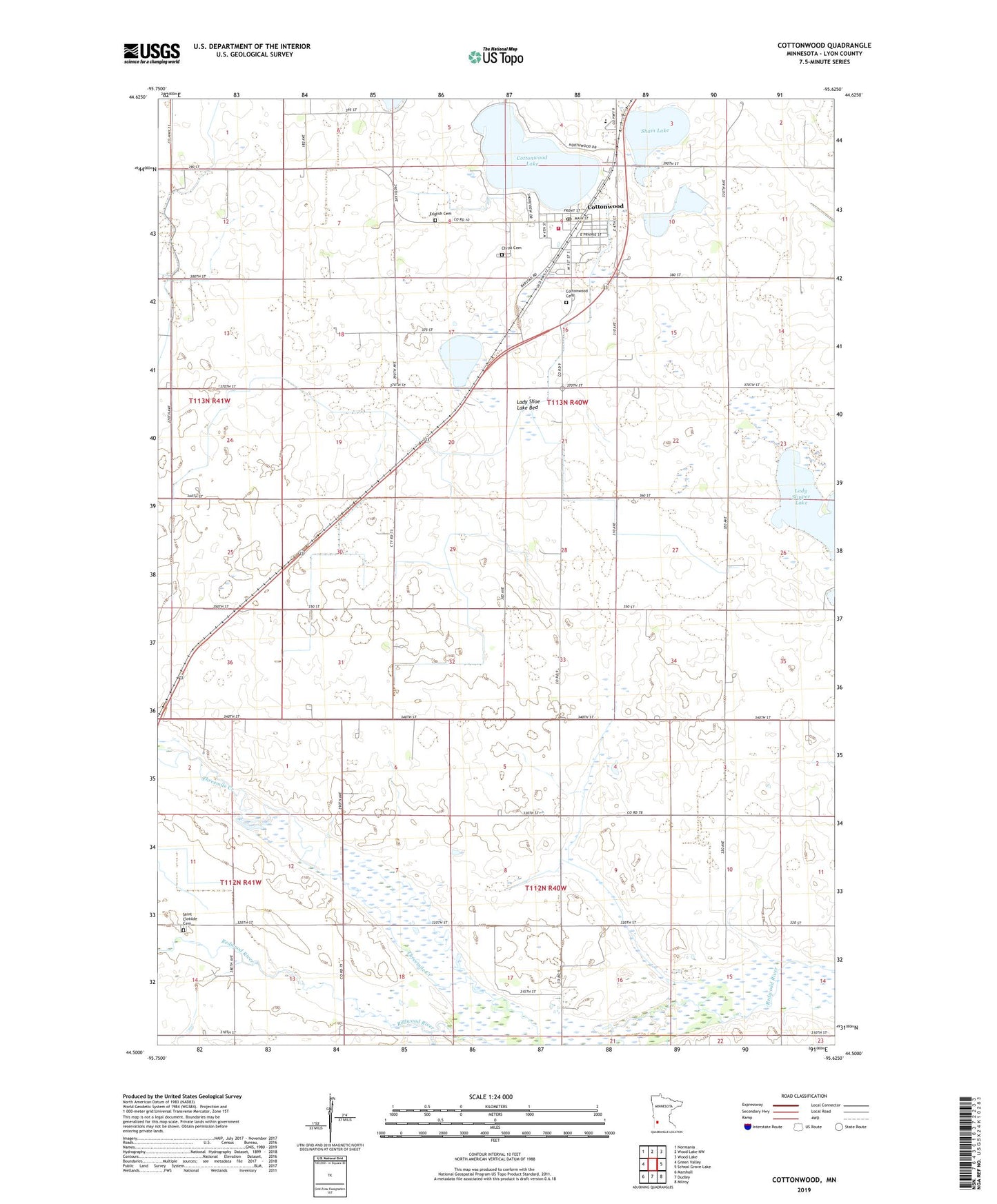
2022 topographic map quadrangle Cottonwood in the state of Minnesota. Scale: 1:24000. Based on the newly updated USGS 7.5' US Topo map series, this map is in the following counties: Lyon. The map contains contour data, water features, and other items you are used to seeing on USGS maps, but also has updated roads and other features. This is the next generation of topographic maps. Printed on high-quality waterproof paper with UV fade-resistant inks.
Quads adjacent to this one:
West: Green Valley
Northwest: Normania
North: Wood Lake NW
Northeast: Wood Lake
East: School Grove Lake
Southeast: Milroy
South: Dudley
Southwest: Marshall
This map covers the same area as the classic USGS quad with code o44095e6.
Contains the following named places: Affiliated Community Medical Center, Christ Cemetery, Christ Lutheran Church, Church of Saint Mary, City of Cottonwood, Cottonwood, Cottonwood Area Historical Society Museum, Cottonwood Cemetery, Cottonwood City Hall, Cottonwood Country Club, Cottonwood Fire Department, Cottonwood Lake, Cottonwood Lake Dam, Cottonwood Library, Cottonwood Post Office, County Ditch Number Eight, County Ditch Number Sixtyone, English Cemetery, English Lutheran Church, Judicial Ditch Number Two, Lady Shoe Lake Bed, Lady Slipper Lake, Lakeview High School, Lindsay Mobile Home Court, Louwagie Farm, Saint Clotilde Cemetery, Sham Lake, Swan Lake Church, Township of Lucas, Township of Stanley, ZIP Code: 56229