MyTopo
Milroy Minnesota US Topo Map
Couldn't load pickup availability
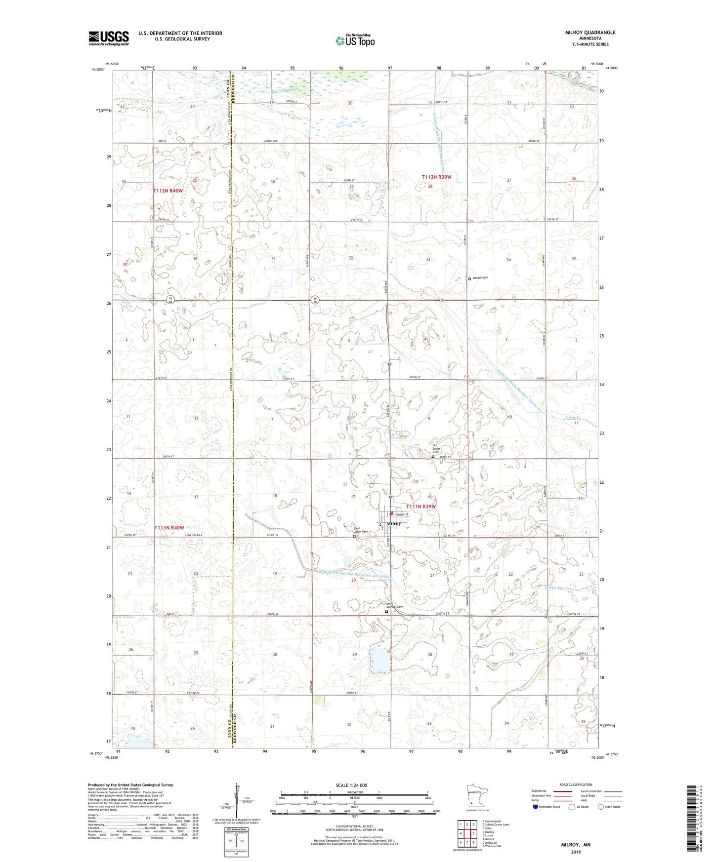
2022 topographic map quadrangle Milroy in the state of Minnesota. Scale: 1:24000. Based on the newly updated USGS 7.5' US Topo map series, this map is in the following counties: Redwood, Lyon. The map contains contour data, water features, and other items you are used to seeing on USGS maps, but also has updated roads and other features. This is the next generation of topographic maps. Printed on high-quality waterproof paper with UV fade-resistant inks.
Quads adjacent to this one:
West: Dudley
Northwest: Cottonwood
North: School Grove Lake
Northeast: Echo
East: Lucan
Southeast: Wabasso SW
South: Milroy SE
Southwest: Amiret
This map covers the same area as the classic USGS quad with code o44095d5.
Contains the following named places: City of Milroy, County Ditch Number Ninetythree, Danish Cemetery, Judicial Ditch Number Fifteen, Judicial Ditch Number Fourteen and Fifteen, Judicial Ditch Number Thirtyone, Lightfoot Farms Airport, Milroy, Milroy Elementary School, Milroy Fire Department, Milroy Lutheran Church, Milroy Post Office, Milroy Town Hall, Our Saviors Cemetery, Saint Johns Cemetery, Saint Michael Cemetery, Saint Michael's Church, Township of Underwood, Township of Westline, ZIP Code: 56263