MyTopo
Duluth Heights Minnesota US Topo Map
Couldn't load pickup availability
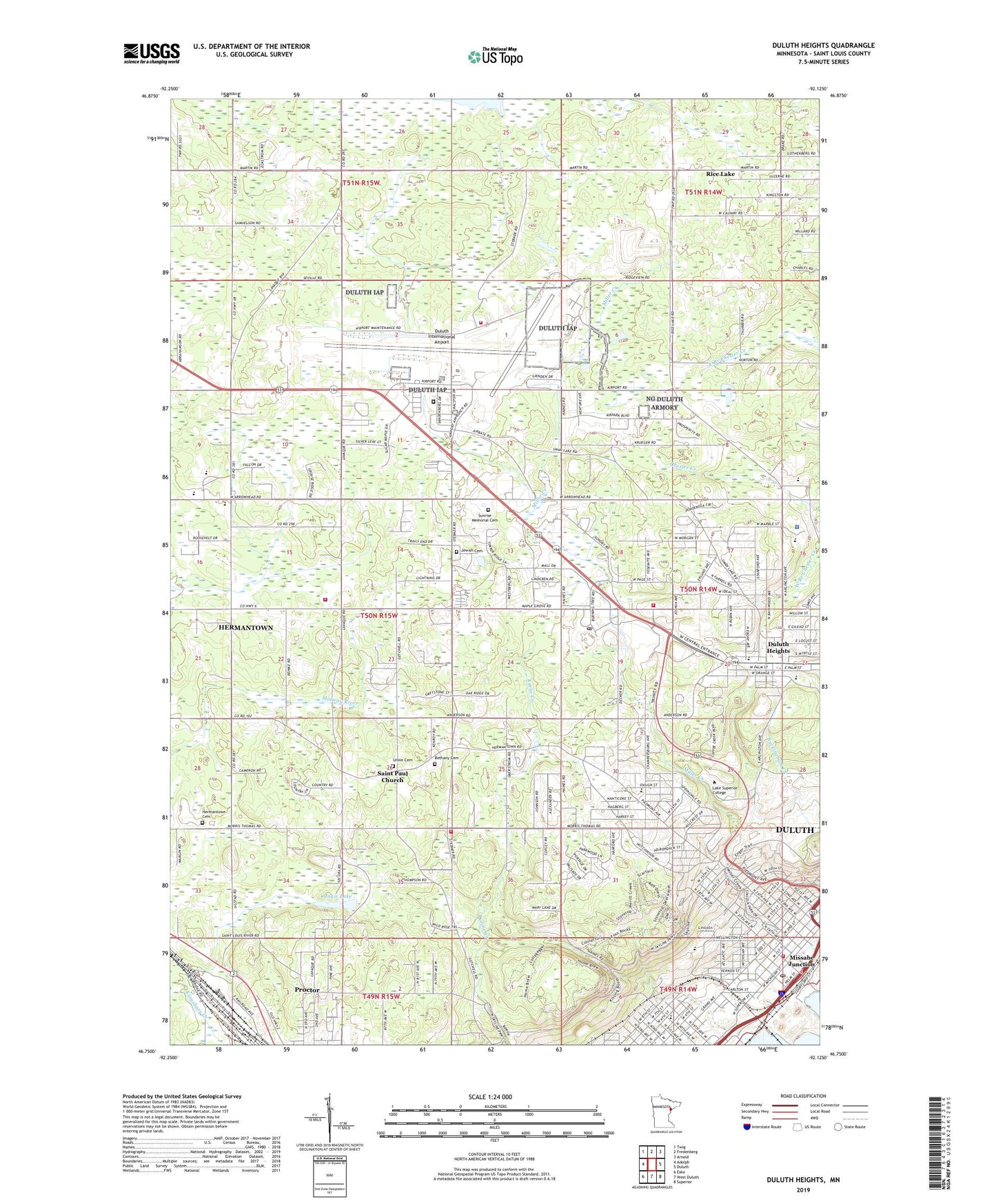
2022 topographic map quadrangle Duluth Heights in the state of Minnesota. Scale: 1:24000. Based on the newly updated USGS 7.5' US Topo map series, this map is in the following counties: St. Louis. The map contains contour data, water features, and other items you are used to seeing on USGS maps, but also has updated roads and other features. This is the next generation of topographic maps. Printed on high-quality waterproof paper with UV fade-resistant inks.
Quads adjacent to this one:
West: Adolph
Northwest: Twig
North: Fredenberg
Northeast: Arnold
East: Duluth
Southeast: Superior
South: West Duluth
Southwest: Esko
This map covers the same area as the classic USGS quad with code o46092g2.
Contains the following named places: 148th Air National Guard Fire Department, 55806, 55811, 55814, Apostolic Gospel Church, Bel Air Mobile Manor, Bethany Cemetery, Bethany Lutheran Church, Birchwood Elementary School, Birchwood Mobile Estates, Brewer Park, Bryant School, Chris Jensen Nursing Home, Christ Lutheran Church, City of Duluth, City of Hermantown, Disciples Mennonite Church, Duluth Church of Christ, Duluth Clinic-Hermantown, Duluth Fire Department - Station 2, Duluth Fire Department - Station 7, Duluth Heights, Duluth International Airport, Duluth Municipal Golf Links, Duluth Police Department, Duluth Police Department Miller Hill Mall Substation, Duluth Post Office, Duluth-Superior Harbor Erie Pier Dike, Eastridge Community Church, Emmanuel Baptist Church, Enger Park, Ensign School, Federal Prison Camp Duluth, First Covenant Church, Gethsemane Church, Great Lakes Gospel Church, Harrison Park, Heritage Baptist Church, Hermantown, Hermantown Cemetery, Hermantown Community Church, Hermantown Elementary School, Hermantown High School, Hermantown Medical Clinic, Hermantown Middle School, Hermantown Police Department, Hermantown Volunteer Fire Department Station 1, Hermantown Volunteer Fire Department Station 2, Hillside United Methodist Church, Holy Cross Lutheran Church, Holy Family Catholic Church, Holy Trinity Lutheran Church, Jehovah's Witnesses, Lake Superior College, Lakeview Christian Academy, Lincoln Park, Lincoln Park Baptist Church, Lincoln Park Congregation, Lincoln School, Lowell School, Merritt Park, Merritt School, Miller Creek, Miller Hill Mall, Miller Hill Post Office, Missabe Junction, Mogie Lake, Mount of Olives Baptist Church, Music Man Heliport, Northern City Baptist Church, Northstar Baptist Church, Peace in Christ Lutheran Church, Pennell Park, Piedmont Elementary School, Proctor Speedway/Fairgrounds, Saint John's Free Lutheran Church, Saint Joseph's Church, Saint Lawrence Church, Saint Louis County Fire Department, Saint Paul Church, Saints Peter and Paul School, Salem Church, Shaara Tzedek Cemetery, Shepherd of the Hills Lutheran Church, Sunrise Memorial Cemetery, Township of Herman, Trinity Episcopal Church, Union Cemetery, Viewcrest Nursing Home, Wesley United Methodist Church, Wheeler Field, Zion Lutheran Church